The National Road in Ohio |
||||
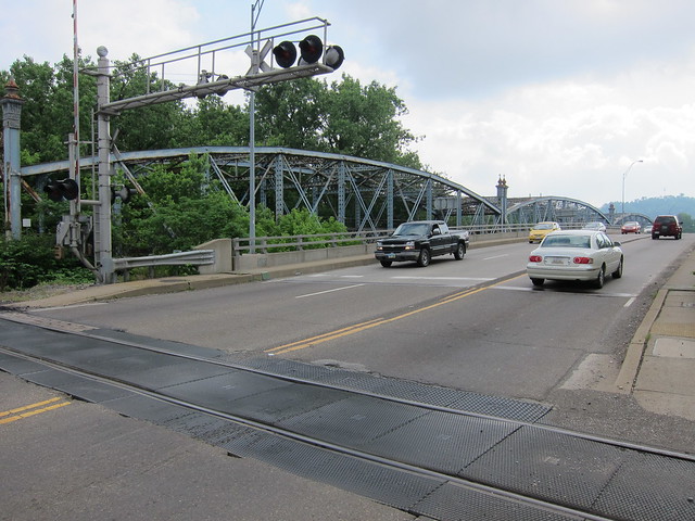
Belmont CountyWheeling, West Virginia, is well known for its suspension bridge that carried the National Road across the Ohio River. It delivers westbound travelers onto Wheeling Island, and from there they must cross the Ohio River’s backchannel to finally enter Ohio at the little town of Bridgeport. That, of course, involves another bridge. This map shows them both: 
Imagery
© 2012 Digital Globe, GeoEye, USDA Farm Service Agency. Map data © 2012
Google. That bridge is a modern slab that utterly lacks romance. But check out the bridge that stands next to it.
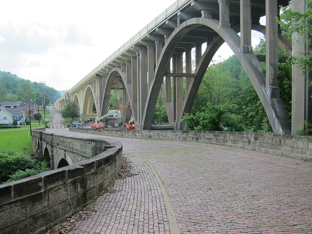
This is the Bridgeport Bridge, named after the town at its west end. It was built in 1893 of wrought iron with a wooden deck, atop piers that originally carried a bridge built here in 1837. A new deck of steel grate was laid in 1950. Subsequently, time (surely aided by lack of maintenance) was not kind to this bridge, and safety became a serious concern. In 1987, additional trusses were installed to temporarily shore up the crumbling substructure. In 1998, a new bridge was completed alongside, and this old girl was abandoned.
My old buddy Jeff was along for this segment of the trip, and he noticed a sign hanging from one of the cross braces. “I want to know what’s on that sign,” he said, and quickly we found ourselves, um, trespassing. Stepping out onto the adjacent walkway (as the bridge’s deck had been removed) we soon had our answer.
The walkway railing was in nice shape, despite the branches growing through.
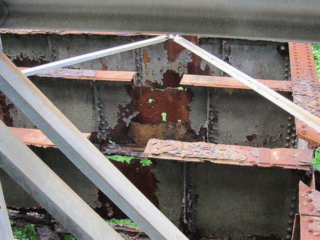
I wish the same could be said about the bridge’s substructure.
This bridge is a basket case if I’ve ever seen one. 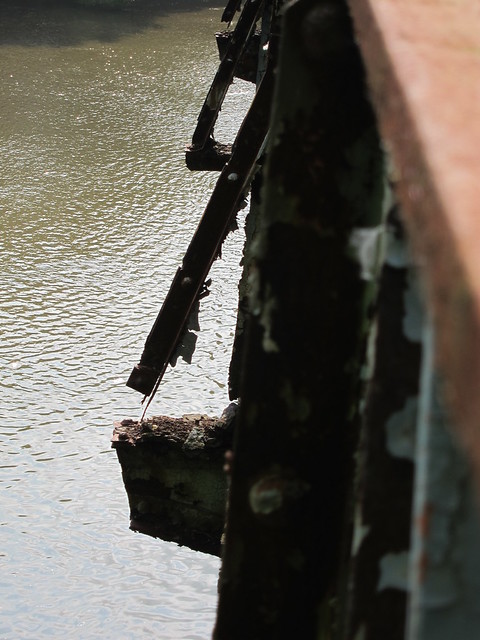
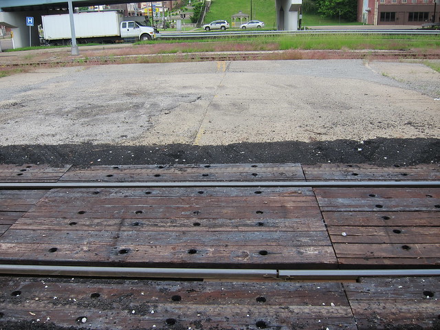
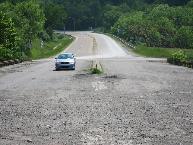
Rumors have persisted for years that this bridge would soon be demolished. Shortly after I took this trip, a television station in nearby Steubenville reported that it would come down in July, 2012. They noted that the bridge’s railing and finials, as well as that Ohio State Line sign, will be given to local historical societies. I suppose that’s better than nothing. The bridge was demolished on Sept. 12, 2012. Here's footage of the demolition from the company hired to do the deed. Looking west from the bridge, a very short remnant of the old road remains. I gather from old maps that when this was still the road, when you reached Ohio State Route 7 ahead, to stay on US 40 you had to jog left and then right. When the new bridge was built, the jog was eliminated.
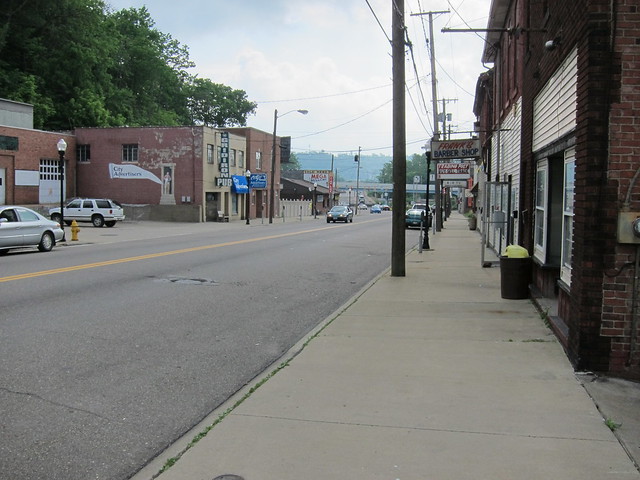
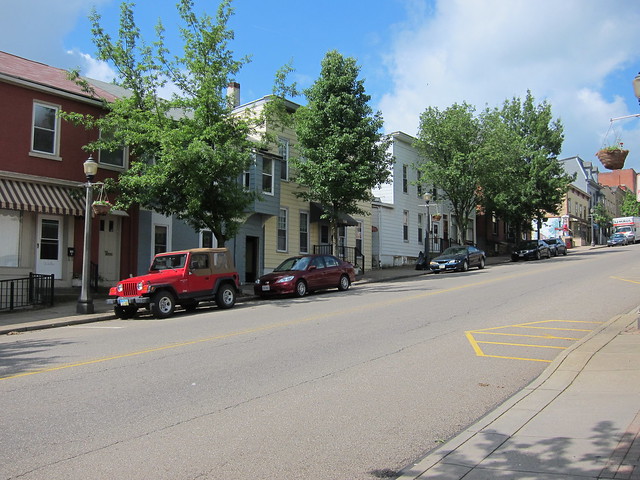
This wasn't my first visit to Bridgeport. On my last visit, back in 2009, I entered the intersection of US 40 and Ohio SR 7 not noticing that the light was red. The resulting wreck totaled my car, but fortunately nobody in my car was injured. Even though two years had passed, I found it a little emotionally difficult to return to Bridgeport. So I didn't linger. I took this one shot of town, eastbound.
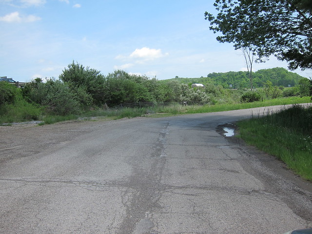
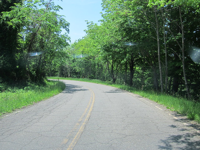
The road leading out of Bridgeport was narrow and pretty twisty. By American standards, the National Road in eastern Ohio is pretty darned old. It was extended west from Wheeling starting in the late 1820s, largely routed over the 1796-97 Zane’s Trace, which was based on even older American Indian trails. None of those trailblazers and roadbuilders had the equipment and technology to do anything but follow the path of least resistance, and so the National Road makes several twists and turns as it heads west from the Ohio River. In contrast, nearby I-70 is a smooth and level ride. It was built in about the early 1970s, when roadbuilders could cut through the hills and fill in the valleys.
Imagery © 2012 Digital Globe, GeoEye, USDA Farm Service Agency. Map data © 2012 Google. Even then, the National Road saw plenty of improvements in its lifetime, especially after the US highway system was founded in 1926 and US 40 was routed over it. One such improvement happened where the road crossed Wheeling Creek at the town of Blaine. The road originally followed what is now Pasko Road, but was straightened in 1933.
Imagery © 2012 Digital Globe, GeoEye, USDA Farm Service Agency. Map data © 2012 Google. Of course, that meant building a new bridge. Fortunately, they left the old one behind, a sandstone three-span S bridge built in 1828. Aren’t they a spectacular pair? (That’s my old buddy Jeff there, unwittingly providing a sense of these bridges’ scale.)
As winding roads were a concession in the old days, so were S bridges. Bridges that crossed a river or stream at right angles were stronger and considerably less expensive to build and maintain than bridges that crossed at an angle. Roads don’t always approach rivers squarely, of course. In Ohio, the solution was to build bridges square to the river and curve the road to meet its ends. This gave these bridges their distinctive S shape and, therefore, their name. A few smaller, single-span S bridges remain on the road in eastern Ohio; I’ll write about them in future posts.
This solution worked very well for traffic in 1830 when an average traveler covered maybe ten miles per day. But as the automobile rose to prominence in the 20th century, drivers needed to slow down to negotiate these bridges. Drivers were just as impatient then as now, and so improvements to US 40 eliminated these S bridges, either bypassing them or demolishing them, but always replacing them with direct crossings that did not impede the traveler. In this case, the new bridge also made what had been a very steep ascent west of the S bridge into a more gradual climb, which drivers also appreciated. Despite being bypassed, this bridge and road were used for local access through 1994. The old bridge had deteriorated badly and was in danger of being demolished. Local preservationists persevered, however, leading to its restoration and conversion into a park. (Check out this page at the Federal Highway Administration that tells this story.) Of course, the National Road was not originally paved in brick. The “brick era” for American roads generally began in the 1910s. My 1916 Automobile Blue Book, a thick guide of turn-by-turn directions between cities and towns, says that the National Road was “good brick, concrete, and macadam all the way” between Wheeling and Columbus. I’d say these bricks were laid not long before then. Weeds poke out from between the bricks west of the bridge where cars are no longer allowed to go.
I saw several old brick alignments on this trip about which I’ll certainly write in posts to come. This was the only one where any of the bricks were marked.
The old road extends beyond the park, where it becomes heavily overgrown. I counted two houses back here with useless driveways to the road. I have to assume that those homeowners now have some sort of access to US 40, which runs behind their houses.
Soon the old road ends, and abruptly. US 40 is high above us.
I left this spot with a strong wish to know how the road used to go west from
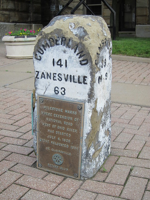
this point. But then I found this photo at the Historic American Engineering
Record at the Library of Congress. The photo is really of the milestone (which
has since been moved), but check out the road’s path. St. Clairsville is about 5 miles up the road. And when I say up the road, I mean up the road!
My chief impression of St. Clairsville was that it once had a grand age.
The Belmont County courthouse was remarkably difficult to photograph, even with my camera's wide-angle lens, because the courthouse was so big and US 40 was so narrow. I couldn't back up enough to get a good head-on shot.
Many Old National Road milestones remain along the road across eastern Ohio. This one stands in front of the courthouse. The plaque attached to it says it was relocated. I'd like to know where from!
This is the 1890 Clarendon Hotel, which as of this writing was owned by the city of St. Clairsville and is undergoing restoration. It is called one of the oldest continuously operating hotels on the National Road.
I really enjoyed St. Clairsville's historic architecture.
Just west of St. Clairsville, US 40 passes under I-70 twice. Then a brief old alignment passes through unincorporated Lloydsville.
Imagery © 2012 Digital Globe, GeoEye, USDA Farm Service Agency. Map data © 2012 Google. This area is rich in old alignments. Three more follow in rapid succession – one through little Morristown, and one on either side.
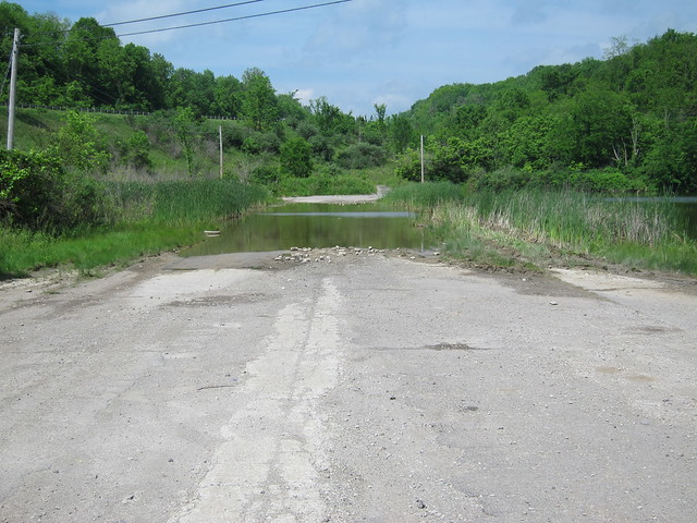
Imagery © 2012 Digital Globe, GeoEye, USDA Farm Service Agency. Map data © 2012 Google. I had my other camera suction-cupped to the windshield, so I shot video of the old alignment east of Morristown. I was astonished to find that it was one lane wide. I figure it was just heavily overgrown. I shot more video as I drove through Morristown. There are some seriously old buildings here. I also drove the old alignment west of it, but didn't stop for photographs. I was eagerly anticipating what I knew came next. More than 20 years ago I made what remains the longest road trip of my life. I drove from Terre Haute to Mississauga, Ontario, to visit one friend, and then through Niagara Falls and across central New York, and then down to Edison, New Jersey, where I visited two other friends. Then I headed home, mostly along I-70. I was bored of the Interstate by the time I crossed into Ohio, and when I saw an exit for US 40 at St. Clairsville, I took it. I regretted it almost immediately. My inner roadgeek had not yet awakened, and I was not amused by all the stoplights in St. Clairsville and by the fellow in front of me who was determined to drive 15 miles per hour less than the speed limit. I got out my big Rand McNally atlas (which seems downright quaint now) and looked for a way to get back onto I-70. It showed that US 40 merged onto I-70 ten or so miles ahead, just past Morristown. It even showed that the road widened to four lanes a few miles ahead of the merge. The slowpoke turned off, and in relief I put my foot into the gas pedal. I reached an intersection where signs said to turn left to reach I-70, but I blew by it eager to drive the four-lane US 40 just ahead. I had the four-lane highway to myself. A rusty guardrail divided the eastbound and westbound lanes. Then I passed a US 40 reassurance marker covered in black plastic, and then a big green sign also covered in black plastic. Was the road closed? Had I missed a detour? My concern turned to fright as I rounded a curve at 65 miles per hour and found myself staring right into a hillside. With no warning, the road ended right at its base! I slammed on the brakes and came to a stop just ten feet away from the end. Rand McNally was wrong. US 40 didn’t merge onto I-70 here; rather, I-70 was built over US 40, at least 30 feet up. I returned to the scene of my fright on this trip. Here’s the old highway at its dead end. I’m told that the road is pretty much always flooded here now. Also, the dividing guardrail was removed at some point.
Here’s how the road curves in from the east.
Here’s the view from the air. Simply put, I-70 was built here along the alignment of US 40 and the National Road.
© 2012 Digital Globe, GeoEye, USDA Farm Service Agency. Map data © 2012 Google. US 40 follows I-70 for about the next 18 miles, to the town of Old Washington. But a remnant of old US 40 and the National Road appears just a mile later, as it emerges from underneath I-70. It’s marked as Co. Rd. 102 and Mt. Olivett Rd. on this map. Before I-70, as it headed west it cut directly across the exit at State Route 800 and followed Co. Rd. 108.
© 2012 Digital Globe, GeoEye, USDA Farm Service Agency. Map data © 2012 Google. Here’s where the old road resumes. Notice how the seam down the middle goes straight even though the road was later made to curve away to connect to another county road.
Turning around from there, it becomes apparent that the old westbound lanes were abandoned.
The routing of I-70 from here west to Old Washington did a real number on the National Road, but other bits and pieces remain as state and county roads if you know where to look. They can be a little challenging to follow. Old US 40 follows State Route 800 here, but the National Road took an even older alignment through Hendrysburg.
© 2012 Digital Globe, GeoEye, USDA Farm Service Agency. Map data © 2012 Google. There's not much left of Hendrysburg. I understand there used to be an S bridge here, but it's long gone. This shot shows where the National Road's alignment through Hendrysburg ends and meets State Route 800.
Not far past Hendrysburg, State Route 800 curves northward. But to stay on the National Road and old US 40, you need to turn left onto County Road 40A. I'm sure that in US 40's heyday, this was a straight shot, and you turned right here to stay on 800.
This through-the-windshield shot shows what County Road 40A is like.
There's more to explore along this alignment left behind by I-70, but the rest of it is in Guernsey County. |
||||
|
||||
|
Created 8 January 2012. |
||||