The National Road in Ohio |
||||
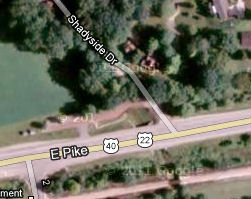
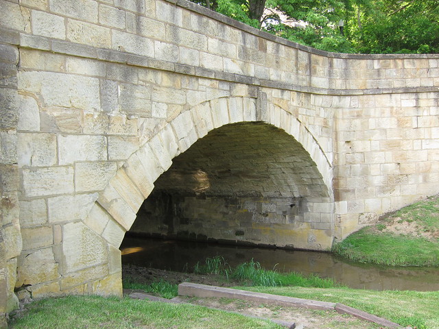
Muskingum CountyNew Concord is immediately east of the county line. On its west end stands another restored S bridge. Like the Cassell S bridge a few miles back in Guernsey County, this, the Fox Creek S bridge, was built in about 1828. It’s easy to miss. I was looking for it, and I only caught it out of the corner of my eye as I sped past. I had to turn around and come back to it.
Imagery © 2012 Digital Globe, GeoEye, USDA Farm Service. Map data © 2012 Google. Isn’t it a beauty? I think I like this one a little bit more than the Cassell bridge.
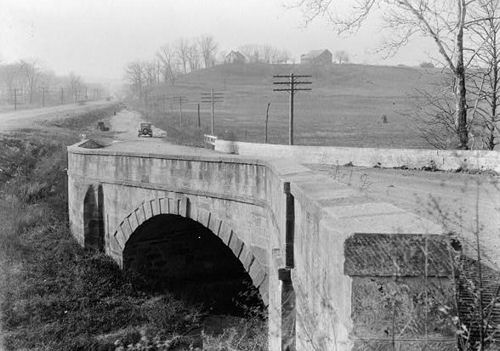
This photo from the Historic American Engineering Record shows the bridge in the early 1930s. Notice how US 40 already bypasses it on the left.
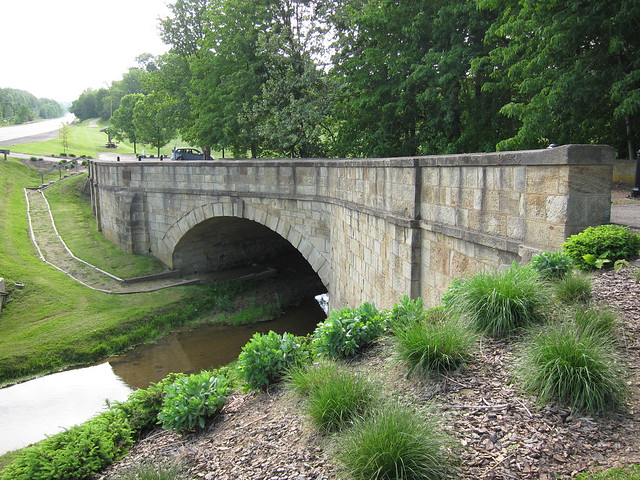
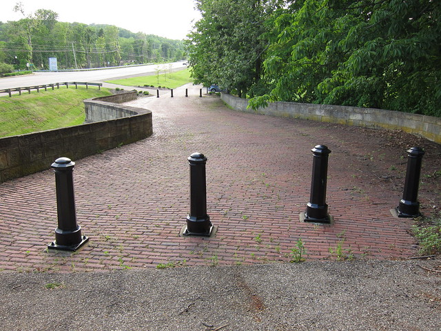
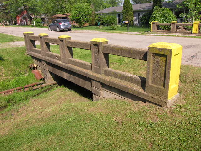
Here’s the deck. A short segment of the brick road extends west beyond the bridge, and you can drive on it to access a small parking area.
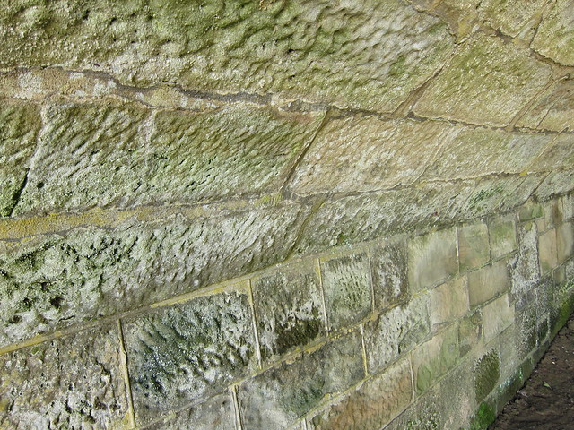
This bridge’s restoration added a narrow path that lets you get close and even walk under the bridge.
It’s not very often you can get personal with the underside of an old bridge!
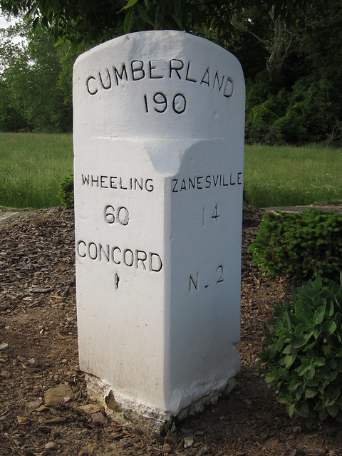
This milestone, probably a reproduction, stands nearby.
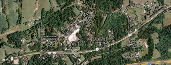
Shortly a long old alignment branches off on the right and heads toward the town of Norwich, which was placed here in 1827 in anticipation of the National Road.
Imagery © 2012 Digital Globe, GeoEye, USDA Farm Service. Map data © 2012 Google. The noteworthy sight in Norwich is the Ralph Hardesty Stone House, which was built in 1836. Local legend has it that Mr. Hardesty operated a tavern in the house. It's a gardening supply store and nursery today.
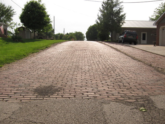
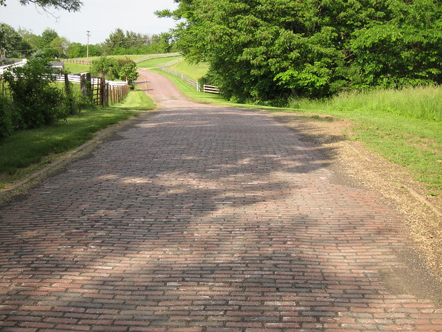
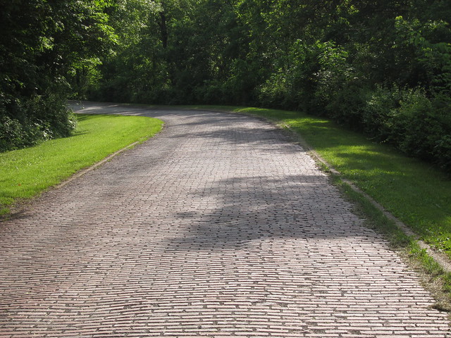
It appears that the road was improved twice here. On Norwich's west end, the original National Road alignment turns right along Brick Road, while a later alignment continues straight. Later, US 40 was moved to bypass the town. Fortunately, Fortunately, this Brick Road is really still brick!
It cuts across a lovely country scene.
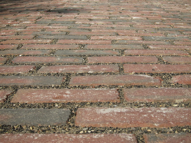
The concrete curbs made me wonder if this road is built the same as the abandoned brick segments in Illinois – a concrete pad topped with bricks. But I learned from the Ohio National Road Association’s wonderful Traveler’s Guide that these are simply concrete strips alongside the brick road.
Sadly, this was the last brick segment I encountered on the trip. But I think this is the finest brick alignment on all of the National Road.
Just beyond Norwich stands Baker's Motel, which as of this writing was still operating.
Norwich was important as a stagecoach stop along the National Road and its predecessor in this area, Zane's Trace. In 1797, Ebenezer Zane cut a trace from the Ohio state line across from Wheeling in what was then Virginia, west across the densely forested countryside 230 miles to what is now Maysville, Kentucky, an Ohio River town about 60 miles upriver of Cincinnati. It was a post road, just wide enough for a horseback rider carrying saddlebags full of mail. When Zane cut his trace as far as the Muskingum River, he liked it so much that when his trace was complete, he followed it back to that river and settled. The town that grew out of that settlement was named Zanesville, of course.
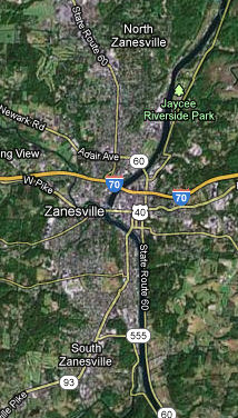
Imagery © 2012 Digital Globe, GeoEye, USDA Farm Service. Map data © 2012 Google. When the National Road was extended into Ohio starting in 1825, it took advantage of Zane’s Trace. I know of several places where the National Road’s builders chose to lay the road over new terrain, however, including most of the route between New Concord and Zanesville. Zane’s Trace still exists between these towns, running about a mile to the south of US 40. If you want to go looking on Google Maps, just look for Old Wheeling Road and Zane Trace Road. You’ll find that the Zanesville Municipal Airport obliterated some of this historic road, unfortunately. I got a little lost as I tried to follow the National Road into Zanesville. I noticed St. Nicholas Catholic Church’s great building, though, and headed off to have a look. It was my good fortune that this put me right back on US 40. I wonder if Nicholas is the patron saint of road trippers.
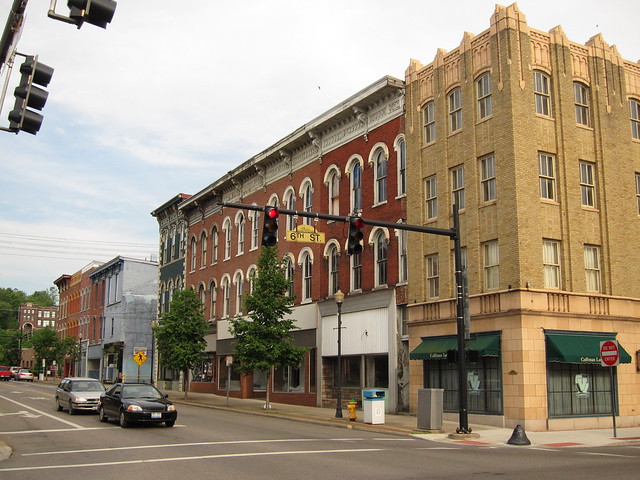
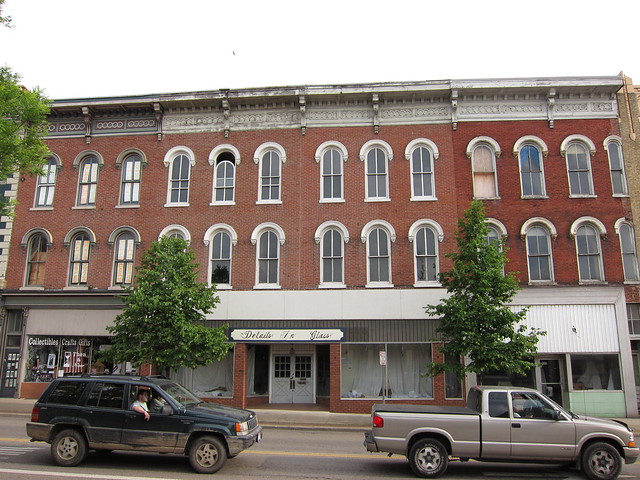
US 40 follows Main Street into town. What a beautiful town it is! Lots of old architecture still stands, and much of it appears to be in very nice condition.
I was impressed not only that this old building still has many of its original windows, but that one of them still opens via the top sash.
Zanesville became Ohio’s state capital in 1810. It was always intended to be temporary; by 1812, the capital had moved to the new city of Columbus. State business was never conducted in this courthouse, however, as it was completed in 1877.
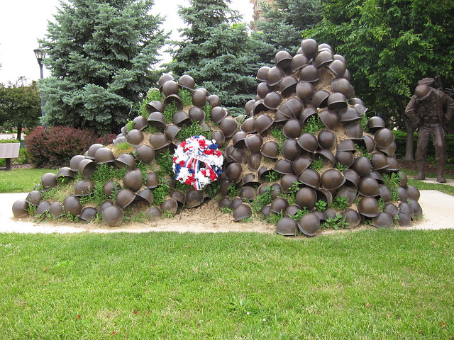
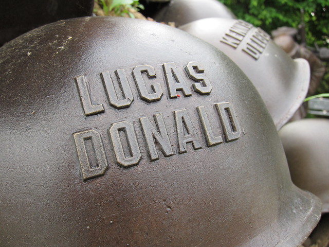
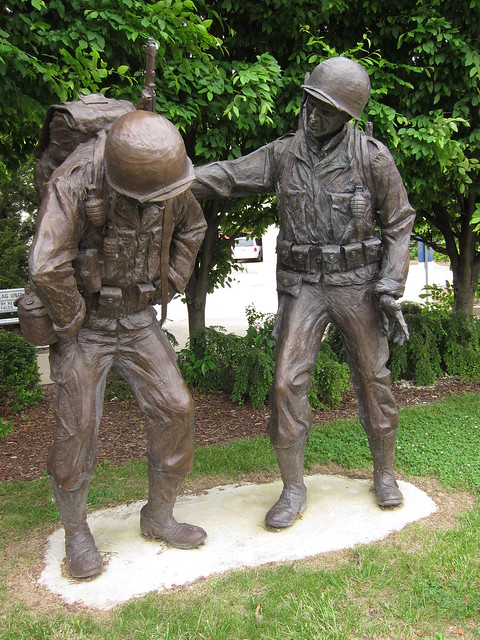
Is it Ohio state law that every county courthouse must have military monuments on the grounds?
At least Muskingum County got createive about it.
Because after all, war is hell.
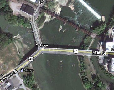
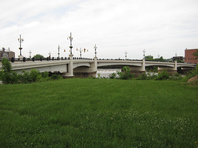
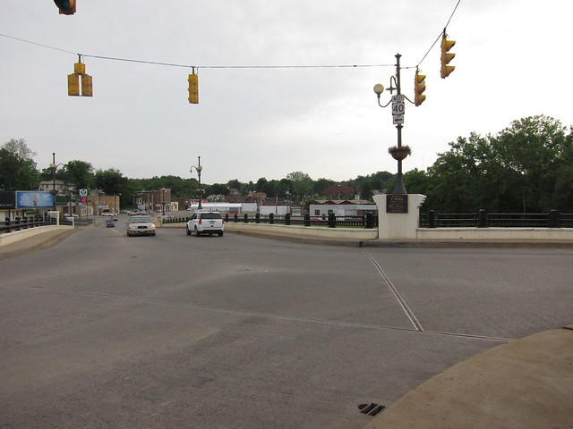
Despite Zanesville’s place in Ohio’s history, its real claim to fame is its Y bridge.
Imagery © 2012 Digital Globe, GeoEye, USDA Farm Service. Map data © 2012 Google. The first Y bridge was built here, at the confluence of the Licking and Muskingum Rivers, in 1814. It was a crude affair that fell into the river. The second, a wooden bridge, was condemned after being badly damaged in a flood. The third bridge, a wooden covered bridge, killed its builder during its construction. I haven’t been able to find out why, but it was torn down in 1900. The fourth bridge opened in 1902. By 1979, its structure above its piers had fallen into such disrepair that it was removed and rebuilt. This, the fifth bridge, has been open since 1984.
I hear that Zanesvillians get a kick of telling out-of-towners to drive to the center of the bridge and turn left.
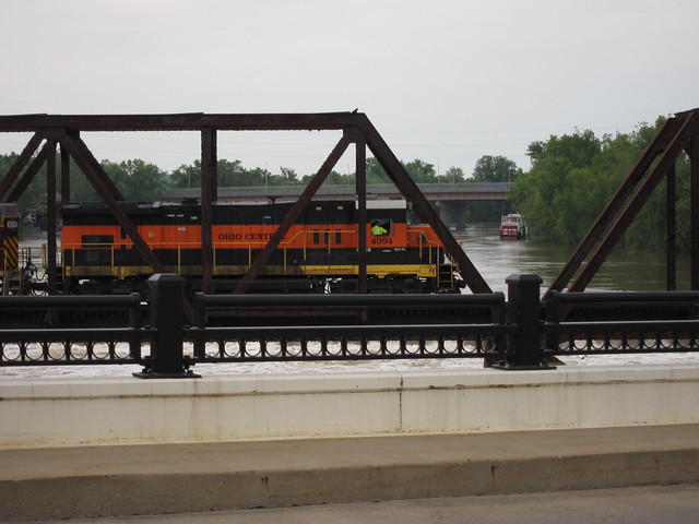
A railroad bridge straddles the Y bridge. As I explored, a train came through.
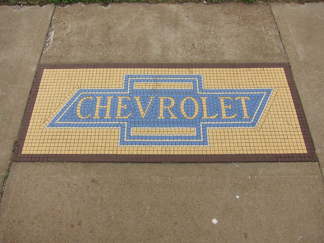
After I crossed the bridge, I noticed this mosaic in the sidewalk in front of a vacant lot. A Chevrolet dealer used to stand on this site; it went into business in 1914. Could this tile be that old? Zanesville was home to a famous mosaic tile producer, and I assume this was their work.
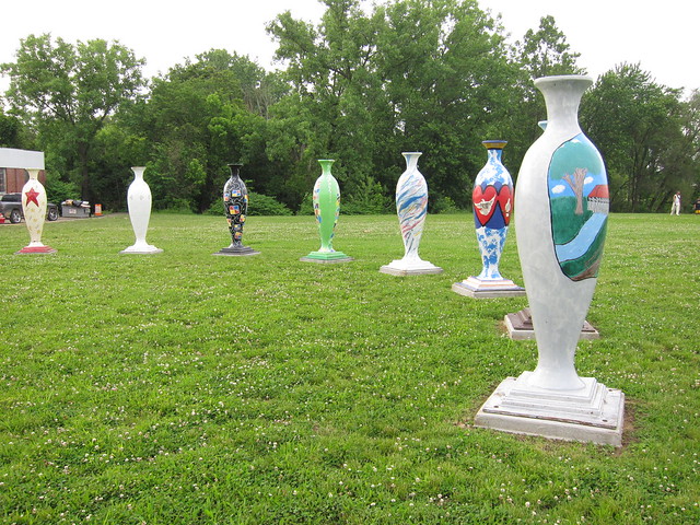
Zanesville is also well known as a pottery center, so I guess I shouldn’t have been too surprised to find these vases on the vacant lot. They are part of a 2008 community art project. Each vase is seven feet tall and weighs 170 pounds.
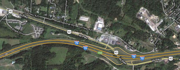
Here the National Road leaves Zane’s Trace, and the challenging terrain of eastern Ohio, behind. It is no exaggeration to say that the entire character of the road changes west of Zanesville. In a big way, Ohio's National Road has three segments, each with its own character: the winding and hilly terrain from the Ohio River to Zanesville, the more or less straight pike from Zanesville through Columbus to Springfield, and the unloved section (where National Road funding ran out) between Springfield to the Indiana state line. Just beyond Zanesville, US 40 passes under I-70. An old alignment lurks directly north.
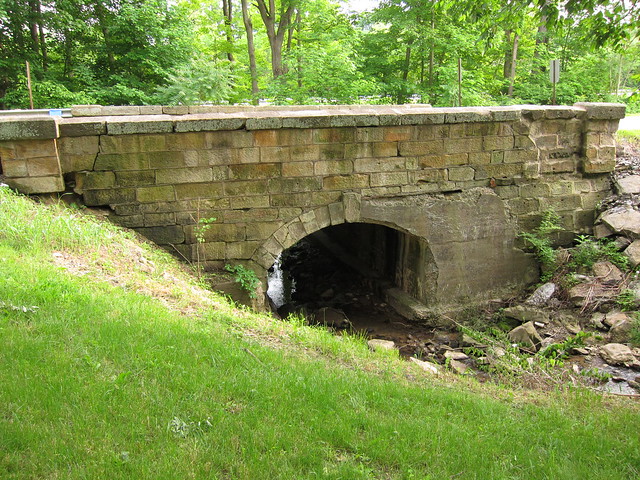
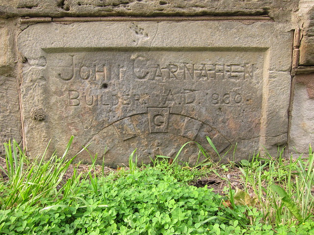
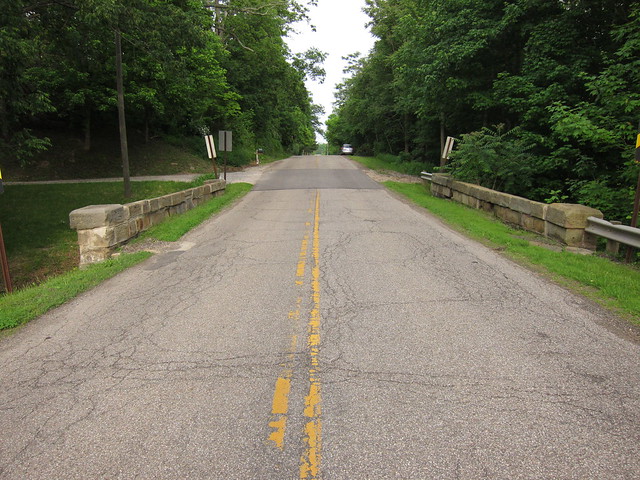
Imagery © 2012 Digital Globe, GeoEye, USDA Farm Service. Map data © 2012 Google. Many brief old alignments like this one remain between here and Columbus. But this one is noteworthy because the 1830 John Carnahen bridge is on it.
What makes this bridge interesting is that the builder left his mark on it. I found no other bridge on Ohio's National Road so marked.
Here's the bridge in context. Unlike the S bridges in counties gone by, this one calls little attention to itself.
As long as there have been roads, there have been businesses that served the
traveler. During the National Road’s early days, horses carried travelers or
pulled them along in wagons or coaches. Inns dotted the road, providing a place
for the traveler to eat and drink, care for his horses, and sleep. They appeared
every ten miles or so – about the distance a traveler could expect to cover in a
day back then. Several taverns still stand along the National Road, and
remarkably a few of them still serve the traveler in some way.
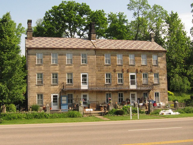
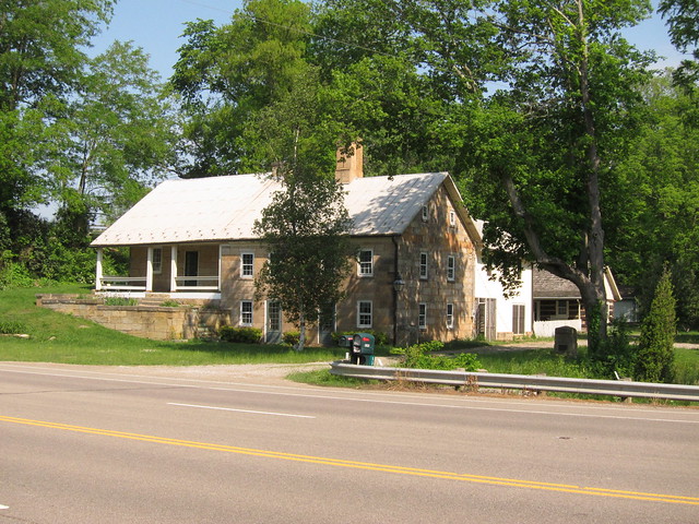
Next is the Headley Inn. Usual Headley built the original part of the house in 1802 and added the two-story portion to the east in 1833, all of sandstone block. It was one of 10 stops for mail coaches to change horses along the National Road between Columbus and Wheeling. The Headley Inn and the Smith house are private residences today.
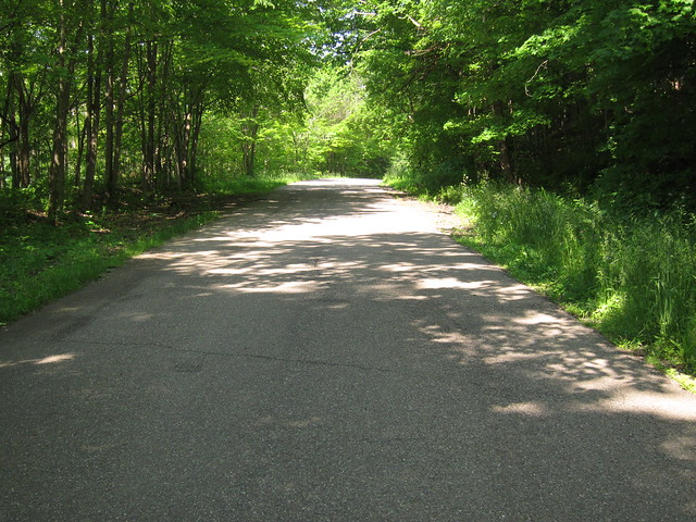
Just beyond these two houses is an almost forgotten old alignment, a little more than a mile long.
Next, the National Road's original path diverges again from US 40 on its way through Hopewell. There wasn't much to see, so I didn't stop for photos. Then many remnants of an older alignment are visible, and some travelable, on either side of Gratiot.
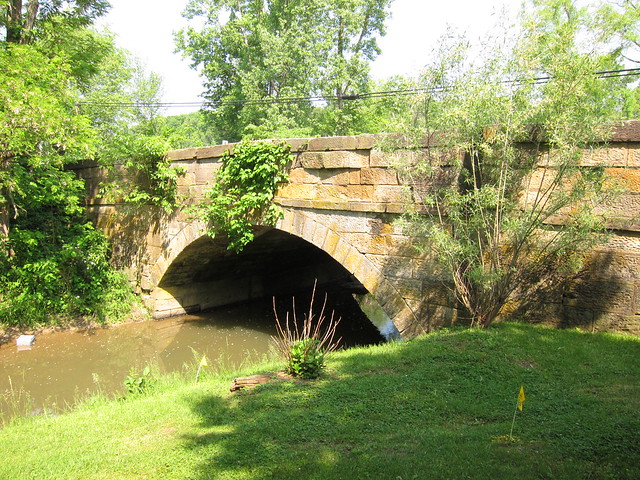
Imagery © 2012 Digital Globe, GeoEye, USDA Farm Service. Map data © 2012 Google. The crazy thing about this section of the road is that it leaves Muskingum County for Licking County just east of Gratiot, then reenters Muskingum County partway through Gratiot – and then almost immediately leaves it again for Licking County. In the Muskingum County part of Gratiot stand two little bridges. The first might not be much more than a glorified culvert, but at least the railing is interesting.
Just beyond it stands the last stone bridge I found on Ohio's National Road.
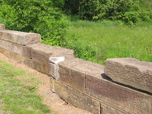
I've seen speculation that this bridge was also built by John Carnahen. Authorities agree that it was built in 1830, the same year as the known John Carnahen bridge. This one could use a little love, with some of its stones out of place and even missing.
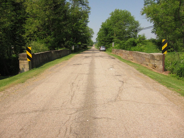
Here's the westbound view across this bridge.
Things get interesting in Licking County, as it becomes apparent that this old alignment was originally concrete. |
||||
|
||||
|
Created 3 February 2012. |
||||