The National Road in Ohio |
||||
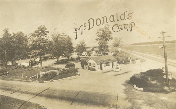
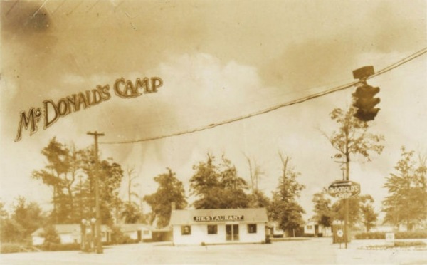
Preble CountyAs we drive around on America’s highways today we encounter the usual fast-food franchises over and over again. McDonald’s is everywhere! In the early 20th century, a McDonald’s sprouted up at the corner of US 40 and US 127, about 10 miles east of the Indiana state line. This was long before the first McDonald’s restaurant, of course. This was an entirely different McDonald’s.
Auto camps were sort of a precursor to the motel. In the 1910s and 1920s there were few services for drivers on the road. Cities had hotels and restaurants, of course. But sometimes the distance between two cities was more than could be traveled in a day, and some travelers wished to avoid hotel costs. So it was common to carry camping gear on road trips and just camp along the roadside. Sometimes a friendly farmer would let a traveler camp in his field. Sometimes a farmer recognized a revenue opportunity and charged for the privilege. Dedicated auto camps were created, and some built small, basic cabins and rented them at nominal rates. That had to be very welcome on a rainy night! McDonald’s Camp offered several cabins for rent.
A Marathon station stands on the corner of US 40 and US 127 today. But if you peek behind the station, McDonald’s cabins still stand. They appear to be rented out long term as sleeping rooms today.
I would liked to have moved in closer, but people were loitering around the cabins and I didn’t want to attract their attention. West of the Dayton metro, US 40 is just a two-lane road. The first McDonald’s Camp photo above shows the road paved in concrete. I found one very short old alignment just east of the Indiana line where a little of that concrete still exists.
With that, my three-day trek along Ohio’s National Road came to an end.
|
||||
|
||||
|
Created 4 February 2012. |
||||