State Road 37 from Indianapolis to Bloomington |
||||
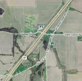
Segment at Hacker CreekLess than a mile later, I accessed the next segment of SR 37's original alignment in the middle, at Liberty Church Road.
The road is signed as Hacker Creek Road at its north end. Its abandoned north tip is visible from current State Road 37, which runs at an angle from just above center left in the photo. This is the abandoned segment of road I saw while driving home from Bloomington a few weeks earlier. The bridge over Hacker Creek was removed, orphaning this segment. This northbound photo is taken from south of the creek.
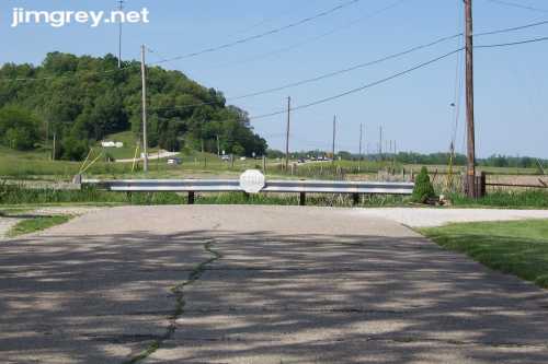
Stepping back a bit, still facing northbound, Hacker Creek Road ends before this abandoned alignment with a guardrail and a faded Stop sign. One house is on this stretch of road north of Liberty Church Road, and its driveway is at the end of the road at the right.
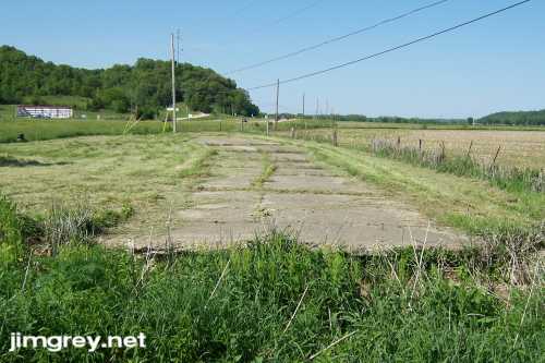
Facing southbound from that spot, the narrow road is cement as far as the eye can see, and it lacks the 2-foot extensions on either side that were common north of Martinsville.
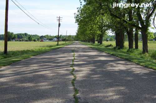
After crossing Liberty Church Road, the road is covered with asphalt (and seemed marginally wider) as it gently curves back toward current SR 37. After crossing a typical concrete bridge, the road curves to meet SR 37. As with the previous segment, there is no sign of how old SR 37 used to flow before this curve was added, despite the ridge visible on the satellite map. This alignment was about a mile long. |
||||
|
||||
|
Version 1.0, 24 May 2007. |
||||