State Road 37 from Indianapolis to Bloomington |
||||
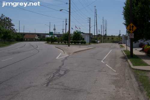
Old State Road 37 through IndianapolisAlthough State Road 37 today goes from south of Fort Wayne all the way to the Ohio River, it originally began in Indianapolis and went south. And while today the road follows I-465 around the east side of town, and then heads south on the Southwestside just west of US-31, at one time it began along West Street in town. I wanted to start at the road's former northern end, but since I'm not sure where that was, I just started on West Street where old US 40 (Washington Street) intersected. I started at the northernmost intersection in this map (the southbound lanes are West St. and the northbound lanes are Missouri St., contrary to what the map says):
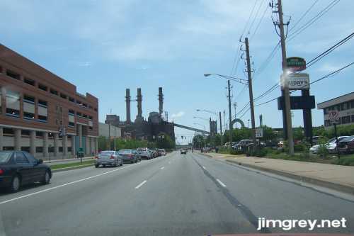
As usual, Downtown Indianapolis was busy with events, and there wasn't a place to park so I could take a photo of my starting point. So I took it from my car as I drove. I had just crossed Washington Street. The Indiana Government Center parking garage is on the left. The arch beyond the hotel sign and the speed-limit sign is for Victory Field, where Indianapolis's minor-league baseball team plays.
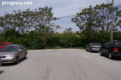
Shortly down the road, West Street curved to the left, went under I-70, and then curved back. Betting that it hadn't always been like that, I went back to check for old West Street. Both streets below are signed as West Street. The original alignment, on the right, is buried under I-70.
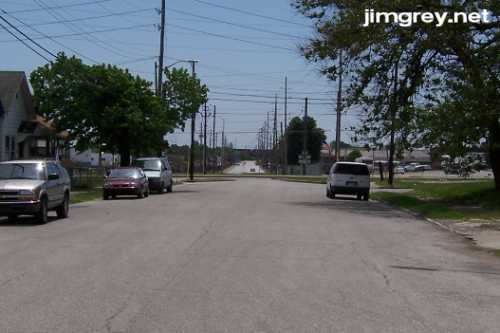
Here's where old West Street picks up on the other side of I-70, which is visible in the background beyond the trees.
South of here, West Street curves back into its original alignment, as this photo shows.
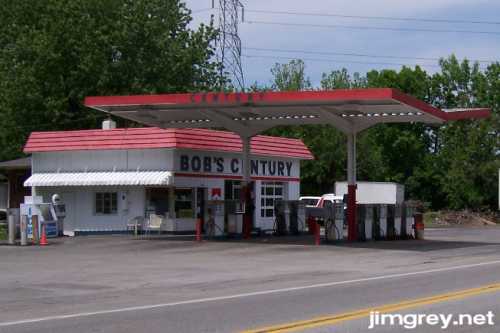
South of Downtown at about Southern Avenue, West Street angles slightly southwesterly and becomes Bluff Road. Even though it's not State Road 37 anymore, it's still a major road with wide shoulders and highway-style striping. I was getting thirsty and started looking for a gas station where I could buy a soda. The first gas station I came upon make me think I had stepped back into the 1970s! I wondered at first if it was abandoned, but the pumps had modern gas prices on them ($3.19 per gallon for regular unleaded). Maybe the station was closed because it was Sunday, another old-time practice.
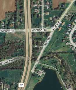
Although State Road 37's current alignment begins at I-465 a mile or two west of old 37, it quickly flows back into the old alignment. After Bluff Road goes under I-465, it passes through several neighborhoods and crosses Stop 11 Road, a fairly major Southside road. But just south of there, Bluff Road curves, becomes Wicker Road, and intersects with SR 37. A short dead-end segment of Bluff Road continues, as this map shows.
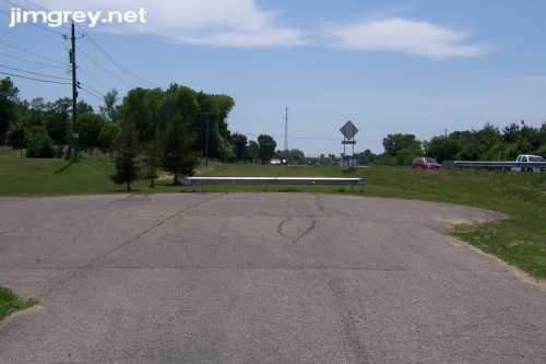
This southbound photo shows where Bluff Road curves. Notice the old edge of the road, which appears as a filled crack and runs south from the lower right side of the photo, past the white line, and across the double-yellow line.
This old segment ends where current SR 37 curves into the old alignment's path. The oncoming cars in the distance once would have come right through where I was standing.
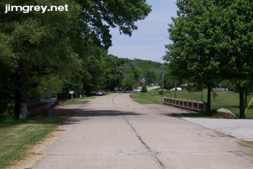
This segment of Bluff Road lacked wide shoulders, except where the bridge crossed. Most bridges I encountered on this trip were little wider than the road, while this one had wide shoulders. Did the road here once have shoulders as wide as the bridge's, or was the bridge wide in anticipation of expansion? I imagine this segment is typical of the old highway, except perhaps for striping it probably had then.
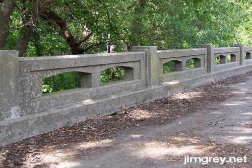
Most bridges on old SR 37 had closed cement barriers; this one had arched openings two by two. Just behind the column at the far left of the photo was a worn survey marker. I couldn't make out all the words but it said "State Highway Commission of Indiana Survey" and mentioned "above sea level."
|
||||
Version 1.0, 24 May 2007. |
||||