State Road 37 from Indianapolis to Bloomington |
||||
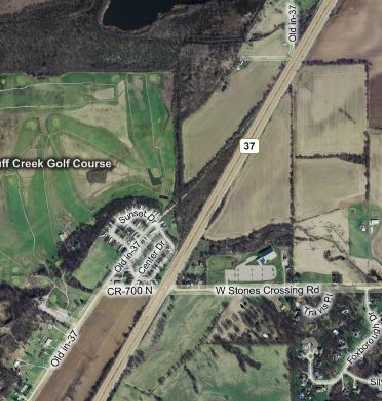
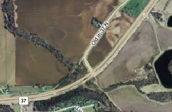
Segment at Johnson County 700NA few hundred yards south of the 800N segment's dead end, I picked up another segment of the old alignment at 700N. Tracing north from where 700N intersects Old SR 37, past where the road goes through a trailer park, a ridge exists where the road used to go. Notice how it would have curved to flow into the 800N segment.
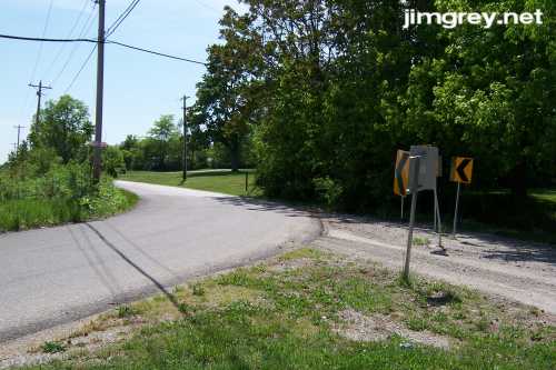
Here's where 700N curves to become Old SR 37 southbound. Notice the path that continues northbound.
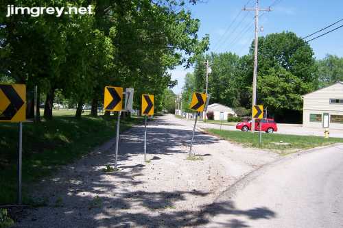
The trailer park was just north of here on Old SR 37, but to access it you have to follow the curve and then drive through the parking lot (where my little red car is parked) to get back on Old SR 37. The trailer park is less than a quarter mile up the road.
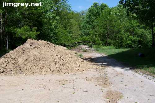
As I drove into the unusually tidy trailer park, a mound of dirt blocked my way. A branch hung low across the road.
I started to get excited — how long would this abandoned stretch be? At first, it looked like the road ended a couple hundred feet ahead.
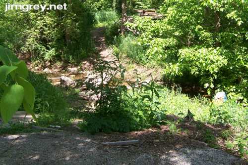
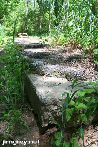
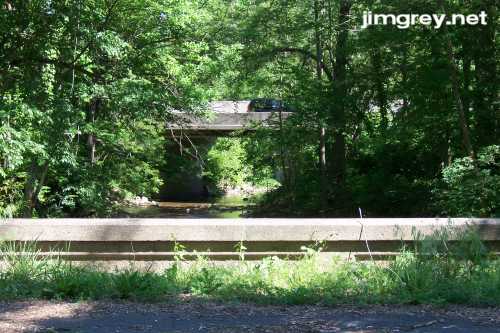
But as I walked near, I saw that this was where a bridge had once been, and that the road continued on the other side. Fortunately, the creek bank and the creek itself were shallow, and people had placed all sorts of objects in and over the creek to aid roadfans like me in their adventures, so I picked my way across.
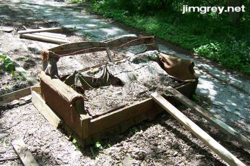
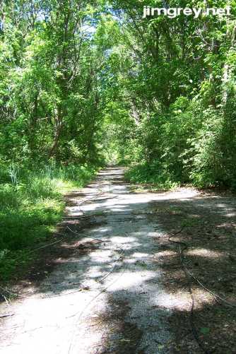
As I came up the bank, I saw the concrete road pad with three layers of asphalt on it, a couch dragged out into the middle of the road, and then the road stretching out for a long way before me. Woohoo! I tore up the bank.
The abandoned couch was a sad, sad affair. It looked deliberately placed, perfectly perpendicular to the road's edge.
The northbound sight from there was glorious overgrown abandoned road as far as the eye could see. What I thought was a ridge on the map was really old road obscured by trees. I am always astonished that without human intervention, roads eventually look like this:
I couldn't tell exactly how far I walked along this segment from where I left my car — I guessed about a half mile — making it the longest abandoned road segment I’ve ever seen. Notice how large the trees are beyond where the old road was cut off. This stretch hasn’t been a road in many, many years, at least since 1970, since my 1970 map shows the road along its current alignment.
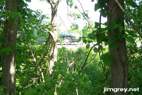
The closer I got to the end, the more I could hear cars. At the end, I turned east and saw cars speeding by through the brush and trees. I was probably 30 feet from current SR 37.
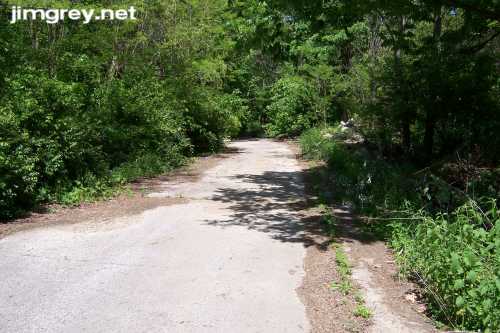
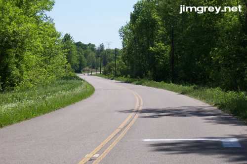
That walk absolutely exhilarated me! It wasn’t until I was halfway back that it occurred to me that people from the trailer park probably used this secluded spot for illicit activities, and that it might not actually be safe to be in there. I got back into my car and drove the length of this segment of old SR 37 as it crossed into Morgan County. It was paved and in good shape. I had it all to myself as it swayed gently through the countryside. I passed through the tiny town of Waverly on the way, but it didn't interrupt the pleasure of this drive.
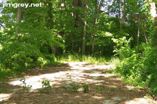
At the other end, the road curved to intersect with current SR 37, as the map shows. But again, a ridge is visible that extends from the old road.
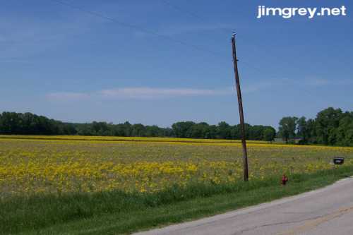
As I neared the end of this segment, I noticed that the farm field to the west was yellow with a flowering weed. I have a little of this growing my back yard along a creek bed, but I'll be darned if I know what it's called.
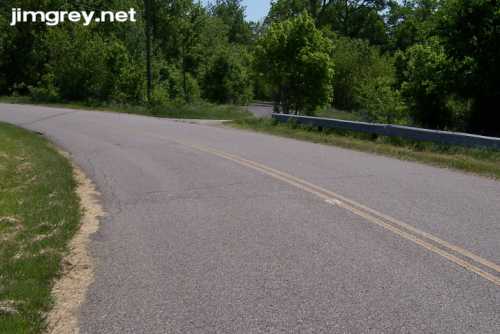
When I reached the end of this segment, which lasted I think about four miles, the road curved to meet current SR 37. But the original road was visible on the other side of the guardrail at that curve. I drove around the guardrail to see.
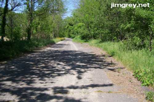
The road looked little used and was overgrown as this northbound photo shows.
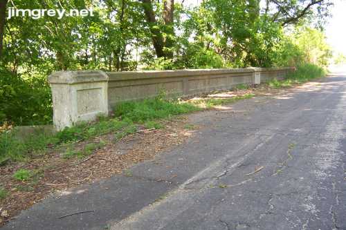
I crossed a little bridge over Crooked Creek. Current SR 37 was just to the east.
The bridge was typical of bridges I've seen on old Indiana highways, a simple concrete affair. Notice how the road is blacktopped, instead of concrete; I found that curious. I did not notice at this point the "Private Property, Keep Out" sign that was tacked to a tree just out of the picture to the left.
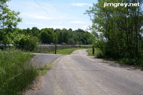
The road ended in somebody’s driveway. Notice the little path at about center left in the photo below? It empties onto SR 37 southbound, I'm guessing to let the people who live at the end of that driveway quickly get onto the highway. It also let a police car in while I was back there taking pictures. It was just before the police arrived that I noticed that "Private Property, Keep Out" sign. Now, I heed “No Trespassing” and “Private Property” signs when I go exploring. I don't want any trouble, and I empathize with property owners not wanting strangers traipsing around on their land. But this sign faced the road; you wouldn't see it unless you stopped next to it and looked right at it, as I did. I hoped that it meant only that the land behind it was private property. But when the police car arrived and hovered anxiously, I realized that this was not the case. The property owner probably called the cops on me. I turned around and hightailed it out of there. Fortunately, the officer let me be chased off.
|
||||
|
||||
|
Created 24 May 2007. |
||||