State Road 37 from Indianapolis to Bloomington |
||||
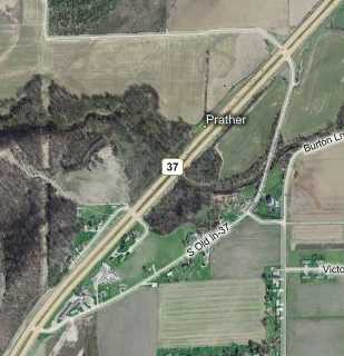
Segment at PratherNot a quarter mile south of the end of the Martinsville segment, the next segment of SR 37's old alignment appeared. I'm calling it the Prather segment because the map labels the region as Prather, even though I saw nothing nameworthy about the area.
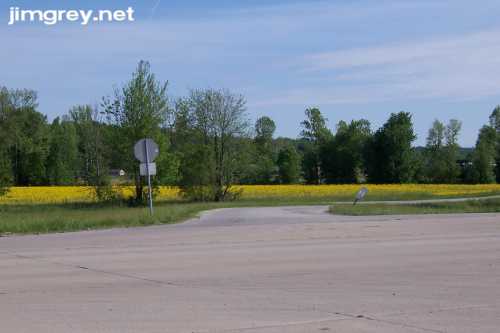
This segment began quietly among a field of those yellow-flowered weeds. The road seemed unusually narrow. I wondered if it widened when it met the original SR 37 roadway.
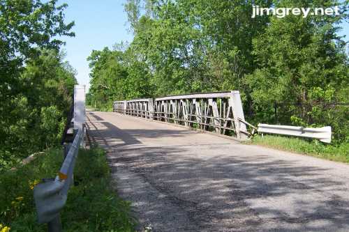
Beyond the curve, the road didn't widen. The road lacked the two-foot "extensions" on either side I had seen since Johnson County. A Narrow Bridge sign appeared before the bridge in this photo. As I approached southbound looking for a place to stop to take a photo, a minivan on the other side flashed its brights at me to say I could cross first. I wanted to stop to take a photo of the bridge there, but not wanting to confuse the other driver I crossed and then took this northbound photo. I had never seen a bridge with such stubby trusses before.
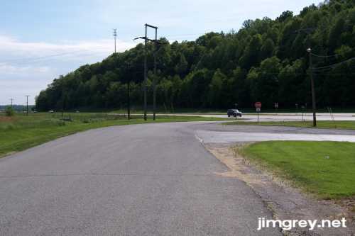
It seems like this segment, which is about a mile long, just provides access to a couple neighborhoods to the east. The narrow pavement along this segment was smooth and even but unstriped. Soon I reached the end. Most segments of old alignments that end this way clearly complete a line with the current road or pick up on the other side of the road, at least in my experience, but that was not true with either end of this segment.
|
||||
|
||||
|
Created 24 May 2007. |
||||