State Road 37 from Indianapolis to Bloomington |
||||
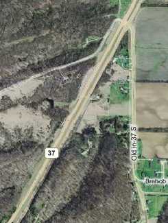
Monroe County and Bloomington alignmentsThe last segment begins 500 yards south of the Hacker Creek segment but lasts for 15 miles, going all the way to Bloomington. If you blink, you'll miss the entrance.
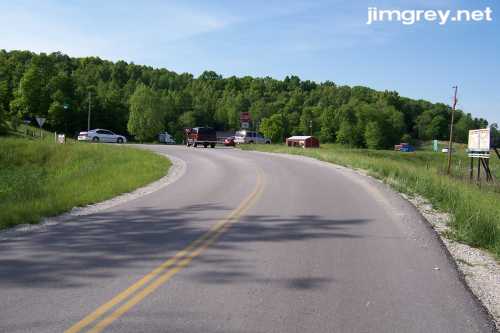
There was no good place to stop to get a southbound photo of the start of this segment, so I drove into it a little bit and took a northbound photo.
This stretch appeared to be recently paved, with highway striping down the middle (but no striping on the edges). This segment quickly became wooded and shaded. The road curved, rose, and fell gently through the woods. The steepest hill I encountered made my car strain a little bit in fifth gear, but I didn't need to downshift; otherwise, the drive was easy and pleasant. I felt like I was way out in the country, and since there was very little traffic I felt alone with the road. My windows were all down, the sun was warm, and the air was cool. I slowed down and enjoyed a perfect Sunday drive. I imagined people driving this stretch when it was still the state highway. I wondered if the trees were as thick then, and if a drive down this road was just as much a perfect way to spend a Sunday afternoon. When I stopped to take this northbound photo, a fellow in a truck stopped to ask if I needed any help. I just said "Thank you, no;" how could I explain what I was doing?
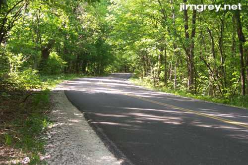
1.8 miles into this segment, a sign announced, "End County Maintenance." The fresh pavement and the gravel edge ended, but the older surface was in pretty good shape overall, with occasional rumbly patches. Striping even ended for a while, and then stopped and started the rest of the way to Bloomington. Down the road, a short segment was freshly paved again. At about 9.5 miles, I entered a clearing gorgeous with a ridge of trees, and widely spaced houses began to appear. Current SR 37 is famous for the limestone and siltstone visible along the roadside, souvenirs of where road builders cut through the terrain. I remember being impressed by it the first time I traveled SR 37 in 1983. Old SR 37, of course, lacks these dramatic displays because it follows the terrain. At just past 10 miles down this segment, I did find one short stretch where rock was visible in the hill on the west side of the road. This photo shows that stretch northbound. It also shows the condition of the pavement beyond the "End County Maintenance" sign.
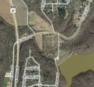
Shortly south of here, two old alignments of SR 37 intersect, as the map shows. I guess this makes the road I was on "Old Old State Road 37."
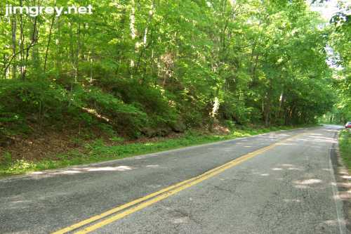
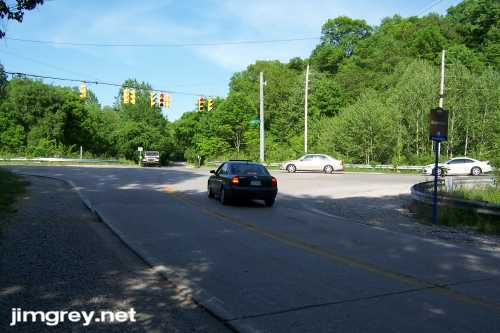
I drove through the intersection heading southbound to take this northbound photo. The lady driving the car signaling left stopped to ask me if I needed help. Maybe the folks around Bloomington are just especially helpful.
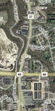
This was the last photo I could take because my camera's battery died. I had been nursing it along since the low-battery indicator appeared north of Martinsville. I wanted to take just two more photos — one where this alignment emptied out onto College Ave. in Bloomington, and another where Business SR 37 met current SR 37. As the last bit of this segment of the original SR 37 alignment entered Bloomington, the road became cement again and the speed limit dropped to 20 miles per hour as it passed a park loaded with people. The road is signed College Ave., but it turned to the left and intersected with College Ave. where it merges with Walnut St. on Bloomington's north side.
If you turn left onto Walnut St. you are on the newer old alignment of SR 37. It's more modern than the older segment, with smooth pavement and passing lanes where the hill is steep. A few miles north of here, it goes over a little iron truss bridge and merges into current SR 37 northbound. I drove current State Road 37 home. It's a pretty drive, especially through Monroe and Morgan Counties, with the limestone and siltstone, and the grand ridges of trees, calling for your attention as you go. But it lacks the intimacy and the peace of the old road. |
||||
|
||||
|
Created 24 May 2007. |
||||