West-Central Indiana Excursion |
|
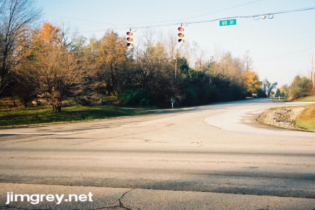
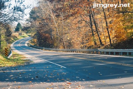
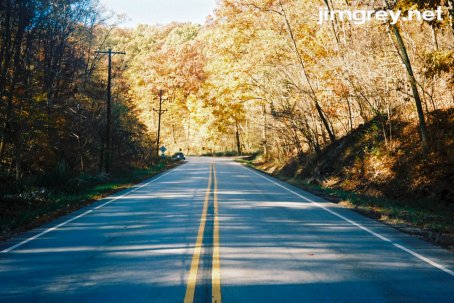
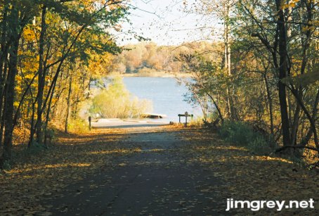
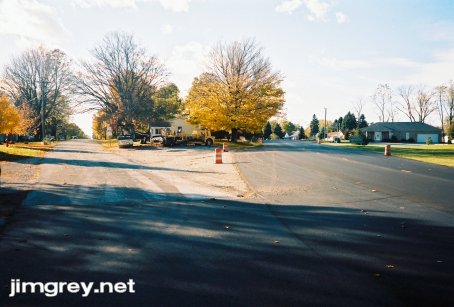
The trees were startlingly colorful in the autumn of 2006, with arresting yellows, plentiful and vibrant oranges, and hot reds in their first appearance in years. I wanted to take a road trip when fall's colors peaked, but that came and went in one day, it seemed, and I was stuck at work that day. There was still enough color left the following Saturday, October 28, though, so off I went. I chose State Road 47, US 41, and US 36 as my route. SR 47 and I go back almost 20 years, when I was experimenting with ways to drive between college in Terre Haute and home in South Bend that didn't involve I-70, I-465, and US 31, which alternated between boring and congested. After I found SR 47, it became the highlight of my trips home. I enjoyed several beautiful autumn drives along this road as it wound through Parke County by Turkey Run State Park, and then through some unexpected curves in the farmland of Montgomery and Boone Counties. US 41 and US 36 cut through some similarly lovely terrain, would bring me back to my Indianapolis home, and fit nicely into one day, so they were in. US 41 is fairly twisty through Parke County, and I had learned from a friend that US 36 is peppered with old alignments. So off I went. The route: State Road 47from US 31 to US 41 State Road 47 currently stretches from US 41 to Sheridan at SR 38. It originally ran northeasterly from US 41 to Crawfordsville. The state decided it was more northerly than easterly, and so gave it an odd number. While later extensions make SR 47 clearly more an east-west road, it keeps its odd number and its "North" and "South" signage. At one time, SR 47 extended east from Sheridan to US 31 north of Westfield. Until recently, a bent sign partially hiding behind some overgrown trees tried to proclaim the distance to Sheridan, but the numbers had badly faded in the sun. Looking forlorn but very official, it seemed certainly to be a relic from the days the road was still a state highway. I wanted to take a photo of it on this trip, but I learned a valuable lesson: don't delay in taking photos. That old sign had been replaced with a gleaming new sign unobstructed by vegetation. Oh well. I started at the old eastern end of SR 47. Here it is, cleverly disguised as mild-mannered 236th St. in Hamilton County, looking westbound.
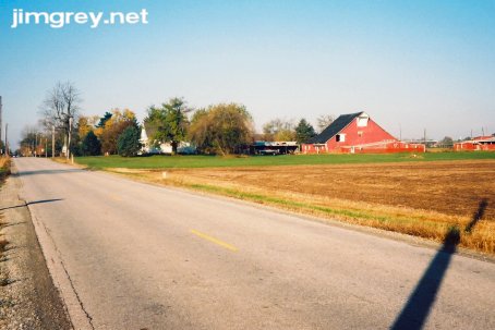
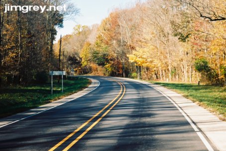
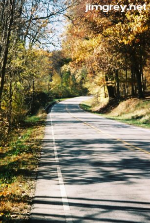
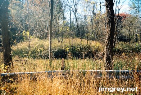
On Monday, back at work, someone stopped me in the break room and asked if that was me taking a picture from the median of US 31. I hid my surprise that anybody I knew actually saw me. I said yes. He was very puzzled, but I left it at that. Old SR 47 is very narrow and flat along its five miles of farmland. It also has no shoulders. It had rained buckets the day before, making ponds out of most farm fields. That didn't make for very picturesque scenes, and so it was hard to find a decent place to take a good photo. This photo shows one of the dry spots westbound along the route.
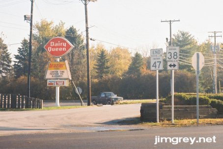
Sheridan arrived in no time. This photo, pointing eastbound, shows old SR 47 coming into town at the road's current eastern end at SR 38, which was freshly paved but not yet striped. Every small Indiana town is required by statute to have at least one Dairy Queen, by the way.
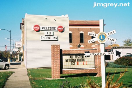
After SR 47 passes through Sheridan's southern edge, its lanes widen. As it passes out of Hamilton and into Boone County, the road occasionally rises and falls gently, but remains straight until it intersects with US 421, the old Michigan Road. Then gentle curves begin to appear, slight bends in the road. The next burg along the way is Thorntown, a well-kept small town lined with tidy homes, churches, and shops. In my twenties, I disliked Thorntown because it needlessly interrupted my swift progress. When my ex-wife and I were dating many years ago, she and I passed through Thorntown on our way to a camping trip. She was driving her car behind me as we needed both of our tiny cars to haul all the gear. As usual, I didn't see the speed-limit signs at the edge of town as I drove in from the west. The police were ready for me. The officer pulled out of somebody's driveway and hit the lights and siren. I pulled over and the officer, a big Sheriff Buford type with the buzz cut and the mirrored aviator sunglasses, began to give me a chewin' out. His face pinched, he was wondering with considerable volume if I had skill enough to read speed-limit signs when my now-ex, who by the way was lovely and slender with blue-grey eyes and a big mess of blonde hair, pulled around in front of me and stopped. Sheriff Buford seemed annoyed and waddled purposefully toward her car. He was gone for quite some time, but when he came back, he was chuckling and smiling. He said to just take it slow through town and wished me a good weekend! Since this happened before everybody had cell phones, I had to wait about two hours until we stopped again and could ask just what the heck happened! She said, "When he came up, I rolled down the window, batted my eyelashes at him, and said, 'If you give him a ticket, you have to give me one too, because I was following him!' He laughed and laughed and I guessed when you drove off that he let us off the hook." This did not do anything to improve my opinion about Thorntown. But I've matured considerably in the years since then, and I have become much better at noticing the speed-limit signs at the outskirts of small towns, and so now I bear no ill will against Thorntown. On the contrary, I find its entrance from the east to be quite lovely. You swing around this little curve over a bridge, and then suddenly the town appears before you. This photo shows the little curve and the bridge. As you can see, SR 47 was recently paved but not yet striped. It was this way along most of its route.
Please pardon that the curve and bridge above are not crisper. When I walk out into the middle of a highway to take a photo, I necessarily keep my ears wide open for the sound of a car coming from behind me. This day was extremely windy, and the wind drowned out the sounds of oncoming cars. Not wanting to be squashed, I took this photo (and many others this day) in a hurry. Thorntown is at the center of what was the 64,000 acre Thorntown Indian Reserve, where the Eel River Tribe of the Miamis lived. This reserve didn't last long, just from 1818 to 1828. Thorntown gets its name from the Miami name for the place, Kawiakiungi, which means "place of thorns." Here's what you see as you swing across the bridge and enter Thorntown from the east. SR 47 is just out of the picture on the left. At any moment, you expect it to start snowing, and Jimmy Stewart to come running through town shouting, "Merry Christmas you old broken-down Building and Loan!"
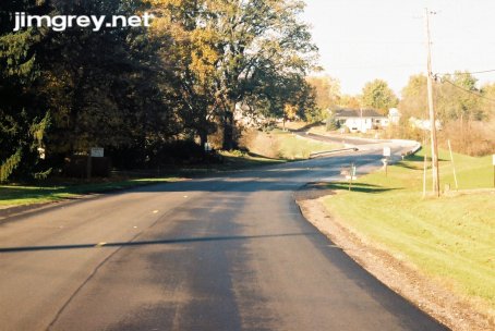
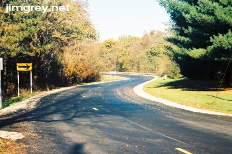
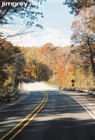
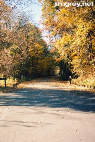
Two miles outside Thorntown the road twists a bit through a wooded area. The road rises and falls a bit through this area as well. A sign near where I took this photo says that a town called Colfax lay five miles to the north. This photo points westbound.
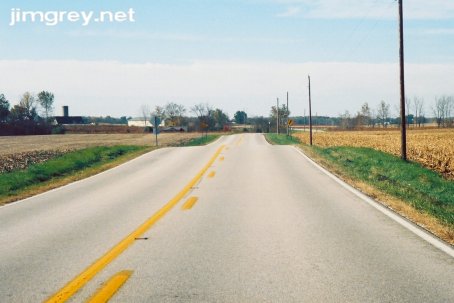
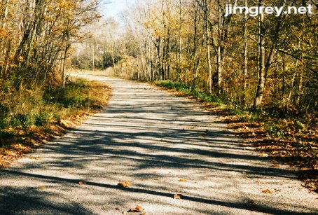
As Boone County faded into the farms of Montgomery County, the fresh pavement ended. Driving is pleasant as the road rolls. Curved and straight sections alternate.
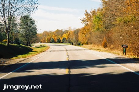
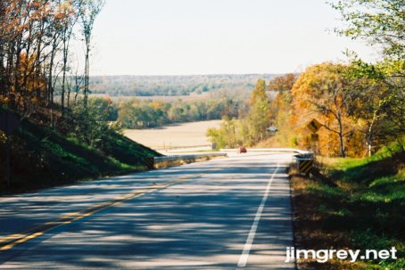
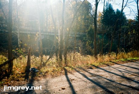
As the road runs under I-74 and draws near to Crawfordsville, farmland is replaced with family homes. This curve showed some of the best fall colors of the trip so far.
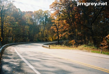
In Crawfordsville, SR 47 multiplexes first with SR 32 and then with US 136. As SR 47 turns south on the edge of downtown, US136 goes its own way, but US 231 multiplexes in. Outside of downtown, SR 47 turns back west, leaving US 231 to its southerly path, and finally SR 32 takes a northwesterly fork, and SR 47 is all alone again. Because of some construction on SR 47, I was detoured down US 231 to SR 234, which intersects with SR 47 8 miles west of Crawfordsville. US 231 was unremarkable, but SR 234 was interesting — narrow and gently rolling through the farmland, with a drainage trench immediately off the road's edge making stopping for photos impossible. At one point, the road gently curved so a bridge could span something perpendicularly. As Turkey Run nears on SR 47, the road becomes more curvy and hilly, and the scenery becomes more lovely. This eastbound photo, a few miles east of Turkey Run, shows the long shadows of the late-morning autumn sun.
Here's a westbound shot from the same spot. This is a nice little hill.
Just west of the entrance to Turkey Run, you drive past the treetops as a bridge spans a valley. A couple miles later, SR 47 ends at US 41.
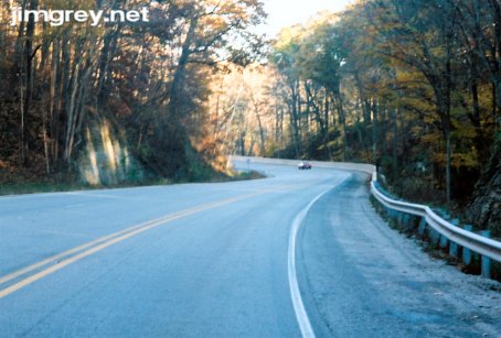
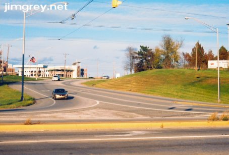
US 41from SR 234 to US 36 I headed north on US 41 to SR 234, and then turned around for the southbound trip, which ended up taking me almost to Terre Haute. In the periphery, imposing tree banks grow upon massive hills that seem to well up out of nowhere. The road curves around them, yet at times is steep enough that my little car bogged down in fifth gear. Naturally, the road's thin shoulder left no obvious place to stop for photographs. That situation changed south of SR 47. The road alternated between gnarled and straight. This southbound photograph is in the middle of an isolated gnarled section.
After crossing US 36 in Rockville, I stopped to take a photograph of a stirring wall of color created by the southbound road's curve ahead. The photograph doesn't do the scene justice.
This stretch of US 41 frequently passed between dense woods and open country. In this photo, the road feels lonely and isolated in the deep woods as it curves uphill. I took this southbound photo from the edge of the road because a curve behind me blocked my view of oncoming cars, and the high winds masked their sounds.
That curve crests a hill, and then the scenery suddenly opens wide. These juxtapositions are common along US 41 in Parke and Vigo Counties, and they make the road a real pleasure.
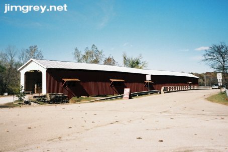
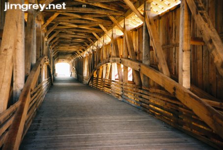
It had been on the order of 15 years since I had last driven here. I remembered US41 being curvier and more challenging to drive; I thought there were big "Dangerous Curves" signs north and south of Rockville. Was I imagining these things? I felt like a man who visited the home of his boyhood — how could a yard that small have ever seemed so huge? Side tripBridgeton, IN When I lived in Terre Haute, I used to drive up to Bridgeton whenever I wanted to get away for awhile and be alone. The old covered bridge there was a great place to find some peace (except during the annual Covered Bridge Festival, when it was cram-packed with people). In 2005, an arsonist destroyed the bridge, which had stood since 1868. (See some photos of the old bridge before, during, and after the fire.) Funds were raised and the bridge was rebuilt in time for the 2006 Covered Bridge Festival. The Festival having just ended, I decided to detour to the bridge. I turned left off US 41 onto a country road that led to Rockville, and then, as in years gone by, I drove around until I found the homemade signs pointing to Bridgeton. I'd forgotten how the Bridgeton Road winds for quite some time before abruptly entering the town and just as abruptly coming upon the bridge. This photo is from Bridgeton Road northbound. Notice how the road is rerouted from the covered bridge to a modern bridge; the covered bridge hasn't carried anything more than tourist foot traffic since 1967.
The old bridge's seeming permanence was comforting to me. It was simultaneously sad and exciting to see the new bridge — sad to lose an old friend, but exciting to see how so many people cared so much to rebuild so quickly and with such historical accuracy. On this sunny day, the bridge was bright inside, and construction was visible in detail. The builders did a tremendous job.
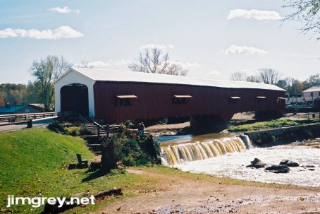
The bridge is most often photographed from the north to show the little waterfall.
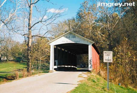
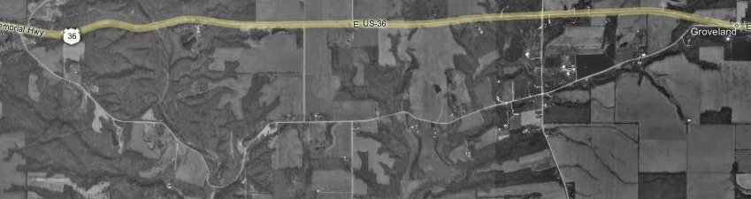
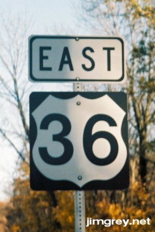
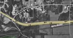
I felt as though my old friend had never left. Satisfied, I followed that country road north past the 10 O'Clock Line, which marked the boundary of an Indian land sale to the US in 1809, toward Rockville. US 36from SR 41 to Indianapolis (I-465) I was surprised and pleased when Bridgeton Road wound its way right into downtown Rockville. I drove around a while trying to find US 36, which turned out to be only one block away but was not signed through town. When I stopped grumbling to myself about that, I headed east. Parke County did a very nice job of signing old alignments of US 36. The first one I encountered was just outside Rockville by Billie Creek Village. It ran south of current US 36, as the map shows.
Old 36 Road, as this alignment is signed, is very narrow. I imagine the alignment is very old and has not been used as US 36 in many decades. I encountered a car and a truck within the first quarter mile, and it was a tight squeeze. When I passed the truck, I wasn't sure we'd both fit, so I edged my passenger-side tires onto the grass.
What the map doesn't show, and I was delighted to find, is the 1895 covered bridge still in use along the route. I had never driven on a covered bridge before — every other one I'd ever seen had been limited to foot traffic. It gave me spooky chills to drive on it since I was trusting 111-year-old wood, rather than good old steel and cement, to hold my 2,700-pound car. With quiet strength, the old bridge stoically did its job.
I find this alignment curious because I saw no evidence that it ever flowed into the current roadbed. Here's where it ends at US 36 about a mile down the road.
About a mile and a half east, I missed what is probably another old alignment of US 36. The map shows how it runs to the north of the current road. Maybe I'll go back and drive it another day. It looks like curvy fun.
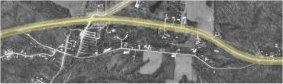
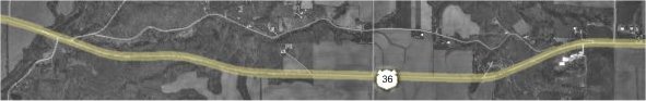
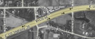
I didn't miss the next old alignment, which runs through Raccoon Lake. Here's the map. Notice how the old road, from west to east, runs slightly north of current US 36, then crosses it, and then ends at the lake and picks up on the other side before flowing back into current US 36. The US Army Corps of Engineers built Raccoon Lake between 1956 and 1960 as a flood-control project. They built a new segment of US 36 straight-as-a-stick across the new lake, and just buried the old road underwater.
Somehow, I missed the western end of this alignment. I realized it when I saw a sign for Hollandsburg. I took the next left, CR 870 E, and drove north on it to the alignment, which was signed as Old 36. I drove west, hoping to find the beginning of the alignment. But without warning, the road dead-ended. The map above doesn't show it, but something, maybe a creek, bisects the road.
This photo shows the barricade at the end of the road, and the mound on which the road is built on the other side. I didn't bother driving around to find the other side; maybe next time. I'm curious: Was the road cut off as part of the Raccoon Lake project?
I stepped back to take a picture of current US 36 to the south. Unfortunately, the sun was facing the lens, which washed out part of the photo. It's hard to see, but the asphalt road was coated in a fine gravel here.
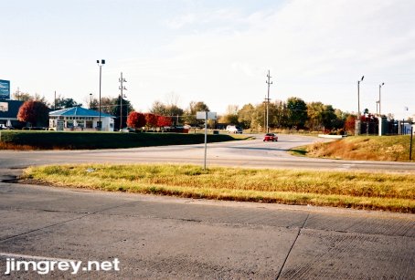
I turned around and drove west. After a couple hundred yards, the gravel ended. As this photo shows, old US 36 here was cut into the scenery. Driving this narrow road made me feel like I was a part of the land. In contrast, driving the elevated US 36 gave me a broad and stirring view of the scenery.
Old US 36 forms an S of sorts as it crosses current US 36. A friend who works in civil engineering tells me that when an old road is rerouted, the old road is usually curved to cross the new road at 90-degree angles for safety. This photo shows this crossing pointing westbound.
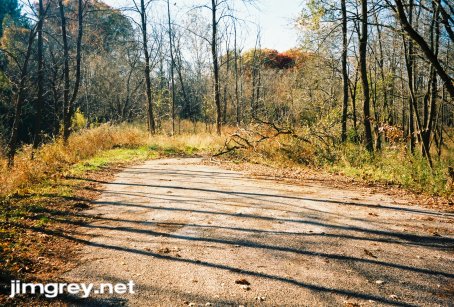
It was exciting to follow this segment of road eastward to its end at the lake. The road is used as a boat ramp today. The road actually curves to the left just before it reaches the water; the boat ramps were built on the right. A co-worker who grew up in this area told me that in the winter, the Army Corps of Engineers lowers the lake by about 20 feet, and you can see a bit of the road that is normally underwater.
Looking back westbound from the end of the road, old US 36 is pretty.
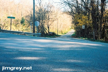
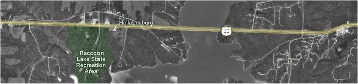
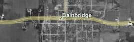
I drove back to US 36, found the eastern end of this old alignment, and spent quite some time driving around trying to find where the alignment ended at the lake on the other side. It would have helped if I had remembered to bring the map I had printed; without it, I was chasing wild geese. Tracing the map above eastward from where the road comes out of the water, I can see now where I went wrong. I followed the curve that headed south rather than making the little jog to the right. The road I took was fun with plenty of tight curves, at least. The yellow background on the curve signs was fading; in a few cases, the yellow had faded away and the black curve arrow was on a silver background. Eventually, I realized I was going nowhere fast and turned around. This failed search used up a lot of my time, and I started wanting to get home. I was so irritated with myself that I forgot to take a photo of the eastern end of this alignment. US 36 jogs to the north as it enters the little town of Bainbridge in Putnam County, as this map shows.
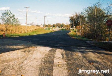
I stayed straight. The road wasn't signed as Old US 36, but it's hard to believe it isn't an old alignment since it lines up perfectly with US 36 on both ends. I didn't get photos of the west end, but here's what the east end looks like pointing eastbound. US 36 had just been paved starting at about the Putnam County line.
Here's the westbound view into Bainbridge from the same point.
When I came across CR 300 E a half-mile east of Bainbridge, I was tempted to drive it. I remembered that the map I had forgotten showed what most likely was a long alignment near here. But I had spent more time on the trip than I planned and was growing tired, so I decided to defer this jaunt for another day. Here's what my map showed. A sign on a pole on 300 E pointed the way to a covered bridge. This looks pretty juicy.
Driving the current alignment of US 36 in this area, I came across a reassurance marker that used a nonstandard typeface. People must think I'm nuts when they see me on the shoulder, taking pictures of road signs.
For about a mile east of CR 300 E, the road cuts through some varied terrain and is pretty and interesting to drive.
When US 36 enters Danville in Hendricks County, it becomes a major artery and loses all of its charm. When I visit friends in this area, I usually ask about back roads to their houses so I can avoid US 36, which gets mighty congested. US 36 was rerouted and widened to four lanes on the east side of Danville. This map shows both alignments where they split as you head east out of Danville. I wonder whether old US 36 used to go straight to meet current 36, rather than curve like it does now to intersect with it.
Here's what this intersection looks like.
It seems pretty clear that they turned the old alignment south to intersect with current US 36, as the map shows.
Here's what the intersection looks like. Now that I think of it, I should have driven back up to where old 36 curves south and taken a photo showing how old 36 and current 36 line up.
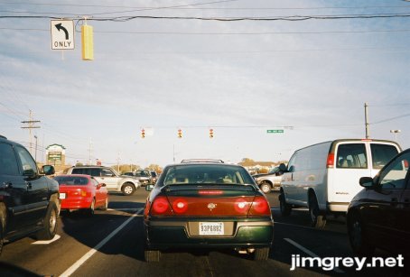
This photo, taken in Avon, is typical of any drive I've made, day or night, along US 36 in Avon. I am always looking at someone else's exhaust pipe. It seems like I never quite make it to the speed limit, either. It seems like most things in Avon dump out onto US 36. What's the charm of living in Avon if every trip involves slow-moving traffic on the town's only artery?
After I made this trip, I learned that US 36's original 1927 route began in Downtown Indianapolis and headed west from there. Another day I'll make a proper US 36 trip, starting at Downtown, driving all the old alignments I can find, and ending no sooner than the Illinois border. |
|
|
Created 17 December 2006. Last update 24 May 2007. |
|