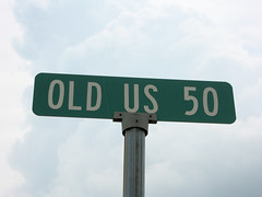
US 50 in Indiana |
||||
Which road to drive? I generally have no trouble choosing a road for a trip. I have a running mental wish list of old roads I want to explore – Ohio’s National Road, Indiana’s two Lincoln Highway alignments, State Road 37 south of Bloomington, and US 50 across Indiana and Illinois are at the top of the list. I am also very curious about the Buffalo Trace, which was cut by buffalo across Kentucky, Indiana, and Illinois; and the Vistula Trail, an Indian trail that ran from about Pittsburgh, PA, through South Bend, around Lake Michigan, and up to Green Bay, WI.
That was enough of a nudge for me. US 50 it would be! I made my first US 50 road trip in June from the Ohio state line west to about Seymour, my second from Seymour to Shoals in July, and my last from Shoals to Vincennes, the Wabash River, and the Illinois state line in August. US 50 is one of the original US highways from 1926. Like all highways with numbers that end in zero, it originally stretched across the nation – Ocean City, Maryland to Sacramento, California. It was extended to San Francisco in the 1930s, making it a coast-to-coast road; but then in the 1970s, the road was truncated to West Sacramento as Interstates overtook the old road west of there. Despite this, US 50 has suffered less at the hands of Interstates than most of the original nationwide highways.
Like so many highways, US 50 has been straightened and widened in some places and outright moved in others, leaving behind a wealth of old alignments. But even with all my old maps and road guides, I found it challenging to trace US 50′s original route in some places, in no small part because the original route doesn’t exist in some places anymore. But where I was able to find the old road, I found plenty of great things to see. I photographed them with my usual obsessive-compulsive thoroughness and share them here with you. As usual, to see the entire road, use the navigation links at the bottom of each page. Use the prev and next links to move back and forth, or just click on the county you want to see.
|
||||
|
||||
|
Created 2 January 2011. |
||||