US 50 in Indiana |
||||
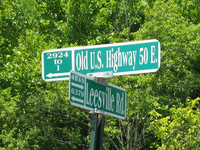
Lawrence CountyLawrence County must be proud of its old-road heritage, because it signs Old US 50 as, well, Old US 50.
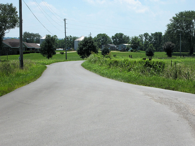
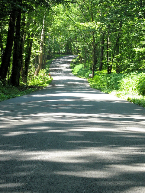
The road snakes around quite a bit in Lawrence County.
This is my favorite shot from along this old alignment.
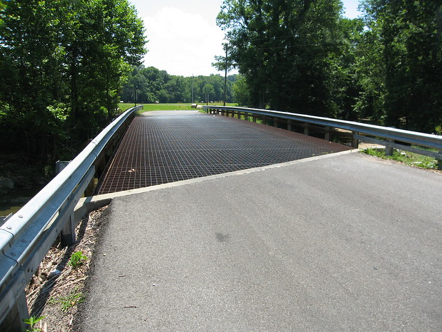
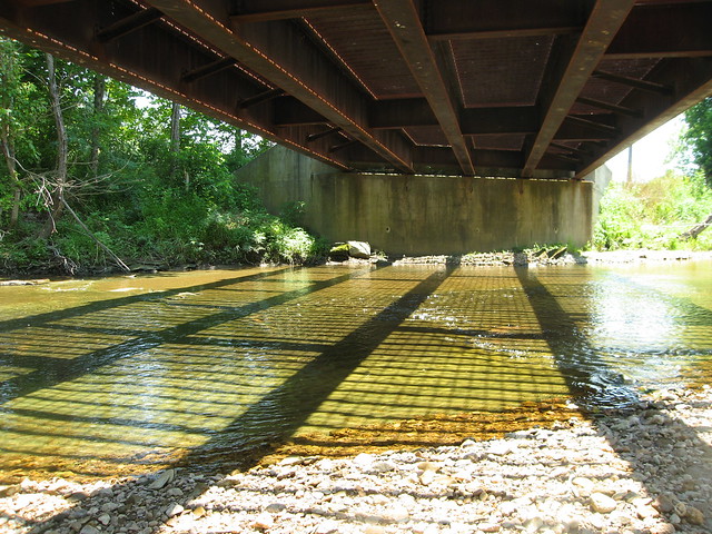
We soon came upon a bridge with a steel deck. It's a pretty recent replacement for an older bridge, but I think steel decks are cool. So we stopped for some photos.
We even got underneath.
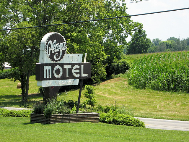
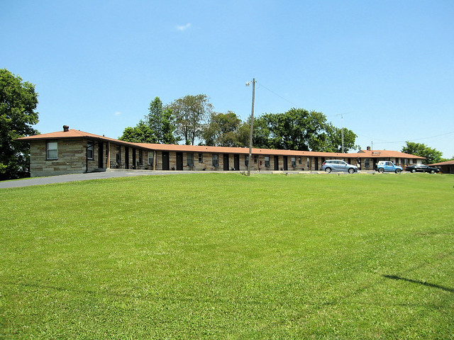
All too soon, this great old alignment came to an end. Back on modern US 50, we came upon this great motel sign.
It stands before this motel, which still operates.
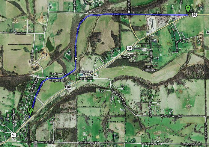
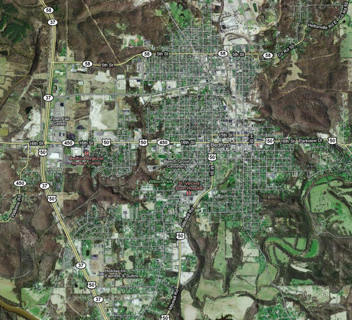
Just before we came to Bedford, we followed what I think was an old alignment. I marked it on this map in blue. It wasn't very picturesque, so we didn't stop.
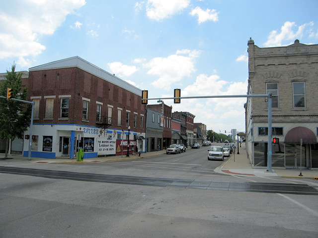
And then came Bedford. My old maps and road guides suggest that US 50 may have jogged up to 15th St. for a few blocks. They are clear that US 50 originally headed south out of town on Washington Ave. (which is two blocks west of M St., one of the roads labeled US 50 on the map below).
This is the Dunn Memorial Temple, on 15th St. It's a little hard to tell in this photo, but the street is a slight incline.
This photo shows the incline better.
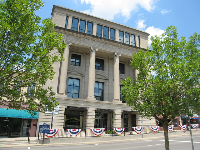
This is the Lawrence County Courthouse, on the town square.
This is 16th St. from the southwest corner of the town square.
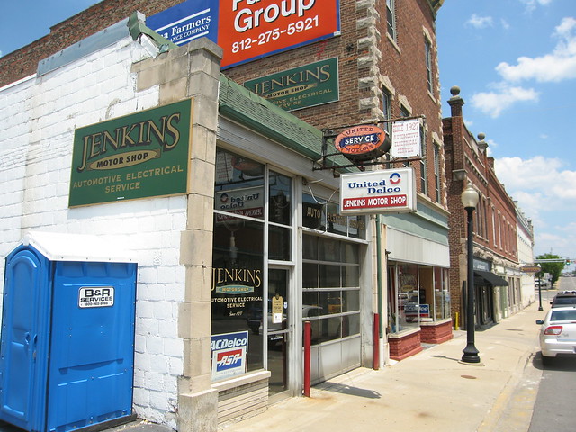
I really liked this garage on 16th St. The sign says it's been here since 1927, which is the year US 50 was born.
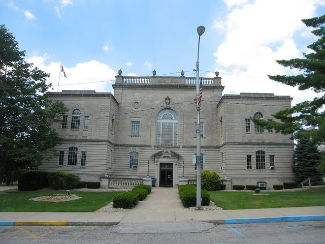
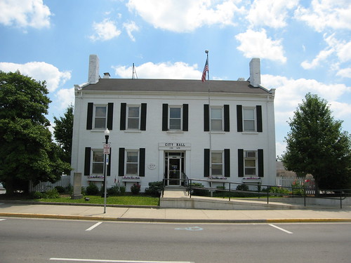
This is the Bedford City Hall.
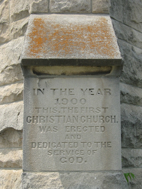
This is the First Christian Church. I'm showing it to you to give context to my next photo.
The letterforms engraved into this cornerstone certainly make you believe that the people who built this church meant every word of this.
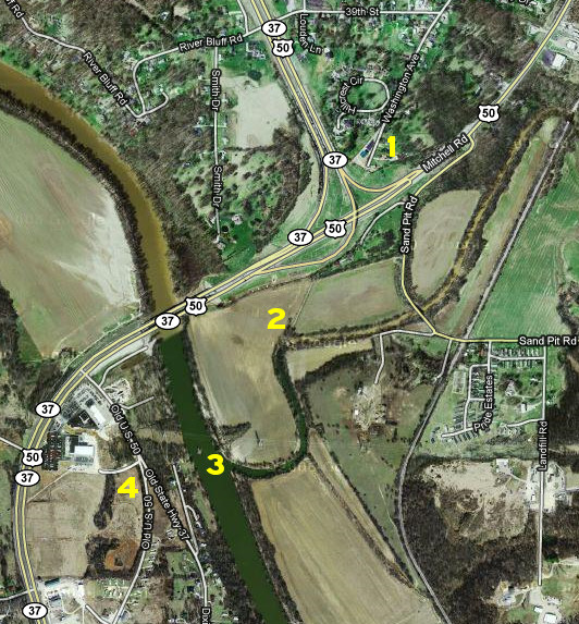
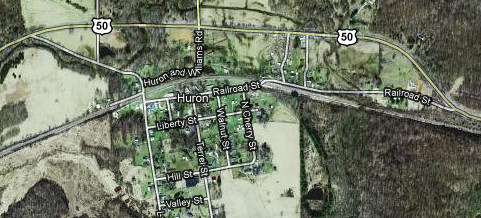
Bedford has done well for itself, thanks in no small measure to being at the crossroads of US 50 and State Road 37. These major highways attract heavy through traffic, so much so that they have been realigned in and around Bedford several times. But once upon a time, back when US 50 was still Old State Road 4 and State Road 37 was Old State Road 22 (and before that the Dixie Highway), these roads converged in downtown Bedford and followed the same path southwest out of town. This image shows how these roads leave town today, with numbers next to various old-road remnants. I believe it shows remnants of at least three former alignments, but I can’t confidently stitch them all together. This is quite a puzzler!
1: Washington St. once carried Old SR 4 and Old SR 22. Perhaps they diverged here; who knows. But today both roads dead end; the right road is private property.
2: If you study the aerial image closely, you can see a two-track road that is on the same line as the left fork of Washington St. I believe I see two utility poles along it, which is a good sign. I can’t explain the little abandoned pony truss bridge that crosses the creek where it bends. It’s near the bottom of the image below. It’s not in line with US 50′s general direction, and no road emerges from it after it crosses the creek.
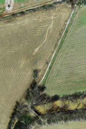
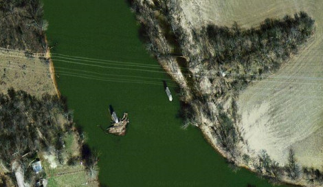
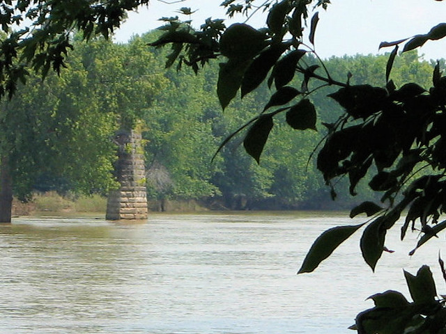
3: I think the old road continued through what is now a farm field. I detect a faint line across the field where the road would have gone. Then it would have curved to cross the White River. Remarkably, two piers from the old bridge remain. They’re plainly visible from the air.
You can also see them from the current US 50 bridge. There wasn’t a good place to stop there, but my travel companion noticed a nearby boat ramp road. We waded into inch-deep mud and were eaten alive by mosquitoes to bring you this shot of one pier.
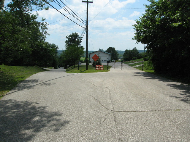
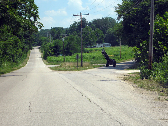
4: A narrow gravel road begins just where drivers would have come off the bridge. It is signed something like “Old Highway Road” on the ground, but it’s perpendicular to the former bridge. The gravel road ends at Old US 50 and Old SR 37, which assumes the gravel road’s line at that point. So before this point, the road labeled Old US 50 and Old SR 37 must be a newer old alignment. This photo shows where Old US 50 forks right, leaving Old SR 37 behind.
An interesting tidbit: My 1916 Automobile Blue Book sends drivers down the road on the left to the next town, Mitchell. Then it has the driver follow what is now State Road 60 west to where it intersects with modern US 50. In contrast, my 1924 ABB sends drivers down the right fork in the photo above. Modern US 50 soon rejoins its path. This resolves one piece of this puzzle – US 50′s path west from here to where it meets SR 60 about 10 miles away was built sometime between 1916 and 1924. But I’m still grasping at straws about everything else I see here. US 50 passes through the Hoosier National Forest before leaving Lawrence County. There were a few possible old alignments along the way, including one through the tiny town of Huron.
But our time was running short on this leg of the trip. We drove this alignment, but didn't photograph it, choosing instead to push on to Shoals. |
||||
|
||||
|
Created 2 January 2011. |
||||