US 50 in Indiana |
||||
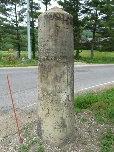
Dearborn CountyI usually photograph state lines on my road trips. As I began to explore US 50 across Indiana I was hoping to capture a Welcome to Indiana sign as the road crossed in from Ohio. What I found was far better than any old sign.
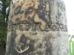
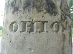
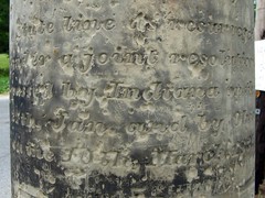
This sandstone monument is right on the state line. Back in 1837 there was some doubt as to where the line actually lay near the Ohio River, so Indiana and Ohio jointly ordered a new survey. The line freshly reestablished, the states had this monument created and placed on the line along this road that one day would become US 50, but was probably known as the Louisville Pike then. Even though this column is round, words are engraved on all four “sides.” The state names are engraved to face the appropriate directions.
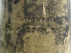
The north side tells that the column was “Erected Nov. 27th, 1838.” The south side tells the column’s story: “State Line as resurveyed under a joint resolution passed by Indiana on the 27th January and by Ohio on the 10th March 1837.”
It was challenging to find any information about this column on the Internet. Apparently, Ohio and Michigan had a serious disagreement about their border in 1835. There’s a ton of information about it on the Net, and sorting through it all was tedious until I got wise and told Google not to return any results that include the word Michigan. And then there it was, the one lone page on the entire Internet about this column. (I guess this just became the second page about it.) That page says that in 2001, the monument was found uprooted, which is pretty remarkable when you consider that it is nine feet tall and weighs 5,000 pounds. Here, then, is how US 50 enters Indiana from Ohio.
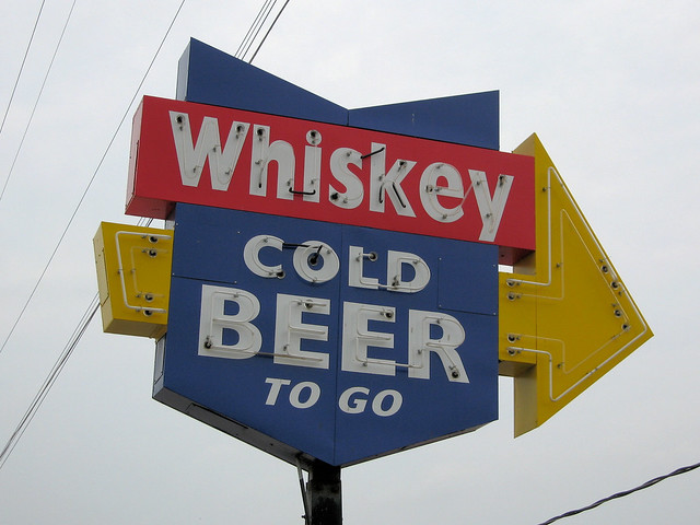
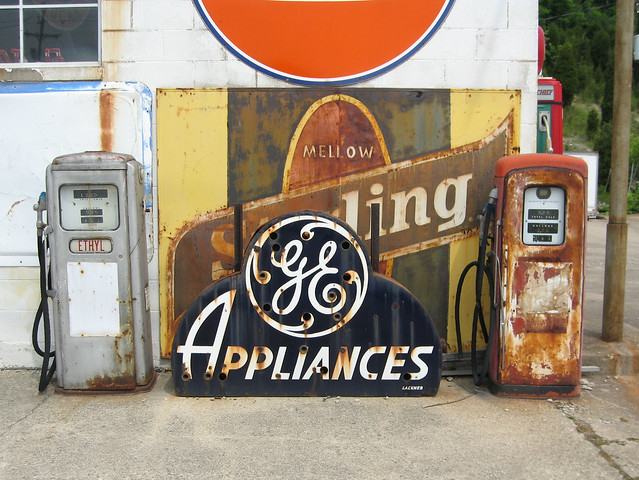
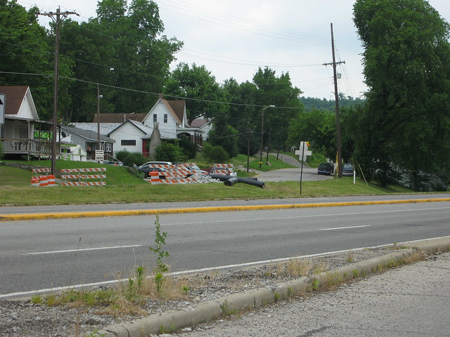
The stretch of road just inside Indiana is a wealth of great old signs. First, I came across this neon beauty in front of a liquor store.
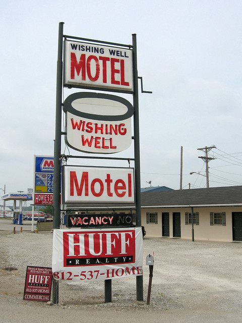
And then, this motel, which was for sale.
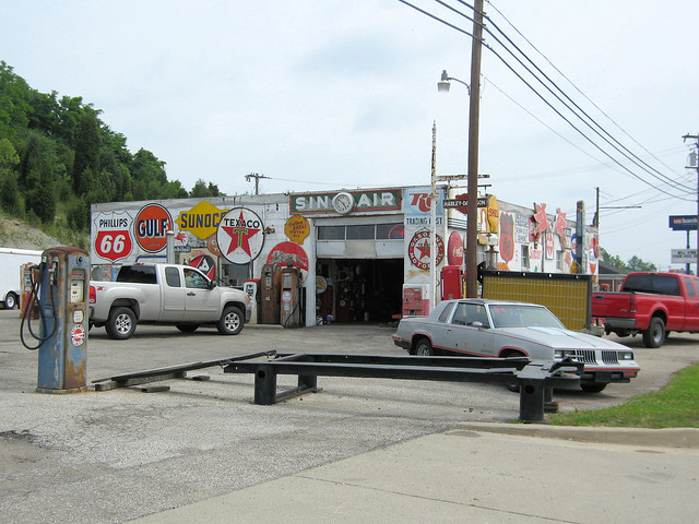
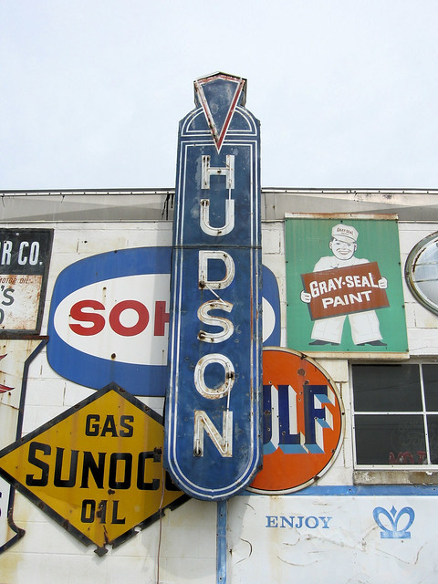
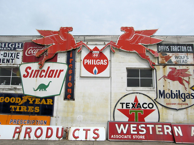
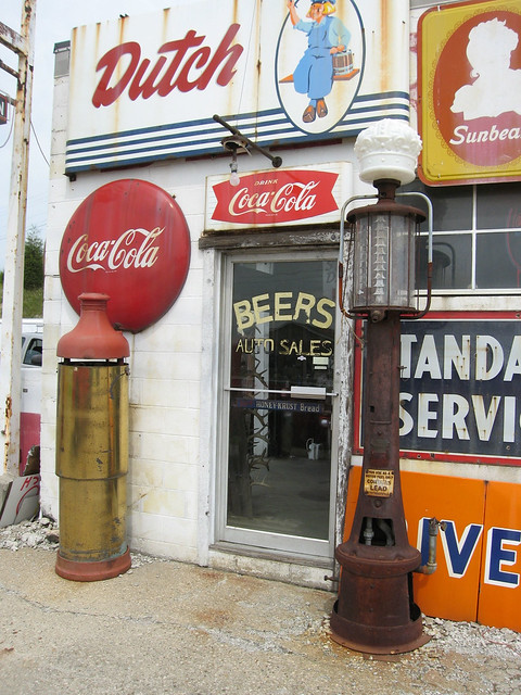
And then I came upon Beers Auto Sales, and I had hit the mother lode.
Apparently, the owner likes signs.
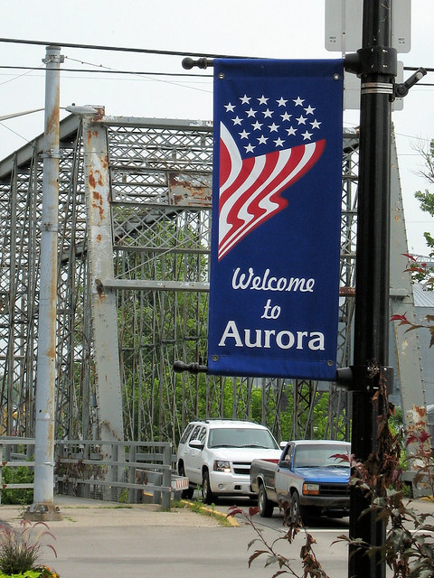
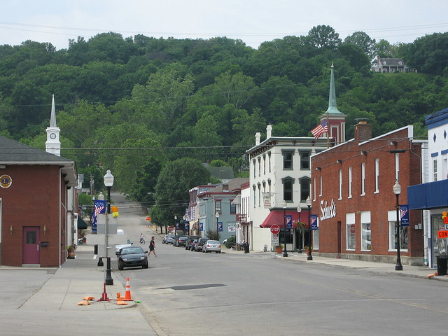
The first town I entered was Lawrenceburg, but seeing no convenient parking I just kept going. Aurora was next.
An old friend of mine, a New Jersey girl, has family in Aurora, Indiana. We became friends while she was a student at Indiana University, and she used to spend some of her breaks in Aurora. Her time there always centered and relaxed her, or at least that’s how it always seemed to me. She described it as a charming small town, the kind where everybody knows everybody else. She was often recognized on the street simply because of her family resemblance.
Aurora was settled in 1796, making it one of Indiana’s oldest towns. It grew rapidly as a busy port town and, later, a railroad stop. Cincinnati and Louisville became the major commerce hubs, however. Aurora’s slowed growth had a happy side effect in that so many of its downtown buildings were not torn down and replaced in the name of progress. And so my friend was right; Aurora is charming and relaxing. But she never told me about one major detail – the bridge.
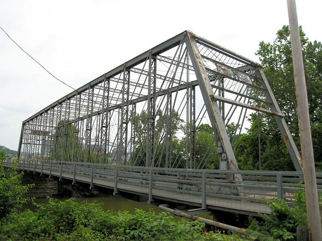
You know I love old bridges! I write about them nearly every time I come upon one. This Whipple truss iron bridge was built in 1887. That was long before anybody conceived of a network of numbered highways criss-crossing the nation, but it was a good enough bridge on an important enough road that US 50 (and its predecessor, old State Road 4) were routed onto it. US 50 was realigned around Aurora in 1950, but this bridge carried State Road 56 until 1972. It’s still a busy bridge – I wanted to stand on its deck to take some photographs, but in twenty minutes of waiting there was never a time when cars weren’t crossing it. So I gave up and walked along Aurora’s Main Street.
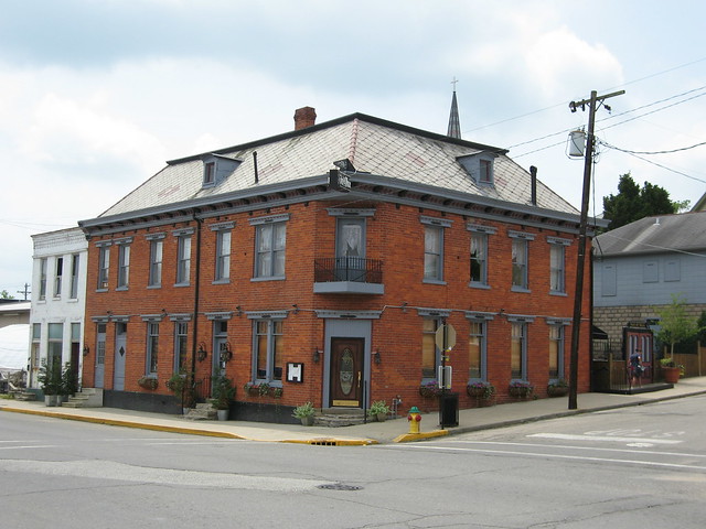
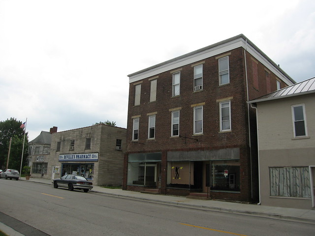
I also checked out Aurora’s business district, which appeared to be concentrated on 2nd Street. I am always tickled by buildings that prominently feature a person’s name, such as the John Neff building. Neff’s Shoe Store operates on the ground floor.
Downtowns in so many Indiana towns of Aurora’s size are either dead or given over to antique stores. But Aurora’s downtown is still vital. Joining Neff’s Shoes on 2nd Street are a florist, an embroiderer, a seller of educational materials, a pizzeria, a furniture store, and a Mexican restaurant (at which I ate lunch). The pizzeria is in the building at left below, and the educational materials store is in the former Aurora State Bank building at right.
Along Main St. I found a steakhouse and this pub.
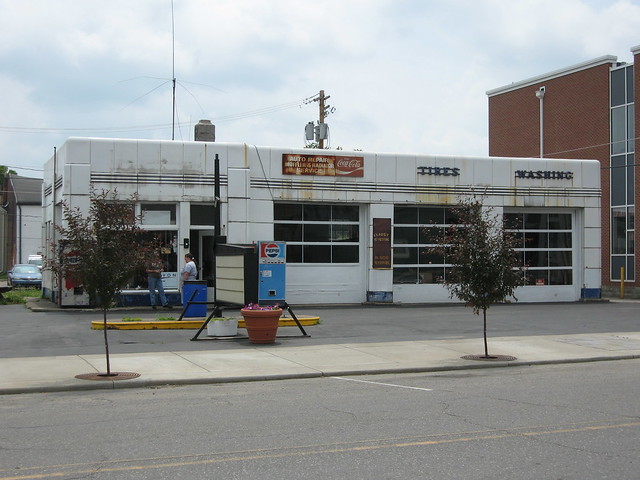
And there was a bicycle shop and this former service station. It clearly hasn’t been restored; it looks like the building is used as a repair shop today. If I had to guess, I’d say this is a former Gulf station. Check out this photo of another Gulf station from the same period – the details are the same.
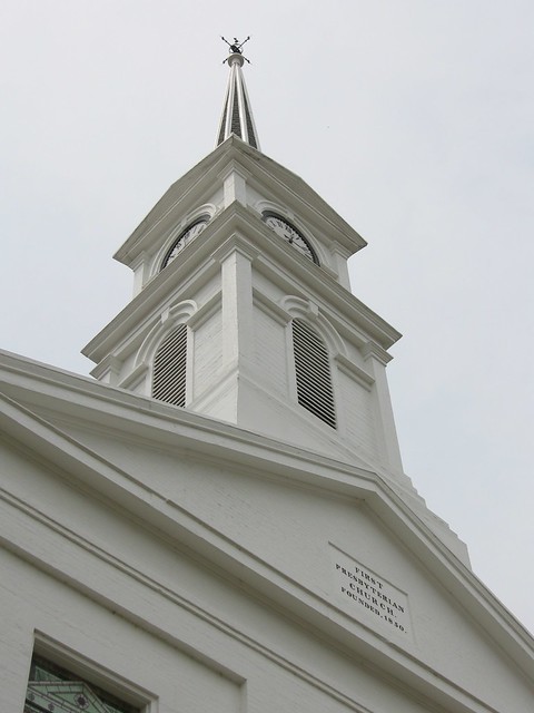
I also found the First Presbyterian Church building on Main St. “Found” is actually a bit strong of a word, as it was impossible to miss as I crossed the bridge into town. It was built in two stages, the first completed in 1850 and the second in 1855, according to the church’s Web site.
The church provided one great photo opportunity after another.
There were so many details to capture.
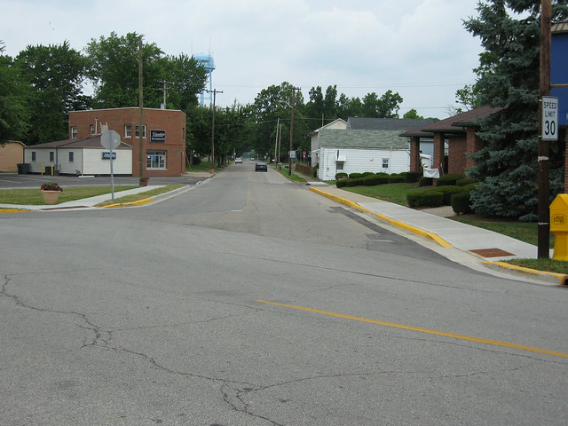
The church is at 4th and Main. Old State Road 4 may or may not have turned right here; while US 50 passed through town, it turned right at 3rd St. Yet I continued straight up the hill, for I caught a glimpse of this grand old dame at its crown.
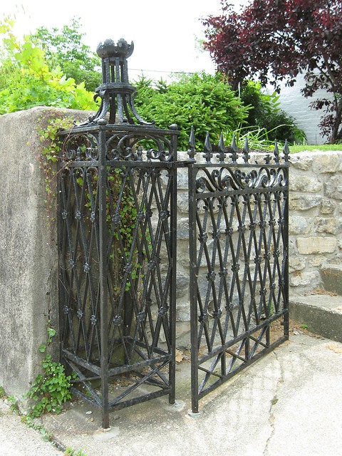
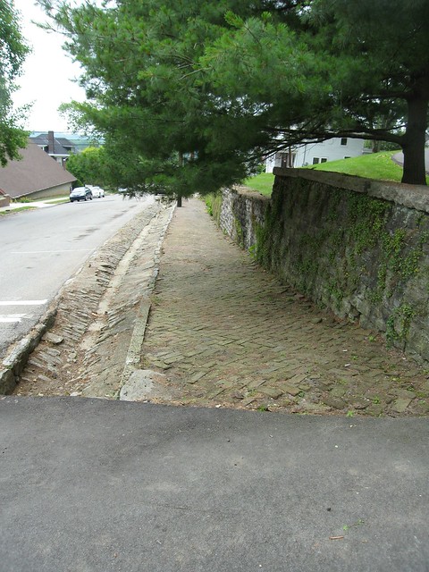
This is Hillforest, built by one of Aurora’s prominent citizens in 1855. It is a museum today; you can tour it six afternoons a week, nine months of the year. In front of Hillforest remain some of the town's original stone gutters.
As I walked back to my car, one of Aurora's fine, friendly citizens came out to greet me. The nick out of his left ear suggests to me that he's a street cat that a local vet rendered incapable of making copies.
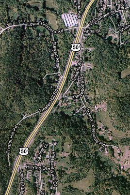
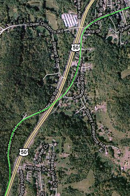
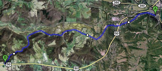
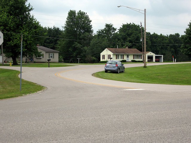
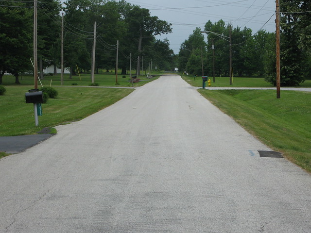
Before I make any road trip, I do a fair amount of preparation using my old maps and road guides. I trace their routes against Google Maps and figure out almost turn by turn the route I will take. I was pressed for time and had not done full research before I made this trip, but I did know of at least one old US 50 alignment leading out of Aurora. What passed for highways in the 20th century's first few decades would surprise you. They were usually cobbled together from existing local and farm roads, so they were often unpaved and routinely followed meandering paths or were full of 90-degree turns around property boundaries. As more people bought cars, they wanted their highways paved and straightened, and states obliged. Indiana in particular seems to have started improving its highways in the early 1920s and built a full head of new-highway steam during the 1930s. Very often, these improvements left the highways' old alignments behind. Sometimes Google Maps reveals road segments that curve around the modern road. Here, as four-lane US 50 leaves Aurora, it is bracketed by Indiana Ave. and Trester Hill Rd. I've drawn a green line showing how the former flows right into the latter. I'll lay money on this being US 50's previous routing.
This photo looks across US 50 to show where Conwell St. curves to become Indiana Ave.
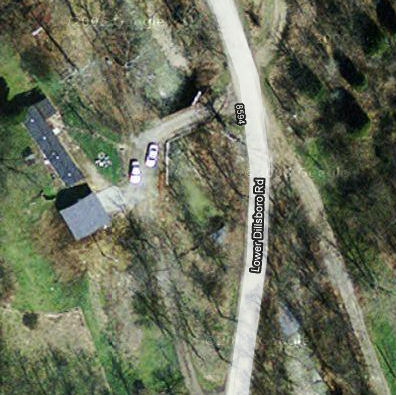
In my rush I also missed a great possible old alignment, an even older path than Indiana Ave. and Trester Hill Rd. My 1924 Automobile Blue Book, a thick tome of turn-by-turn directions across the Midwest, sends the driver down US 50's current corridor, but my 1916 ABB very clearly sends the driver down Lower Dillsboro Rd., a winding drive through the country.
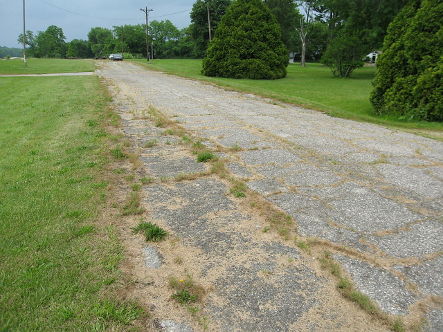
Because the US route system began in 1926, and my 1924 ABB specifies US 50's current corridor, Lower Dillsboro Rd. was never US 50. But US 50 was originally signed along old State Road 4, which came into being in 1917 when Indiana formed its first numbered highway system. I'd need a 1917 (or maybe 1918) ABB to know for sure whether old State Road 4 had an older alignment that ran along Lower Dillsboro Rd., but my gut says it did. Remember how I said that the first numbered highways ran along existing roads? Dillsboro is the next town west of Aurora; it sure makes sense that Indiana signed its highway along the existing road to Dillsboro! Even the oldest roads were sometimes improved. At 4.8 miles west of downtown Aurora, the 1916 ABB cautions the driver: "Caution for sharp right and left turns across small bridge." I traced the route to 4.8 miles and found this:
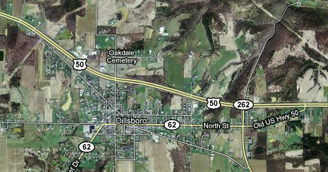
Do you see the old bridge there just above the center of the image? It is now part of somebody's driveway. Lower Dillsboro Rd. now sweeps smoothly by. Can you see the traces of the original route? I followed current US 50 towards Dillsboro. As happens so often, US 50 once passed through this town, but now bypasses it.
Tip: Whenever you see a road curve off like this, it may be an old alignment.
As also happens so often, when a highway bypasses a town, the town declines. Dillsboro's history stretches back to 1830.
US 50 turned right here, in the middle of town.
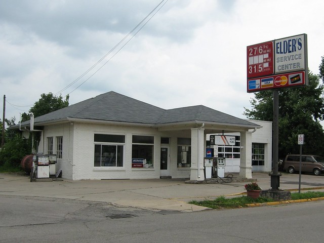
I was pleased to find this old service station still in business. Those pumps have got to date to the 1970s. They're marked "full service," a real throwback.
Old US 50 curves back to meet US 50 west of town, but leaves this long stub of the old highway behind.
Just before the road took me out of Dearborn County, I spied this crumbling abandoned old alignment. It appears to be used mostly to park cars.
|
||||
|
||||
|
Created 2 January 2011. |
||||