US 36 in Western Indiana |
||||
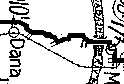
On to IllinoisThe TIB Guide showed a pretty jagged route for the PP-OO west of the Wabash River.
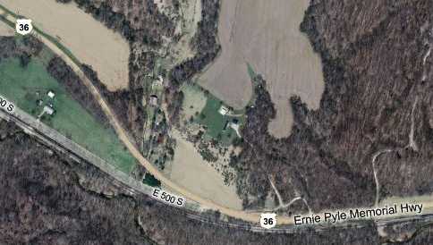
US 36, not surprisingly, followed a much smoother path. If the shape of the road on the TIB Guide map is accurate, it looks like a portion of the little sliver of road near the top of the map below was the old PP-OO route. It's currently called E 600 S. I can't tell how the PP-OO got up there after crossing the Wabash.
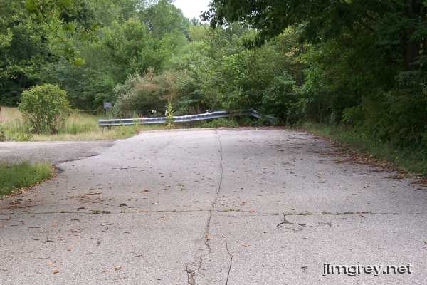
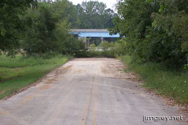
The PP-OO sliver runs into a segment that dead ends at both ends, which made my old-alignment radar go, "Ping!" So I drove over there for a look. Its east end looks like this.
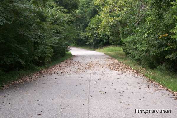
I hoped I'd see concrete, but no luck. Here's what the road looks like westbound. A drought in the area has trees unceremoniously shedding leaves in August; hence the brown leaves on the road. This road provides access to two homes, both of which are on the north side of the road. The trees and grass on the north side are trimmed back from the road, while on the south side they grow over.
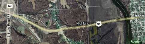
The alignment ends just west of the road that allows access to it. As you can see, the State Road 63 overpass is visible. My guess is that the road was realigned when State Road 63 was moved there and made a four-lane divided highway – its previous alignment is the first road east of this segment. This road provides access to nothing here, and the double yellow stripe suggests it has seen no maintenance since US 36 was rerouted.
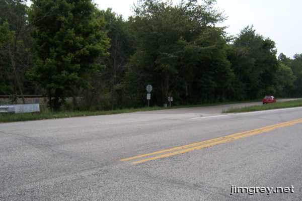
The PP-OO and US 36 follow the same route again starting about here, but it lasts only about ¾ mile. A railroad track begins to parallel the road just beyond SR 63, PP-OO stays with the tracks, but shortly US 36 curves to pass over the tracks and the old PP-OO.
Here's what the split looks like.
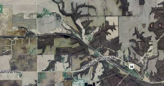
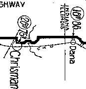
This map shows the routes of US 36, the railroad tracks, and PP-OO. US 36 is the southernmost road on the map. The railroad curves off and heads west. PP-OO stays on its trajectory a little longer before heading straight west, and is the northernmost road on the map.
I feel confident that this is PP-OO's route because just before this road enters Chrisman, Illinois, the road takes a particular shape that appears on the 1915 TIB Guide map. Here's TIB.
And here's the aerial image. The road comes in from the top right of the image; it's 2300 N. I'm not sure where the PP-OO made the northerly turn shown on the TIB map, but I decided that State Route 1/US 150 (the north-south road highlighted in yellow) was as good a choice as any. It then headed west on the east-west road highlighted in yellow, which is also 2300 N.
I don't know about you, but seeing stuff like this make me really wanna go drive the road. I was so excited about this PP-OO business that as I finished driving US 36 I failed to get the obligatory photograph of the Indiana-Illinois state line. There was even some roadside historic site about Ernie Pyle that registered in the corner of my eye only as it was almost past. No matter; I was on a mission to drive a segment of a very old coast-to-coast highway! Just take my word for it that US 36 is straight and unremarkable the rest of its Indiana route. It's no different in Illinois, either. I cruised on into Illinois, headed north on SR 1/US 150, and made my way into Chrisman. Although that's it for US 36 in western Indiana, and this is the last page in this series, I did drive the PP-OO route back from Chrisman to where it joined US 36 just west of SR 63. If it interests you, I wrote about it here. |
||||
|
||||
|
Created 26 August 2007. |
||||