US 36 in Western Indiana |
||||
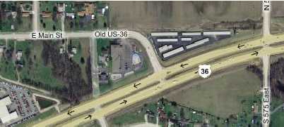
DanvilleAfter crossing out of Marion County into Hendricks County, and after driving through the traffic nuthouse that is Avon, US 36 goes through Danville. Just before entering Danville from the east, US 36 curves gently to the south, but Old US 36 continues, as the map shows. It looks pretty obvious that US 36 used to go straight through where that set of buildings, actually a storage facility, lies today.
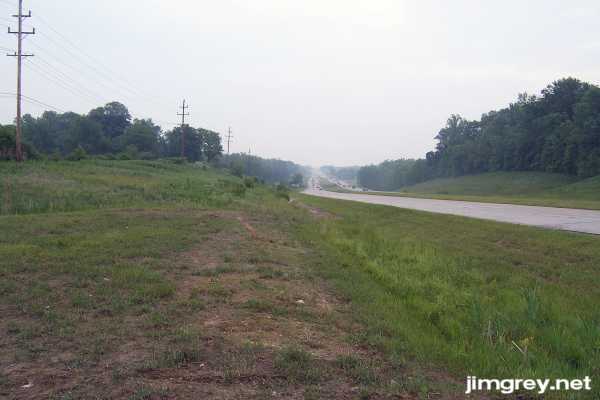
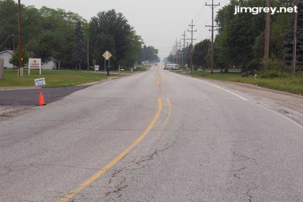
What's interesting is that the storage facility was built right on the old roadbed. This eastbound photo shows US 36 curving a little bit south in the background, and a mound in the foreground that picks up in a straight line from where the road begins to curve. Notice how the utility poles at left run along this straight line, too, converging with the road in the distance. This photo is taken from the road east of Old US 36. The map calls it 575E, but it is signed 571E.
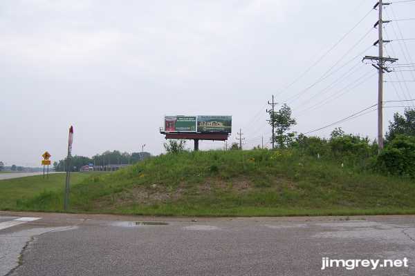
I turned around from this point and saw that the mound continued, utility poles planted right alongside. The yellow sign on the left announces the intersection of Old US 36, also known as Main St. in Danville.
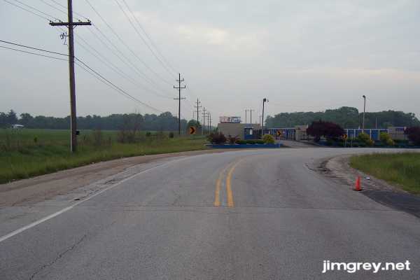
The storage facility's fence kept me from walking this old roadbed, so instead I drove to the west side of the storage facility. The utility poles tell the tale: The road once went here.
And here's this segment of Old US 36 as it heads towards Danville.
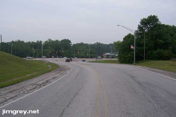
This segment of US 36 is a good wide road with shoulders not quite wide enough to pull your car onto. Right turn lanes appear at entrances to subdivisions and churches. The road is smooth even though it hasn't been repaved in a while. About 2 miles along this alignment, at the Danville city limits sign, the pavement is even older, and the striping becomes more faded, as the eastbound photo below shows. A few old rectangular Do Not Pass signs still stand here. About 3.5 miles in, the road curves gently to the south and ends at the current alignment of US 36.
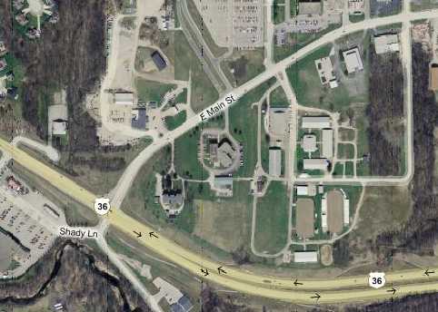
The way Old US 36 curves to meet current US 36 left me few clues about how this old alignment used to flow into the road's current alignment. On the map below, trace E. Main St. (Old US 36) from the east past the first slight curve to the second slight curve just before the road ends at US 36. The utility poles that have lined the north side of this road end at that second curve. And notice how the road might have originally curved instead more westerly, following that stripe of grass between the trees, meeting with that short dead end. Could that dead end once have gone through as US 36?
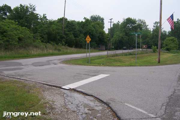
First, here's where Old US 36 intersects current US 36. Notice how there are no utility poles.
I drove around the corner to check out that little dead end. Notice how the utility poles follow this little segment.
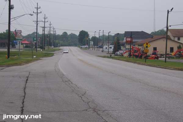
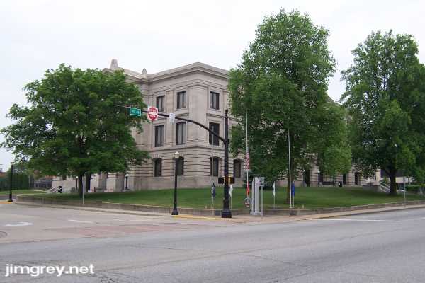
I followed US 36 west into downtown Danville. The road's four lanes soon narrowed to two lanes with a center turn lane. Like so many small Indiana towns, a courthouse square is at Danville's heart.
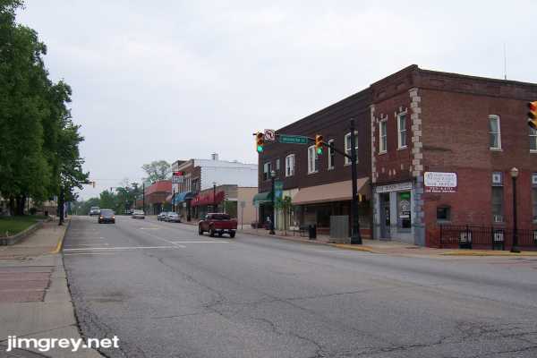
Danville's downtown business district lies around the courthouse. Here's a photo of the shops and restaurants along the US 36 side. The Mayberry Cafe is on this block, well-known for its theme of the Andy Griffith Show. They usually have a black and white 1962 Ford Galaxie police cruiser parked out front, but it was missing this day.
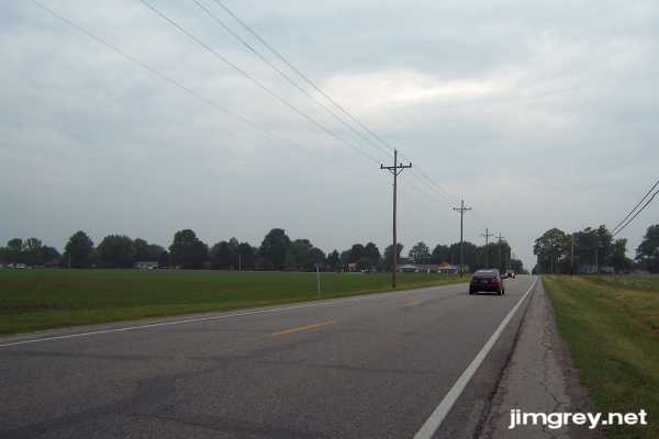
Past downtown, US 36 narrowed to two lanes on its way out of town. Outside Danville, US 36 becomes a standard two-lane highway with thin shoulders.
|
||||
|
||||
|
Created 27 June 2007. Updated 26 August 2007. |
||||