US 36 in Western Indiana |
||||
Original Indianapolis alignmentUS 36 originally started on Indianapolis's near Westside as a humble two-lane highway along what was known as Rockville Road, the road to Rockville, about 55 miles away. It branched off US 40 just after it crossed Eagle Creek.
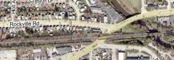
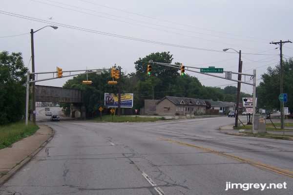
I started out this grey day at this once-vital intersection, which is busy with things to see. As I came over the bridge, the railroad bridge crosses Washington St. and parallels Rockville Road as it branches off to the right.
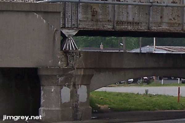
The railroad bridge looked pretty abused. I found a date on the bridge. Only the last digit is still crisp. You can make out the first two digits as 19, but the third digit is obliterated.
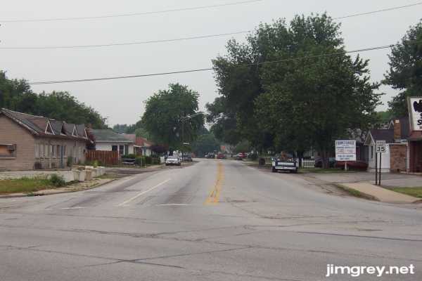
Here's the view of old US 36 westbound from where it started. This neighborhood has seen better days. Notice especially the decay on the building on the corner at left.
I walked in the street in front of the white house with the white car in front of it to take the picture below of where old US 36 ended at old US 40. I assumed this neighborhood would not be friendly – I was actually quite nervous to be standing out there – but a nice, proper old gentleman out trimming his hedge remarked to me about the weather and wondered whether it would rain today.
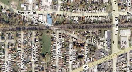
As I drove west along Rockville Road, the tiny houses with their tiny front yards were pretty tidy for this depressed part of town. Quickly I reached Rockville Avenue. Rockville Road curved to the right and picked up Rockville Avenue's alignment, as this map shows.
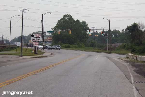
My old Indiana maps go back to 1937 but none of them show US 36 as having taken the Rockville Avenue alignment, ending at Holt Road and Washington Street (Old US 40). I think Rockville Avenue doesn't actually intersect with Holt or Washington today. Beyond here, Rockville Road widened a bit. Homes were set farther back from the road, and businesses started to appear. At Lynhurst Drive, the road widened to four lanes lined with businesses and stores. The road had curbs, which isn't too unusual in the city, but is pretty unusual for a highway. In August, 1978, when I was still a kid, three teenage girls died when a van struck the rear of their Ford Pinto while it was stopped along US 33 in Elkhart County so the driver could retrieve a lost gas cap. The resulting fireball burned the girls to death. Sure, the placement of the car's gas tank made it vulnerable to explosion in rear-end collision. And certainly, the van driver probably being stoned out of his mind didn't help matters. But a little-touted fact of that case was that US 33 had curbs, and so the driver of the Pinto could not pull safely off the road. It's not like this accident was the first clue of this problem -- a citizens' group had written the highway department asking that the road be rebuilt to allow safe stopping places in emergencies. I remember in the years following, curbs slowly and quietly were replaced with shoulders on highways near my South Bend home. I don't know if these events are related, but it sure seems like more than coincidence to me. Anyway, I wonder if this gives a clue that US 36 hasn't gone here since at least the 1970s. I could be reading too much into these curbs, of course. Shortly, I-465 appeared. The curbs disappeared just east of the interchange. Just west of the interchange, the first reassurance marker appeared.
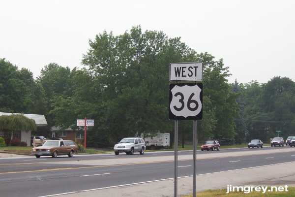
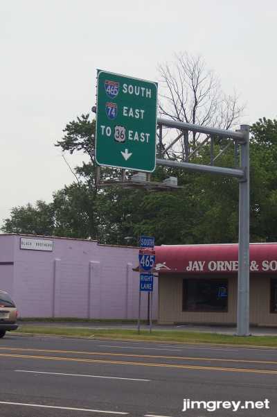
Across the street, facing the eastbound lanes, a button-copy sign directs drivers to follow I-465 South to reach US 36 East again. No US highways run through Indianapolis anymore; they all follow I-465 around the city in what is called the "mega multiplex." But only I-74 is co-signed with I-465 along its route. You have to watch the exit signs to follow your US highway.
Beyond I-465 along US 36 I saw some nice older homes of brick and stone set far back from the road, surely built when this part of Marion County was way out in the country. The road widened to five lanes, including a permanent center turn lane, and stayed that way into Hendricks County. |
||||
|
||||
|
Created 27 June 2007. Updated 26 August 2007. |
||||