Old US 31 in Northern Indiana |
||||
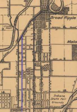
IndianapolisBecause US 31 is a critical artery in the northern half of Indiana, I was surprised to learn that Meridian St., which was was US 31 on Indianpolis's Northside, hasn't always gone all the way north out of the county. The digital collections of the IUPUI University Library has placed online several Indianapolis and Marion County maps from the 1850s to the 1950s. The maps disagree about where Meridian St. actually ended at various times around the turn of the century, but it's clear that the road ended well inside the county. A 1905 map from the collection shows Meridian St. ending at Westfield Blvd., or about 57th St. I've excerpted it here and highlighted Meridian St. in blue.
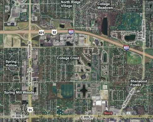
No wonder my 1916 and 1924 Automobile Blue Books sent drivers down what is now Westfield Blvd. into Indianapolis. Meridian St. had likely not yet been built to Carmel! I hope one day to find out when the road was built to there, whether it was built for the purpose of being US 31, and whether US 31's route followed Westfield Blvd. until the Meridian St. route was built. Here's a map of northern Indianapolis along Meridian St. today. Indianapolis begins at 96th St., which is the east-west street just south of I-465. The map incorrectly labels Meridian St. as US 31 in Indianapolis. Today, US 31 follows I-465 around the east side of town until it reaches the exit for US 31 on the Southside. Westfield Blvd. is still there, of course, and still runs through the Nora neighborhood.
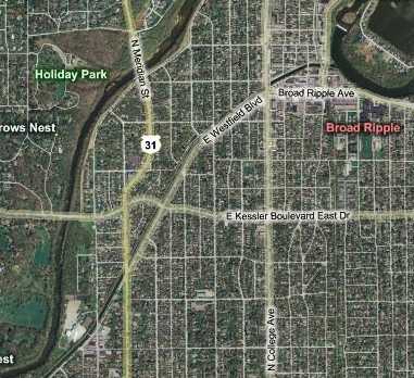
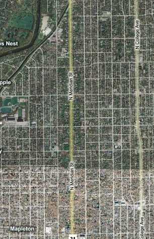
We stopped for no photos for the first few miles of old US 31 in Indianapolis not only because we were running out of time, but also because the five-lane road lacks shoulders, leaving few good places to park. So we made for the White River, south of which Meridian Street's character becomes more residential, which made parking possible. Compare the map below to the 1905 map above. The area is much more built up now, as you'd expect. But Illinois St., which is one block west of Meridian St., no longer crosses the White River. Kessler Blvd. gets that honor now. The road the old bridge connected to was what is now Kessler Blvd. there, but it wasn't called that then. A historical note. Kessler Blvd. was named after George Kessler, a leader in the City Beautiful movement. Kessler was supervising construction of this road in Indianapolis when he died, and the road was then named for him. If you've read this report through, you may remember that the Leeper Park bridge in South Bend was designed in the City Beautiful style. Also, in Broad Ripple, Westfield Blvd. runs one block north of Broad Ripple Ave. Since the days of my two ABBs, the block of Westfield Blvd. along the canal just east of College Ave. has become one way east. Broad Ripple Ave. is a much better road today anyway, so everybody coming south on Westfield Blvd. drops down to Broad Ripple Ave. and then rejoins Westfield Blvd. again on the other side of College Ave.
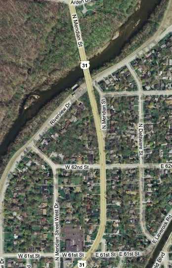
Brian and I should have made the time to explore the Westfield Blvd. route. Another day. One more map before I get to the road photos. At the White River, there's evidence of three Meridian St. and/or US 31 alignments. I suspect the oldest is the road labeled N. Meridian St. West Dr. It flows perfectly from Meridian Street's alignment from the south. My guess is that it is the oldest Meridian St. alignment here, and that it never crossed the river. The big green space north of the river is Holliday Park. This 94-acre park was donated to the city in 1916 by John Holliday, who founded The Indianapolis News, now defunct. So no roads were built on that property. The next oldest alignment is the stub labeled N. Meridian St. just east of the current road. There was probably a one- or two-lane bridge on it. When that became insufficient, the current alignment with its four-lane bridge was built.
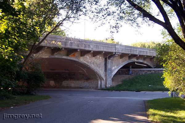
This southbound photo is from the Meridian St. stub, showing how Meridian St. curves away at this point, but easily could have kept coming straight along this road.
This northbound photo shows how the Meridian St. stub ends with the current Meridian St. bridge. It was quiet in this neighborhood despite being next to a well-traveled bridge.
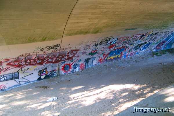
The Indianapolis Water Company installed the wall under the bridge a few years ago. Kids climb over the wall to paint graffiti under the bridge.
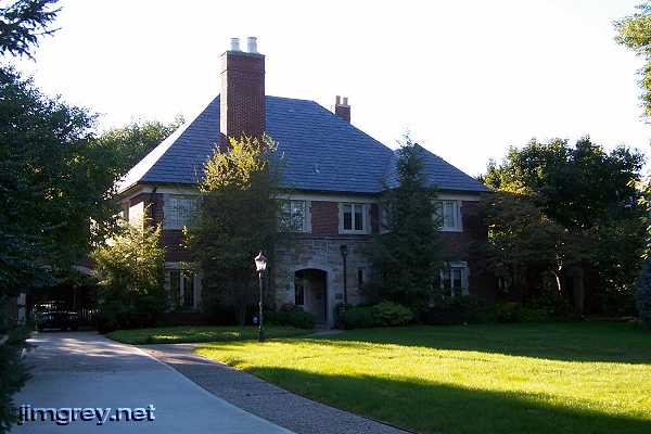
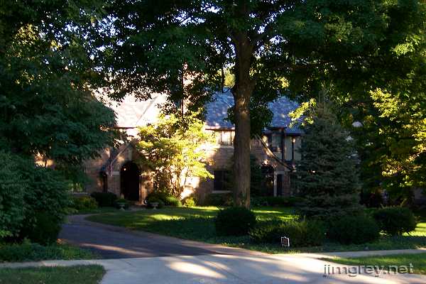
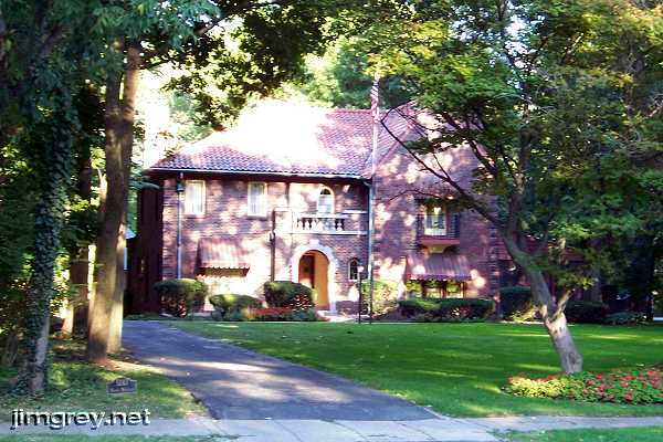
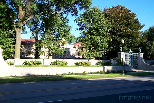
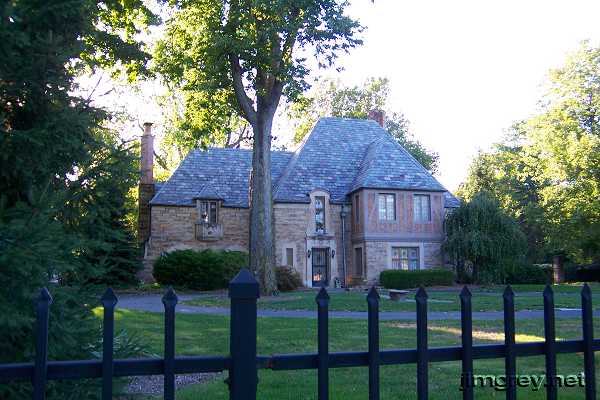
I wanted our day to end Downtown at Washington St., which was US 40 and the National Road. Unfortunately, the day got away from us and light was fading. I decided we'd finish our trip along the N. Meridian St. Historic District between Westfield Blvd. and 40th St. This area is in the National Register of Historic Places because of the gorgeous homes along the route, most built by the wealthy in the early 1900s.
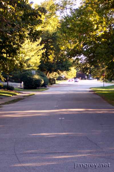
These photos are from Meridian St. near 52nd St. Given the lighting and my meager photographic skills, only a few of my photos turned out.
When I was a boy, my family made our first trip from South Bend to Indianapolis on US 31. I was bored stiff until we reached here. The homes along this stretch were something to see!
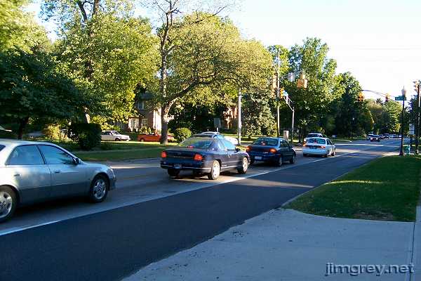
You might expect to see homes like this in a secluded neighborhood, perhaps in a gated community, but all of these homes are right on the main road through the city. This photo is of the old highway at about 53rd St.
We wrapped up our trip here, along this stunning road that once sported US 31 reassurance markers. |
||||
|
||||
|
Created 13 January 2008. |
||||