Old US 31 in Northern Indiana |
|
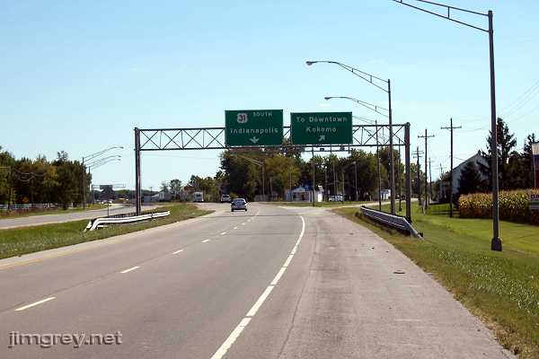
KokomoKokomo, a boom town in the late 1800s when natural gas was discovered here, is 20 miles south of Grissom. I am told that before US 31 bypassed Kokomo, driving through Kokomo was a pain because of all the traffic downtown. A bypass was built east of town to ease congestion, but businesses just moved to it, and today the bypass is a pain, a highway of a thousand stoplights. Driving through downtown Kokomo isn't so bad anymore, though – but there's little to see. Here's where US 31 veers off to bypass Kokomo. Old US 31 follows the route to downtown.
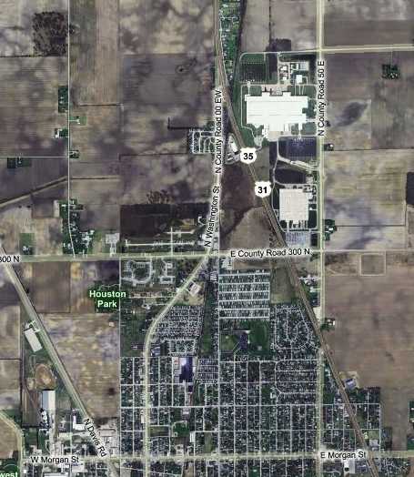
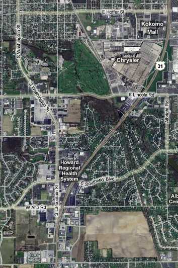
This map shows how US 31 veers east to bypass town, while old US 31 swings west on its way downtown as Washington St. Brian had his nose in the 1924 Automobile Blue Book, which said to turn right on Morgan St. and then right onto Washington St. We guessed that this meant that in 1924 Washington Street didn't extend this far north, and that drivers entered Kokomo from the north on Apperson Way. That's the skinny road that extends straight south where Washington St. starts to swing southwest. I imagine that this was State Road 1's route, and depending upon when the curved section of Washington St. was built, an early alignment of US 31, too. We drove Apperson to Morgan to Washington; it was unremarkable.
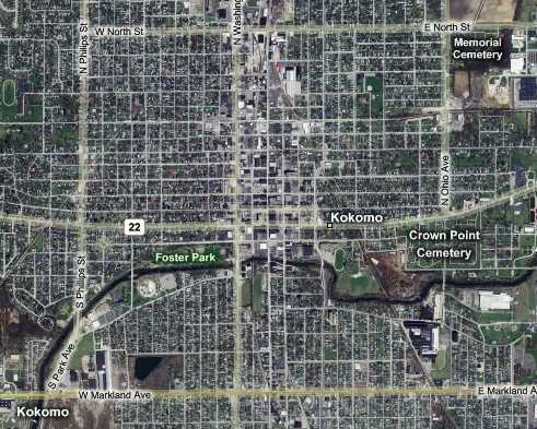
Shortly we reached downtown, which this map shows.
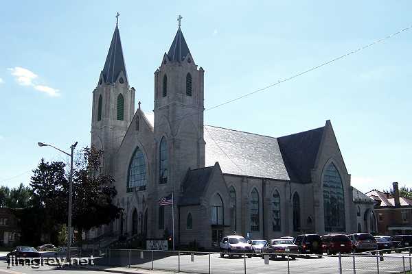
Just south of North Street, we came upon this grand building of the St. Patrick Catholic Church, completed in 1911.
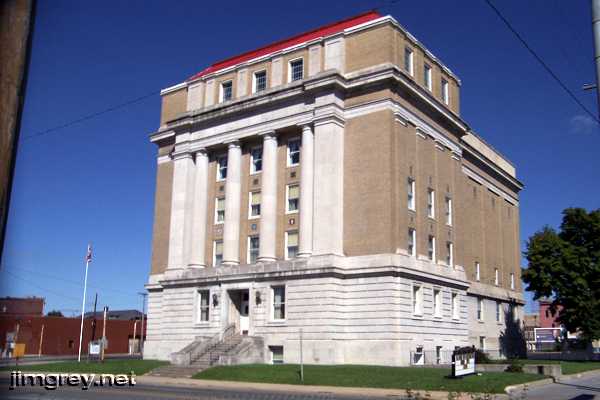
The Masonic temple, completed in 1891, stood on the southeast corner of Taylor St.
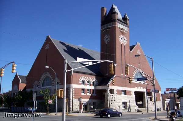
The Grace United Methodist Church, completed in 1896, stood on the southeast corner of Mulberry St.
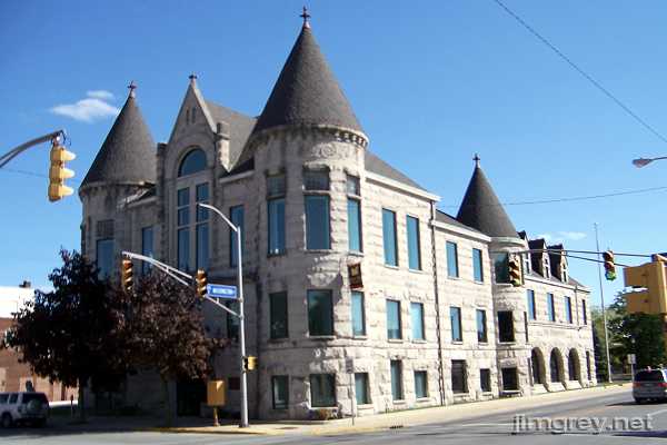
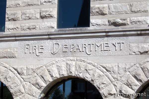
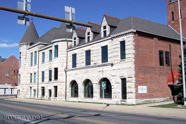
The most interesting thing we saw in Kokomo was this building on the southeast corner of Walnut St.
We couldn't figure out what it was, but one section of it was prominently labeled "Fire Department."
This is the building from the southwest.
Three blocks south of this building, Washington St. crossed a river and neighborhoods lined the road. We followed it to where it curved to intersect with US 31.
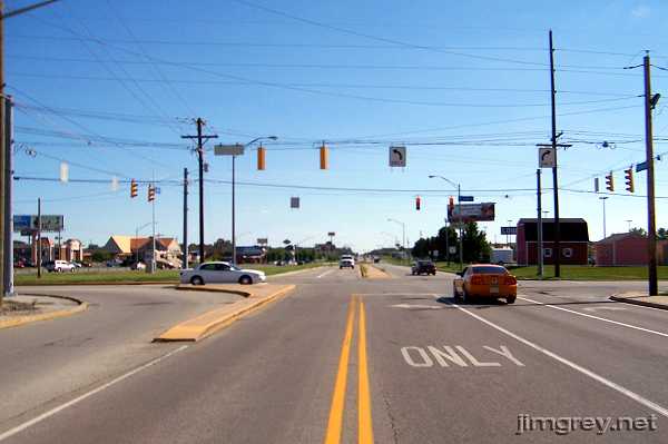
Here's a photo of the two roads look like coming together, southbound. There wasn't a safe place to get in close, unfortunately. US 31 curves in from the left. Beyond the stoplight, Washington St. becomes a ramp that empties onto US 31, which by that time has curved into the path of Washington St.
The 1924 ABB had drivers turn east onto Hoffer St. and then south "with the trolley," which was probably Lafountain St., which led them all the way to Westfield. My 1916 ABB gives even more confusing directions, having the driver meander all over northern Miami County before entering Kokomo on old US 35 (David Rd. on the first map above) and exiting with a series of turns back and forth along that trolley line. Today, the toughest thing about driving to and from Kokomo is being patient with the thick traffic and all the lights on US 31. The Indiana Department of Transportation follows through with plans to bypass Kokomo again with a limited-access highway, which would be a blessing to through travelers, but probably not so welcome to the businesses along the current bypass. |
|
|
Created 13 January 2008. |
|