Old US 31 in Northern Indiana |
|
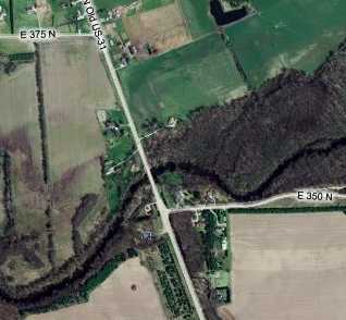
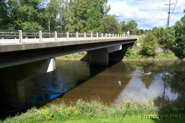
RochesterI was telling Brian the things I've learned about sniffing out the old alignments. I got interested in them at a good time, because online aerial maps sure make the job easier. But I've also discovered how helpful old maps and road guides can be. I had brought my 1924 midwestern Automobile Blue Book along and showed it to him. He seized upon it and studied the turn-by-turn directions from South Bend to Indianapolis. He asked about State Road 1, which the book mentions and which was US 31's name before 1927. He observed that some of State Road 1's path appeared to be different from the old US 31 that we were traveling. We continued south into Fulton County, sometimes cruising less than 1,000 yards away from current US 31. When we entered Fulton County, I noticed that the road was signed Old US 31. I'm not sure that it was in Marshall County. This shoulderless road's lanes were wide enough for oncoming semis to pass comfortably, suggesting that it was a fairly modern two-lane highway when it was replaced. I had heard about a one-lane bridge on US 31 near Rochester. We came upon where it used to be, at the Tippecanoe River, about four miles north of Rochester.
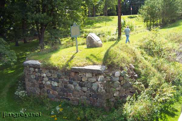
As we drove over this bridge, I saw an old stone abutment on the left, so we stopped. While I took photos from the current bridge, Brian walked out onto the old roadbed. A woman drove a tractor below, cutting the grass.
I was surprised to learn that the one-lane bridge lasted until 1982! Given that the road flows straight over the current bridge, but had to curve a bit to meet the one-lane bridge, I'd say that there was at least one earlier bridge here. It stood where the current bridge now stands.
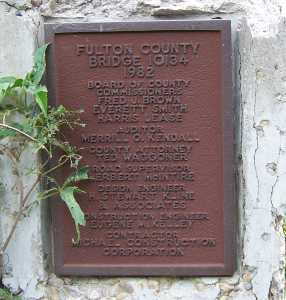
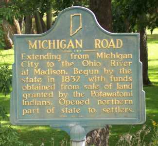
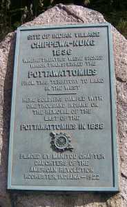
I wonder where the Michigan Road historical marker and the Trail of Death plaque were before 1982, because the certainly didn't stand on the old roadbed.
I walked out onto the old roadbed and abutment to see the other side of the river. The bridge's northern end wasn't as plain to see. We guessed that it was at right in the photo below, where the cement bits remain along the bank.
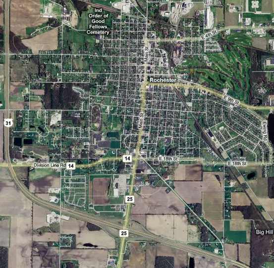
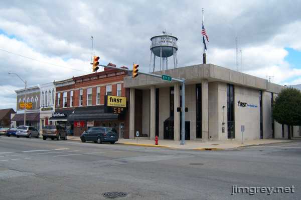
On this map of Rochester, old US 31 is Main St. Old US 31, and Main St. with it, curve off to the southeast just north of 18th St. This is where old US 31 strikes out on its own, departing from the Michigan Road and the Dixie Highway. Those roads have to settle for being called State Road 25 the rest of the way to Logansport.
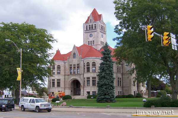
The 1896 Fulton County courthouse is on Rochester's square, on Main St. between 8th and 9th Streets. This Bedford limestone courthouse came 60 years after Fulton County was formed and Rochester was named the county seat. Rochester was here for about a year before a county formed around it.
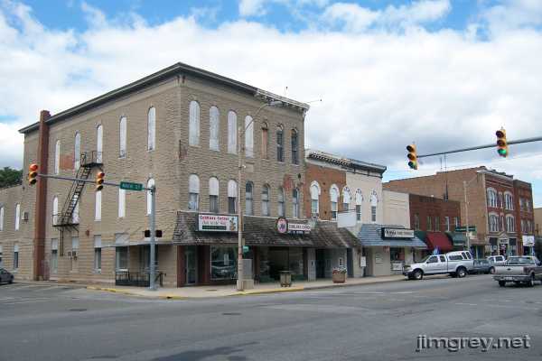
The courthouse is a real jewel among the buildings in downtown Rochester. These two photos are from the business district, which is near the courthouse.
It's sad to see all the boarded-up windows in the building at left below. I left downtown feeling like it was really too bad that Rochester's downtown weren't more like Plymouth's, to go with its excellent courthouse.
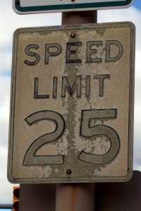
We also saw this badly weathered speed limit sign downtown. Curious that it hasn't been replaced long before now.
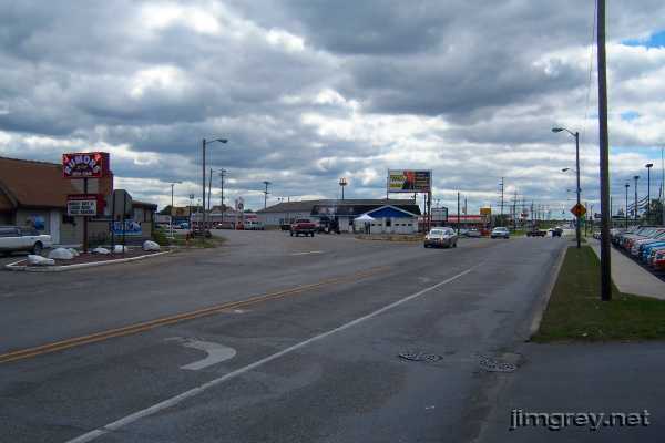
About eight blocks south of the courthouse, old US 31 veers left, leaving the Michigan Road and the Dixie Highway. We arrived as some rain clouds rolled in. In the photo, you can barely see the current US 31 overpass over State Road 25 in the distance.
We walked up and down the curve taking photos. A couple times, people stopped Brian to ask what we were doing. I guess Brian seems more approachable than me! Brian said to me, "We should tell them we're building a traffic circle here!" Beyond the curve, old US 31 flows straight out of Rochester. But we didn't drive it.
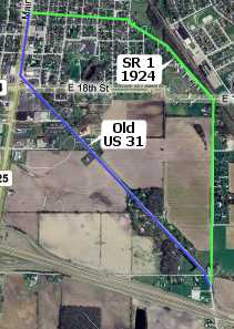
After I told Brian about old State Road 1 and showed him my 1924 Automobile Blue Book, he started to turn into a crazed old-alignment maniac. He noticed that the ABB gave directions for driving through Rochester that differed from old US 31's path, calling part of it "State Road 1," and he was stoked to follow them. So we did. We backtracked to 14th St. and headed east. This map shows the route we took in green and the old US 31 route in blue. Based on my 1924 ABB and other resources I have, I'm only pretty sure that 14th St. was part of State Road 1 between Main St. and College Ave., which is where 14th St. bends south a bit. I'm sure that the rest of the route was State Road 1.
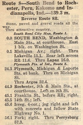
Here are the directions the ABB gave.
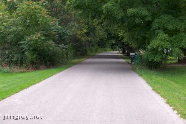
The very narrow road curved through a residential area. The houses appeared to be quite old, at least from the turn of the last century. The ABB said to jog right and then left at an "irregular four-corner." We took that to mean the intersection of 14th and College, because we had to jog right there. But we never jogged left anywhere, suggesting that the road had been straightened somewhere along the line. After the road passed College, we were stuck by the beauty of the scene.
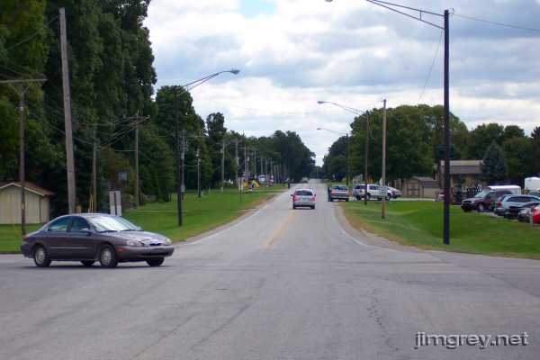
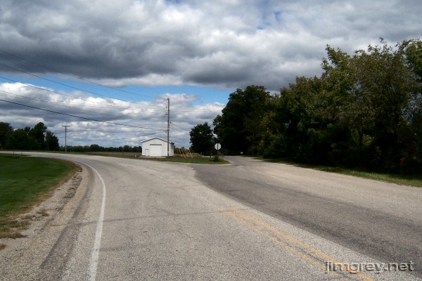
We became confused when we reached 18th St., where 14th St. became CR 225 E and headed south. I thought we might be way off course as we drove, until we saw our road merge with what we correctly guessed was old US 31. Here's a northbound photo of the merger. Old US 31 is on the left. Notice how much wider it is than old State Road 1.
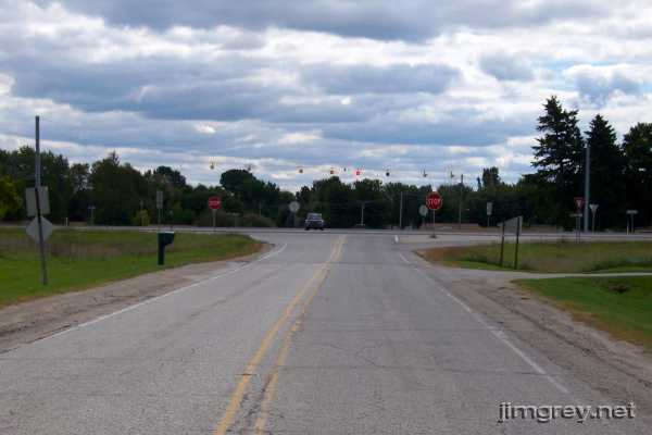
And then old US 31 intersected with current US 31.
|
|
|
Created 13 January 2008. |
|