Old US 31 in Northern Indiana |
||||
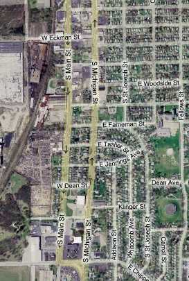
South Bend, Part 2Heading north from Chippewa Ave., after passing a large church and some empty storefronts, Michigan St. and its surrounding area becomes predominantly residential. This map shows the many houses along the route.
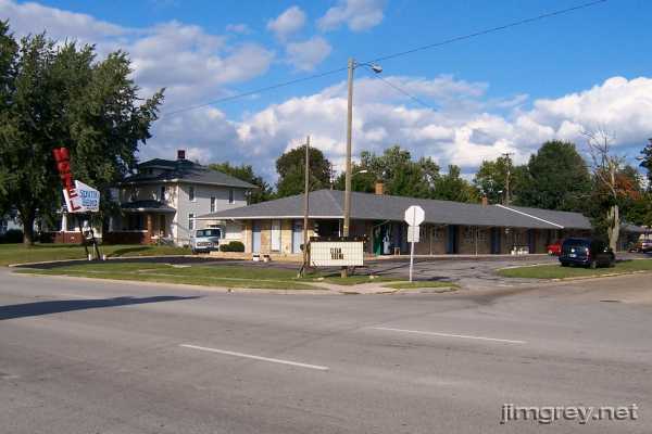
The South Bend Motel stands at the corner of Klinger St., advertising its clean rooms.
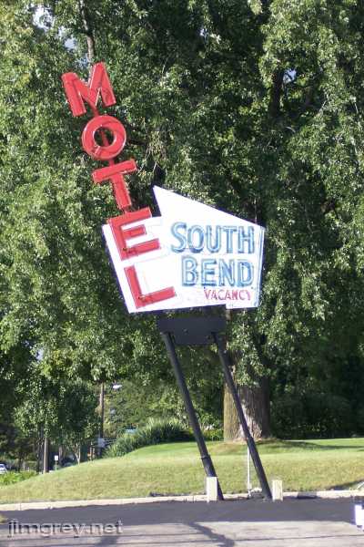
Its leaning neon sign lights up every night.
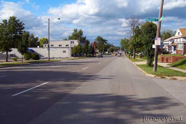
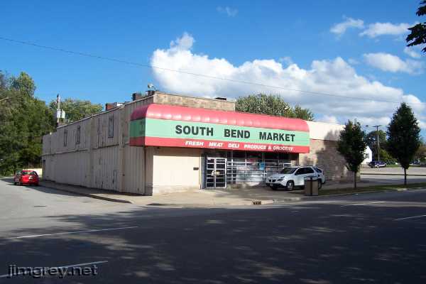
I stopped a few blocks north at Woodside St. for a photo of the road and its three wide lanes. And now please take a walk down memory lane with me, as my childhood home is four blocks east of here.
The street sign in the photo says "Woodside Av." The old embossed street signs all said "E Woodside St" until the city replaced them all several years ago. Inexplicably, narrow Woodside became an avenue in the process. This grocery store was called Cira's in my day. It had maybe five aisles. The prices were higher than the chains, but the meat counter was well respected. Its primary advantage to my family was that it was close enough by that Mom could send me for milk if needed. The bars across the windows are a recent addition, and it saddens me to think that a business in my old neighborhood needs them.
Across the street and a block north at Oakside St., this banquet facility used to be Hans-Burkhart Pharmacy, Hans Haus Restaurant, and the Ranita Bar and Grill, from left to right. I bought candy, MAD Magazine, film for my cameras, and the occasional pen or pad of paper at Hans-Burkhart. The owner was the pharmacist, and he barely tolerated the kids who came in, so I was sure to be quick and quiet when I shopped there.
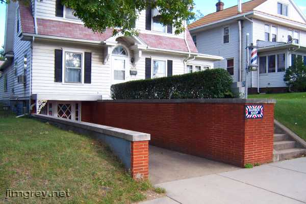
In the 1980s, I walked this block every day because it was at the far end of my paper route. I always liked this house with its barber shop on the lower level. I was pleased to find the shop still operating.
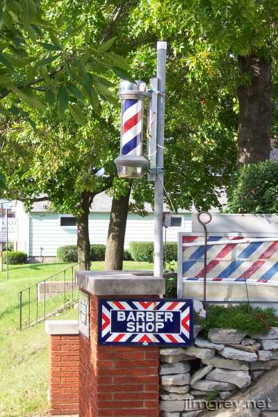
The shop's little pole was motionless. My dim memories say it stopped spinning sometime in the late 1970s. It seems strange today that thirty years ago you recognized a barber shop by its pole, though even then poles were starting to disappear.
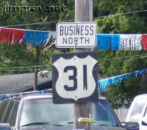
Leaving memory lane and driving north on Michigan St., I found another one of those strange US 31 shields in front of a used-car lot. The block-style numbers remind me of those used on the embossed cutout shields originally placed on US highways after the system was created. I've never seen shields like these anywhere but in South Bend, though. The combined "Business North" sign is also a South Bend creation; the standard is to have separate Business and North signs.
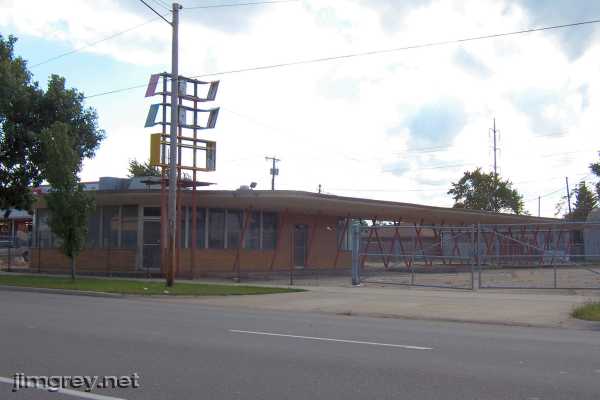
This building about a mile north on Michigan St. just south of Indiana Ave. used to be a Bonnie Doon drive-in. Imagine a day when the locked gate was gone, the sign's first two parts still read "Bonnie" and "Doon," and you could get a great tenderloin and wonderful made-in-South-Bend ice cream here. At one time, Bonnie Doon locations dotted Michiana. I think only one Bonnie Doon, on the Lincoln Highway in neighboring Mishawaka, remains.
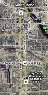
Part 1 showed that North Michigan St. was lovely with Notre Dame, the Leeper Park bridge, Memorial Hospital, and downtown. Unfortunately, and in contrast, South Michigan St. is best known for blight. Here's a map from Indiana Ave. on the south to the north split. The worst blight is between Indiana Ave. and Western Ave., which is where Michigan St. curves into St. Joseph St.
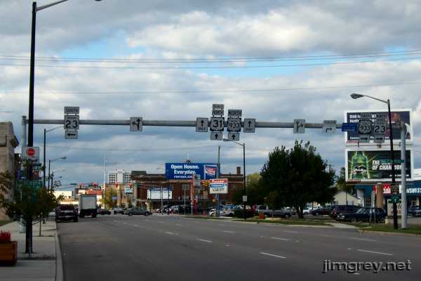
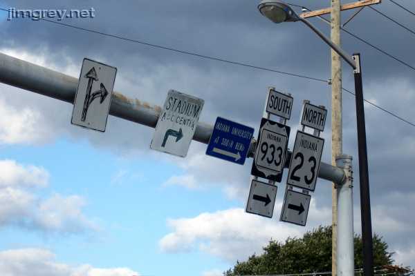
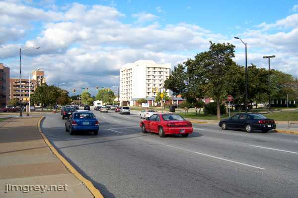
This northbound photo is taken from just south of Sample St. State Road 933, which used to be US 33 before it was truncated at Elkhart, joins US 31 here.
Notice how the signs have seen better days. It's amusing how the state just plastered 933 signs over the US 33 shields.
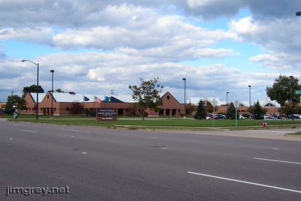
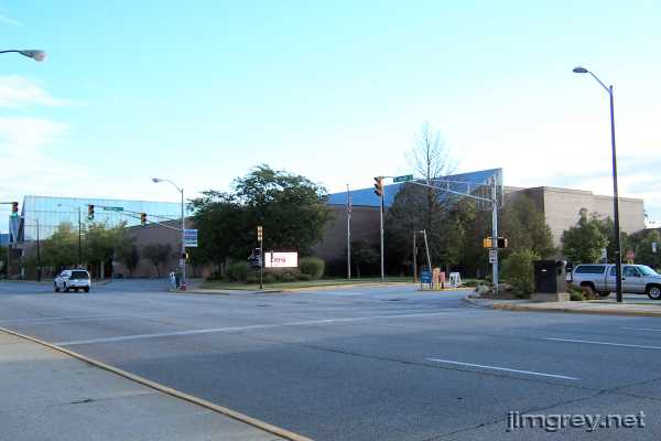
While there has been some new construction, like the sprawling Juvenile Justice Center...
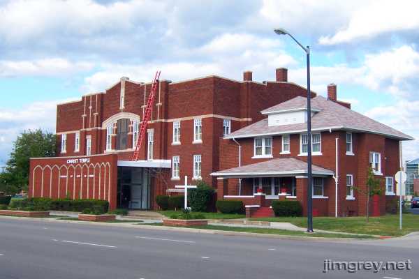
...and some older buildings, like the former First Brethren Church, have been preserved...
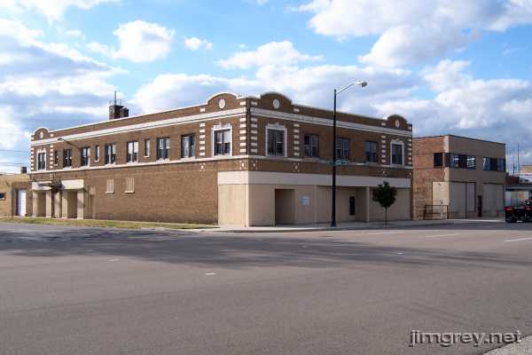
...the razed blocks...
...and the boarded up buildings team up with the liquor stores and strip clubs to give the near southside its unfortunate ambiance.
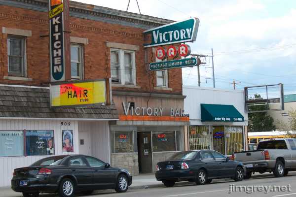
The Victory Bar's sign is a landmark close to downtown.
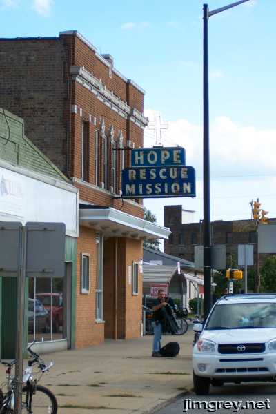
So is the Hope Rescue Mission's often-photographed neon sign.
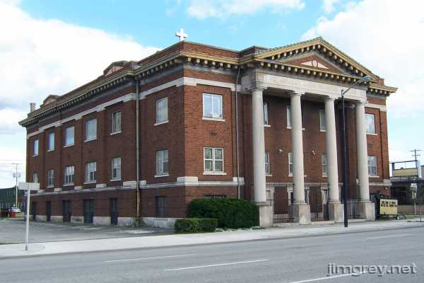
This Greek Orthodox church building anchors its block.
Just before Western Ave., Michigan St. curves to the east and becomes St. Joseph St., Michigan St. continues beyond the trees and across Western Ave., as this photo shows. I'm told that St. Joseph St. was a glorified alley before it was rebuilt to handle US 31 traffic.
As Michigan St. becomes St. Joseph St., the beauty of South Bend's downtown returns.
Shortly after rounding the curve, the Century Center appears on the right. Built in the early 1980s, it was an early home to the Studebaker National Museum. My high school's drama club held its plays and musicals in its auditorium, making the Century Center a second home in those days for my thespian pal Brian.
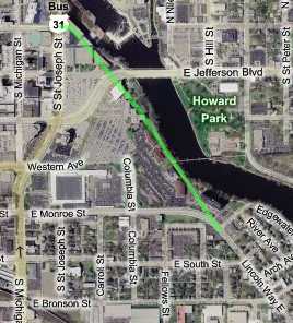
Quite a bit of the Lincoln Highway was torn up to build the Century Center and other city projects along the river here. A 1916 city map I have on hand says that the Lincoln Highway used to connect with Washington St. as I've drawn it in green on this map. The Century Center is the series of buildings at the green line's north end.
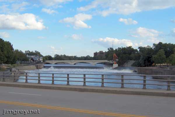
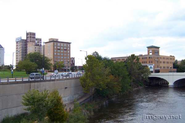
The St. Joseph River hugs St. Joseph St. just north of the Century Center. This photo, off the Colfax Ave. bridge, is of the Century Center's back yard. The orange girder structure is Keepers of the Fire, a 1980 abstract expressionist sculpture by Mark di Suvero. Its erection was controversial to the tune of, "The city spent taxpayer dollars on steel beams painted orange?"
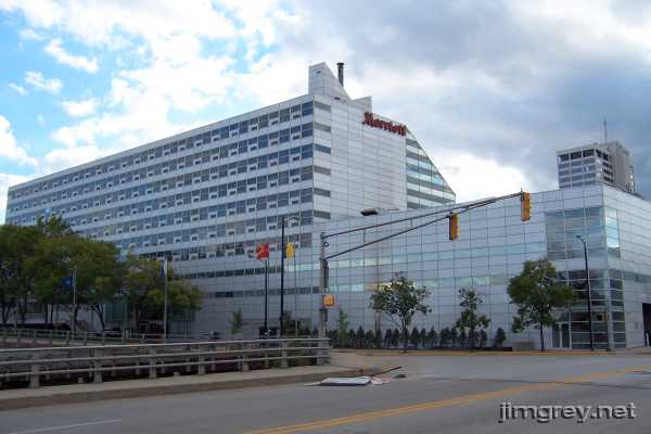
The Marriott Hotel's flat facade runs along St. Joseph at Colfax.
As old US 31 heads north from here towards LaSalle St., it curves to meet the old Michigan St. alignment.
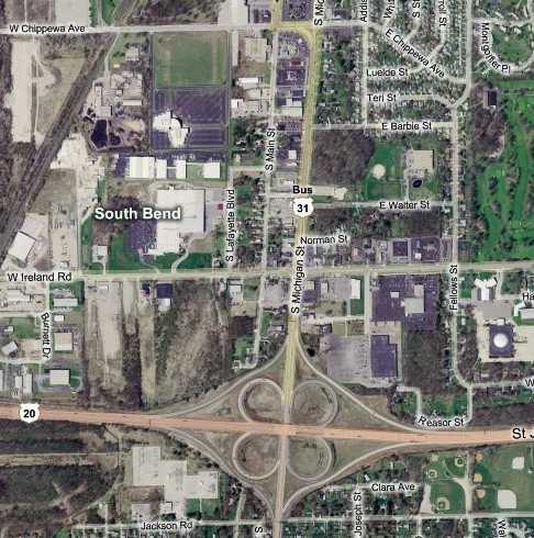
Zooming back to the far south side where this northbound trip began, the southward journey resumes. This map shows Business US 31 from Chippewa Ave. to "the bypass," which carries US 31 and US 20 around the city. Southbound US 31 comes in from the west on this map, but exits to rejoin its original alignment at the interchange.
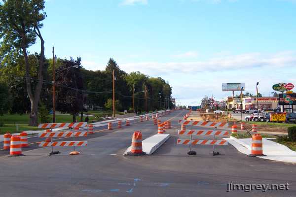
When we made our trip, Michigan St. was being rebuilt at Chippewa Ave., as this southbound photo shows. The single lane with the cement median in the photo is for traffic turning left onto Michigan from westbound Chippewa. It's a tight fit for city buses.
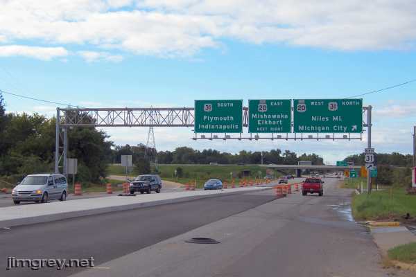
Shortly we came upon the interchange that brought US 31 back to its original alignment. I don't remember a time when this interchange didn't exist, but during the year I lived in South Bend the bypass did not continue east of here. The future road's right-of-way lay empty for years, however, and malls, schools, and neighborhoods were built around it. My aunt owned a house a few doors north of the right-of-way in one of those neighborhoods. Today, the elevated highway crowds the neighborhood. Roadfan.com has a great timeline of the bypass, which is officially called the St. Joseph Valley Parkway.
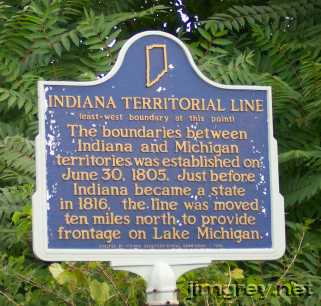
Just past this interchange, at Jackson Road, stands a historical marker that explains how land north of here originally belonged to Michigan. It's why I sometimes joke I'm from extreme southern Michigan.
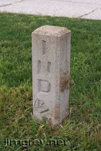
Across the street, in front of a furniture store, Brian noticed a right-of-way marker in the tree lawn. I've driven through here hundreds of times but never spotted it before.
As we drove south out of town, US 31 was four undivided lanes all the way to Lakeville. |
||||
|
||||
|
Created 13 January 2008. |
||||