State Road 42 |
|
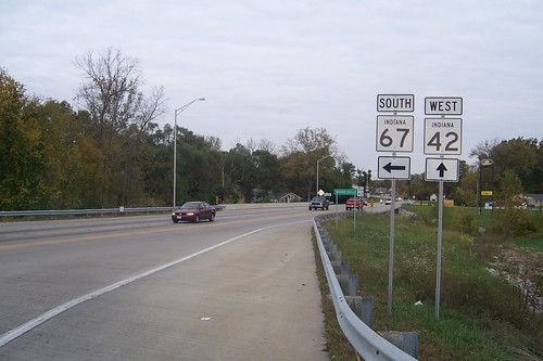
There's little reason to drive State Road 42 if you're on your way to Terre Haute from the Indianapolis area. Both US 40 and I-70 do the job much faster – I-70 will get you there in an hour, where State Road 42 takes more than two. State Road 42 is a narrow, minor highway. It was stitched together from a series of farm roads, and since the route has only seen minor improvements over the years, it makes many 90-degree turns around farm boundaries. But two steel truss bridges still stand on the road, as does a magnificent cement arch bridge over a man-made lake. State Road 42 also takes you through some rolling Indiana farmland and several very small towns that still have some vigor in them. If you're not in a hurry, as I certainly wasn't on an autumn Saturday, State Road 42 is a satisfying scenic drive that represents rural Indiana well. I took this trip on what I figured would be my only chance to see some fall color in 2008. I might have had some better views in southern Indiana, but everybody goes to southern Indiana when the leaves pop, making for crowded roads. I was in the mood for some quiet time by myself, and after driving and carefully documenting the Michigan Road all summer I was ready for a pleasure drive. I've had sleepy little State Road 42 on my to-drive list for years, so this seemed like the perfect day. Thanks to Flickr, you can click any photo on this page to see it in larger sizes. I took more than a hundred photos on this trip, more than I could comfortably include here, and if you click any photo you can see the whole series on Flickr. State Road 42 begins at State Road 67 on Mooresville's east side. Mooresville is essentially a southeastern suburb of Indianapolis.
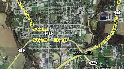
Here's where SR 42 begins.
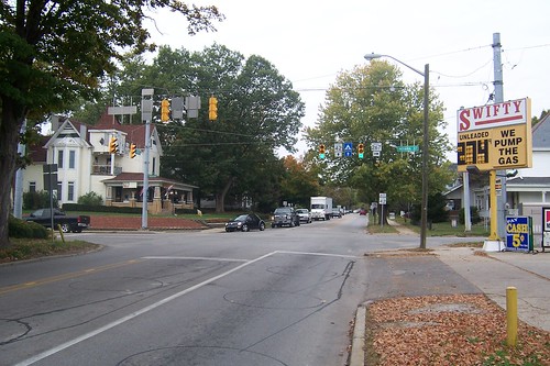
Until 1994, SR 42 began at the intersection of SR 267 inside Mooresville. Here's a westbound photo of that intersection.
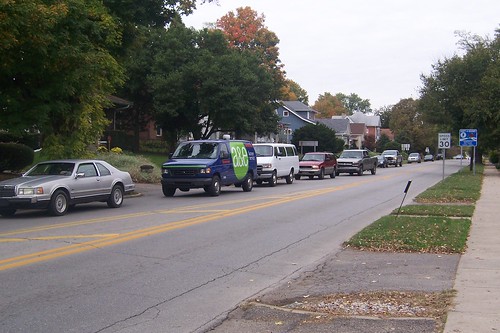
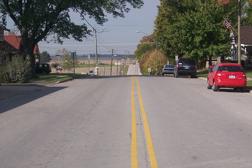
Mooresville is a typical small Indiana town except that, at least on this Saturday, it was busy. Check out all these cars. The traffic didn't let up while I was in town.
On the western edge of town, the road took on its rural character.
The Hoss Farm, just outside of Mooresville, looked pretty desolate.
The road curved just beyond the farm. Broad curves like these are rare along SR 42, except for a section in Putnam County. SR 42 was stitched together from a series of farm roads that naturally followed farm boundaries. A feature of roads built like this is that you make a lot of 90-degree curves, and even some hard rights and lefts, around farms. If SR 42 had become a more major road, the interests of speed and safety would have led the state to buy portions of the farmers' land and smooth and straighten the road. But with US 40 not that far to the north, providing a fine link between Indianapolis and Terre Haute from before the advent of the state highway system, SR 42 stayed a minor road that never saw those kinds of improvements.
The West Union Friends Meeting has gathered on what is now SR 42 since 1832. They've been burying their dead there that long, as well.
The first little town along the way was Monrovia.
Where SR 42 makes its 90-degree curve into town there's a football field, and I was fortunate to find a game in progress.
The 90-degree curve here is not how this road always was, of course. In this case, the original T intersection remains for local access.
Monrovia has a few old buildings in its downtown.
This building started its life as a bank. Notice the depository drawer. I think that vent-like thing is an alarm.
Most of the buildings showed the year they were built, and all of the dates were after 1900.
Most Indiana towns and cities have an Odd Fellows building, and here's Monrovia's. It's sad that the second-story windows are boarded up.
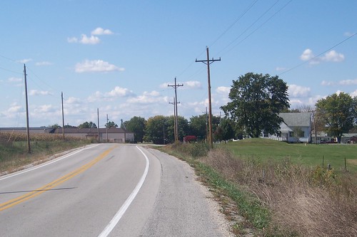
SR 42 rolls gently through Indiana farmland as it leaves Monrovia.
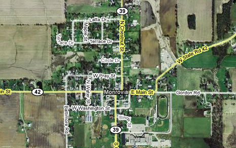
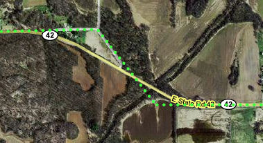
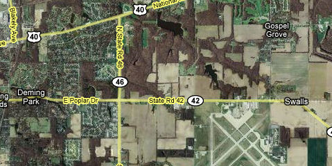
West of Monrovia, SR 42 goes through its most intense series of 90-degree curves, as this map shows. The last time I drove SR 42, which was the first time I drove it, probably 20 years ago, I reached this mess and became so frustrated that I bailed onto I-70 at Little Point. Clearly, my roadgeek seeds had not yet sprouted.
Indiana is dotted with little old white churches, and there's one where the road turns south at Crown Center.
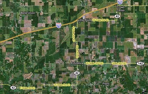
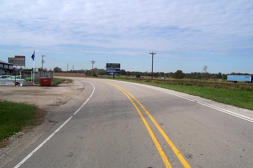
Little Point is just a couple truck stops that serve I-70. Perhaps it was more a long time ago. Those truck stops are on the only I-70 exit in Indiana that drops you onto a county road. Just beyond the truck stops, SR 42 curves out of I-70's right-of-way. Wanna bet that this was a 90-degree turn once?'
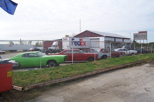
On the left in the photo above is a joint called Koger's. You can see its sign from I-70. I don't know what they do there – if their sign explains, it's too faded to read – but they do have a bunch of old cars in their yard. The green car at left looks like a '71 Plymouth Satellite, except that the wheel wells are wrong. The next car is a '66 Ford Galaxie 500, and then there's a 1964 Mercury Comet, a 1962 Ford Galaxie, and a Mustang II of indeterminate year.
There isn't much to tiny Eminence, but when I stopped at a gas station for a soda, I was surprised to find it quite busy with people. The grand old Eminence High School building looks like it belongs in a much larger town.
There's less to Eminence's downtown than to Monrovia's, but clearly the rivalry between the towns is strong. Somebody spray-painted "Monrovia Sucks" on the side of this crumbling building that once housed Gash & Co.
I'm including this shot of the Gash & Co. building's doors just because I like how it turned out. If you squint, you'll see me in my cameo appearance in this trip report.
State Road 142 has its western end in Eminence. Across SR 142 from Gash & Co., Eminence's Odd Fellows building houses a bank. I'll bet it's Indiana's only Odd Fellows building with a drive-through.
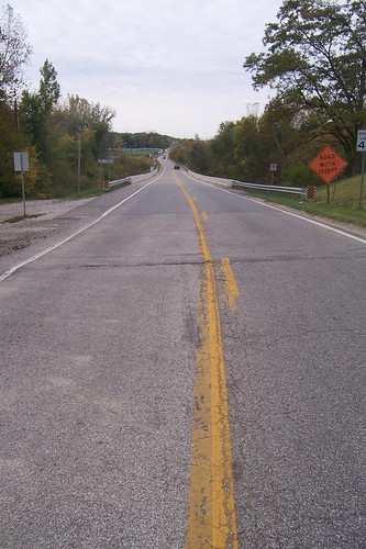
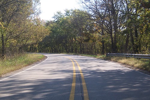
A few miles from Eminence, the road is lined with trees as it approaches Mill Creek. This photo is eastbound.
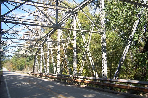
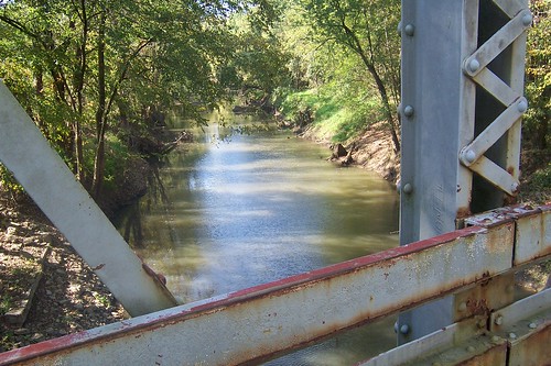
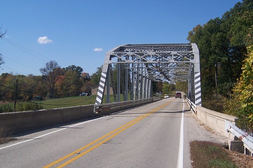
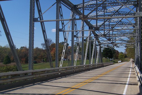
In 1939, the state built a steel truss bridge over Mill Creek. A similar bridge up the road made the National Register of Historic Places in 2000, but this one has not. I hope somebody in Putnam County picks up the mantle!
I thought it was standard that these bridges be painted green, but word has apparently not reached Putnam County.
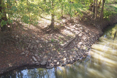
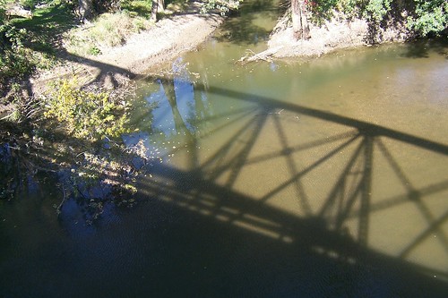
The view of Mill Creek is lovely. I took this photo off the south side of the bridge. But wait – what's that in the photo's lower left?
See it there? That neat row of cut stones?
Please consider the following:
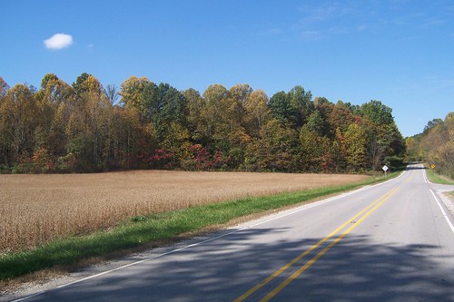
Just beyond the bridge is a road that pulls away and then turns to be right in line with current SR 42 after it completes the curve west of the bridge. This fairly screams "old alignment." Notice how the suspected old alignment, if extended southeast, would cross Mill Creek directly, instead of at a bit of an angle as it does today. In the olden days bridgebuilders' bags of tricks were fairly limited, leading them to build bridges straight across creeks and rivers. So could that row of stones be part of an older bridge's foundation? Could the stones lying around it be debris from the old bridge when it was torn out? In the excitement over all this, I forgot to drive the suspected old alignment. I did, however, think to take a shot of some of the fall color just west of the bridge.
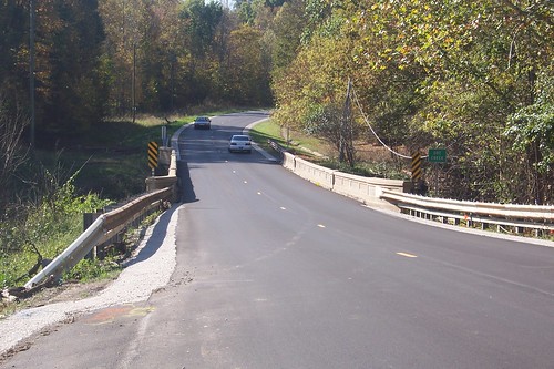
State Road 42 skirted Cloverdale on its south edge and then the terrain became more challenging. The road stopped the 90-degree-curve nonsense and began to curve around the terrain. At Doe Creek, a narrow cement bridge awaited.
My experience is that bridges only as wide as the road with cement railings like this were built in the 1910s and 1920s. I could see a clear path down the bank, so I walked down to see what the old girl looked like in profile. Sadly, she was a bit ungainly.
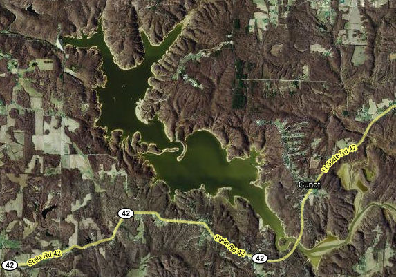
But shortly I came upon Cagles Mill Lake, one of many lakes the US Army Corps of Engineers built to control flooding.
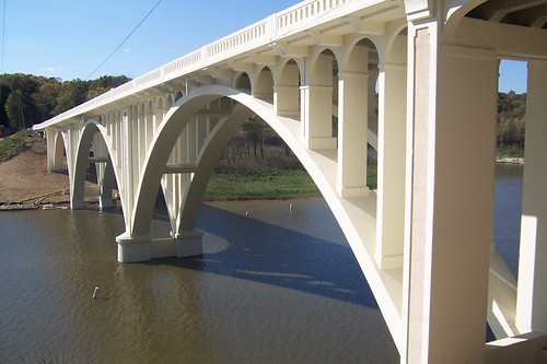
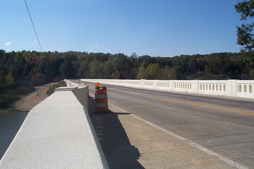
The bridge over the lake did not disappoint.
As I approached the bridge, there was a traffic signal flashing yellow, and cones everywhere. When I saw this bridge's pristine state, I wondered if maybe it was newly built, or perhaps just restored. Either way, the signal was there to allow traffic to flow only in one direction at a time.
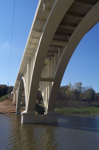
I'm not sure how such a minor road warrants such a major bridge, but this one is a real gem.
I passed through the remainder of the lush lake area and into Clay County. I zipped through the little town of Poland without even slowing down because I knew another steel truss bridge awaited on the other side – but it turns out I missed an old church on the National Register of Historic Places in so doing. I guess my consolation is that the steel truss bridge is on the Register, too.
Have I mentioned how much I enjoy steel truss bridges?
A sure sign of fall is how low the sun is at midafternoon.
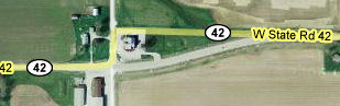
I lived in Terre Haute for nine years and when I needed to go to Indianapolis I liked to to drive SR 42 to the I-70 exit in Brazil because SR 42 was more fun over that distance. Well, except at the Vigo-Clay county line, where the road made two 90-degree turns around a church. I was surprised to find that the road had been curved gently on the Clay County side and the double-90 removed. This change is new enough that Google Maps hasn't updated the route yet!
The church is in the photo at right; the road used to run on its right side.
The people who own this house, I'm sure, let out whoops and hollers when they learned that the state was removing the double 90 – because the first turn going west happened right here. While I lived in Terre Haute, this house got clobbered a couple times by people screaming down SR 42 at night and failing to negotiate the turn.
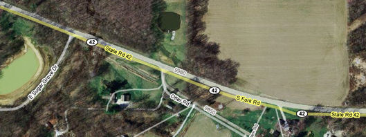
Shortly inside Vigo County, SR 42 curves northwest. I have old maps that suggest that this curve did not always exist, and that Sugar Grove Dr. used to run straight and connect with what is now SR 42. Sugar Grove Drive ends west of here where the Indiana Air National Guard base (and the stunningly overnamed Terre Haute International Airport) begins, and picks up on the other side as Hulman Ave., which goes through Terre Haute. But notice little Otter Road just below the center of the map image. Do you see the abandoned strip of road near it?
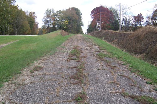
Here's what it looks like, eastbound.
My old map suggests that what is now Sugar Grove Rd. used to fork here headed east. The left fork is what is now SR 42, and the right fork, which is now Otter Rd., was the road to Bloomington. This road is interrupted by I-70, but you can detour over it on another road and pick the road back up again on the other side. It still goes to Bloomington. It joins with State Road 46 inside Clay County to finish the journey. Speaking of State Road 46, State Road 42 ends there today, just past the optimistically named Terre Haute International Airport. Here it is on the map. Notice how US 40 converges. I went to college about where US 40 enters the image.
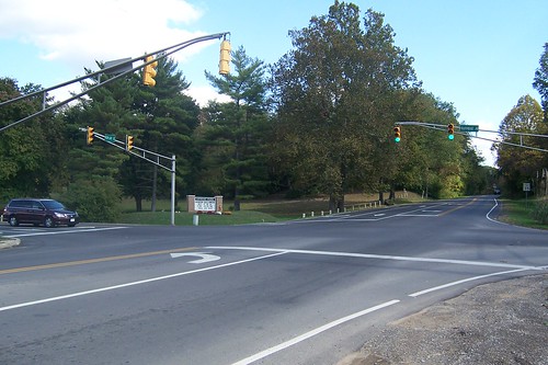
And here it is in living color.
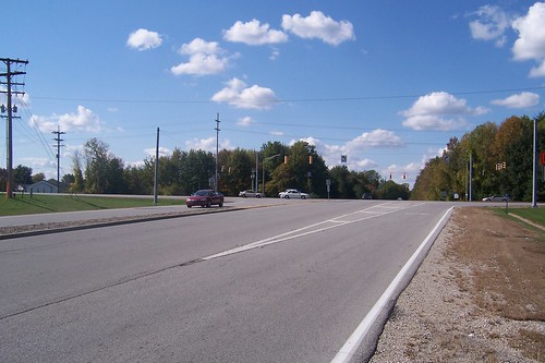
SR 46 is Terre Haute's eastern boundary. Beyond the stoplight, the road becomes Poplar St. and cruises laterally through Terre Haute. At one time, SR 42 went along for the ride as far as US 41, and so did I this day. Not far into town stands the Sycamore Farm, which has been there since about 1860. Fifty years ago, Sycamore Farm was still way out in the boonies.
Terre Haute is a decaying town, its best days so far behind it that nobody who remembers them is left. But somebody along the way made sure its park system was well funded. Say what you will about Terre Haute, but it has wonderful parks. Old SR 42 is the southern border of Terre Haute's crown jewel, Deming Park. This is an eastbound shot.
In 1971, Vigo County tore down its five old high schools and built three sprawling, boring, characterless modern buildings to replace them. It's a shame, because this is the kind of school building Terre Haute used to build. This is the view from 25th St.; the school's south edge is on old SR 42.
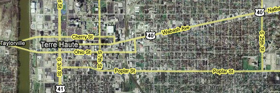
This map shows old SR 46's trip from about here to its end at 7th St., which is old US 41. It also shows the Wabash River for perspective.
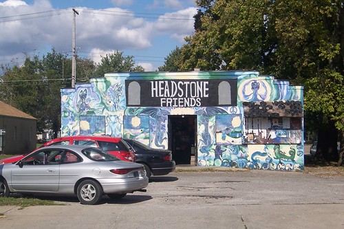
At 12th and Poplar stands Headstone Friends, which sells CDs and records, posters, incense, shirts. And scales and rolling papers, or at least they did when I was in college in the late 1980s; I failed to look when I visited this day. This is one of my favorite places on the planet. Headstone's has been in business since 1969, and in this location since the '70s sometime. They've been burning incense, presumably, in there so long that the whole joint has a distinctive sweet smell that always makes my nose run. I bought a tie-dyed T-shirt here on this trip and all the way home my car smelled like Headstone's, which I suppose is better than it smelling like my dog, who was along for the ride. If you're ever in Terre Haute, put Headstone's on your itinerary.
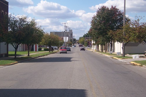
Here's a westbound shot from in front of Headstone's. Terre Haute is not a city of tall buildings.
At 9th St. stands the former E. Bleemel Flour and Feed building. Most of the time I lived here, this was an auto repair garage, and a dump of one at that. But in the early 90s somebody restored it. It was, for several years, an antiques store, but now it's a restaurant. I think that's a better use of the building.
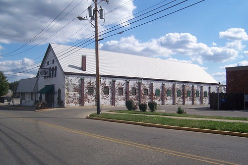
The section of old SR 42 between 9th and 9½ St. – Terre Haute is known for its half-streets – is rich with old buildings, like this one, which housed the former Terre Haute Brewing Company. It really needs some love.
I'm not sure what this building was – I couldn't even recall if I'd ever noticed it before. But it's a steakhouse today.
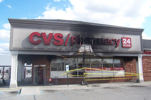
This CVS drug store is, of course, neither old nor historic, but it was surprising to see its facade torched.
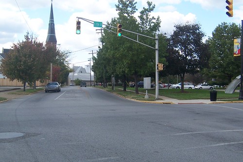
Finally, at 7th St., comes the end of the line. At least I think this was the end. I have on good authority that SR 42 used to end at US 41. I assume that SR 42 was truncated at SR 46 long enough ago that 7th St. was still US 41. It's possible that SR 42 went all the way to 3rd St., which is US 41 today; I don't have any maps to say for sure. On the right, just out of the photo, is the Vigo County Public Library, the very one that Steve Martin mentioned in his movie Dead Men Don't Wear Plaid.
|
|
|
Created 19 October 2009. |
|