The National Road in Western Indiana, Revisited |
||||
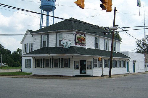
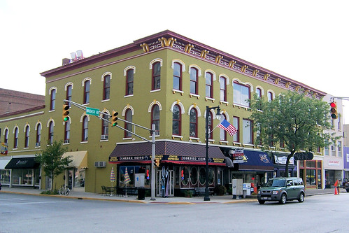
Vigo CountyMy trip along US 40 and the National Road in western Indiana finally brought me to Vigo County, where I lived for nine years. Sadly, those were years before my full roadgeek had been awakened, and I was blind to much of what the road offered there. Of course, since then my eyes have opened. I’ve made a number of road trips, taken thousands of photos, and written quite a bit about it all here in my little corner of the Web. And then in July of 2009 a reporter at the Terre Haute Tribune-Star found some of my writing as he was researching a story about US 40 and the National Road. He interviewed me for his story, and I was thrilled to have been quoted extensively in his article. When I moved to Terre Haute in 1985 I was a student at Rose-Hulman Institute of Technology. Many of my friends had apartments in nearby Seelyville, the first small town you encounter as you enter Vigo County on US 40. Downtown Seelyville involves one stoplight. This 1906 building stands on one corner.
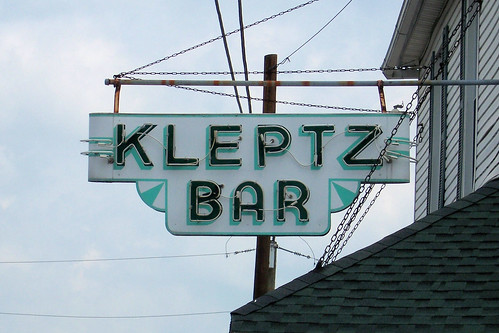
Kleptz's Restaurant stands on another.
I came back by here late one night a couple months later hoping to photograph Kleptz’s great neon sign while it was lit, but sadly the sign was gone.
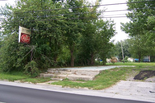
This used to be a dumpy little building that housed a pizzeria of sorts. A friend and I actually ordered a pizza from this place in about 1988. The pizza was terrible! Here's a photo from before it was torn down.
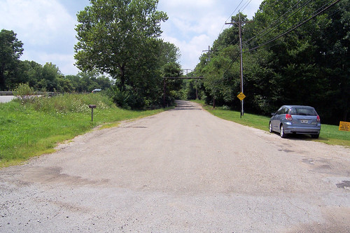
Just west of Seelyville is Vigo County's first old alignment.
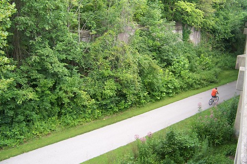
US 40 spans a former interurban railbed that is now a fitness trail. When US 40 was widened to four lanes, a new bridge was built here on a new alignment, and the old bridge was removed. Here's the short bit of old US 40 leading to the old bridge approach.
From the west, here's the fitness trail and the east bridge abutment.
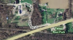
I had on my list to visit Twigg Park, which was an early rest stop along US 40. Unfortunately, I had bad information and missed that it was essentially across the street from this old alignment. Grumble! This derelict motel, the former Ritz Plaza Motor Lodge, stands on the outskirts of Terre Haute. This was a dump even when I was a student at Rose. It was operating as efficiency apartments for students then; I think the sign (far right) was still intact. The building looked abandoned on this day, but when I drove by a couple months later a pizzeria occupied the building out front and its name was on the sign. (Thanks to Autostitch for making this panorama. Click it to see it larger on Flickr.)
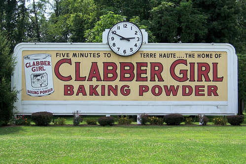
I didn't miss the Clabber Girl billboard, however, which is on the opposite corner from the motel. The first time I ever saw it was in 1984, when my parents brought me to visit Rose-Hulman for the first time. The clock was stopped that day, but I’ve always seen it keeping accurate time since.
Indulge me for a moment for a few photos of my alma mater.
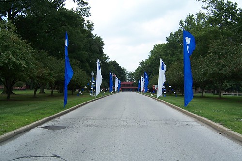
Even though school colors are red and white, Rose's entrance was festooned in blue and white – this is where the Indianapolis Colts have their summer training camp every year, and camp was in session.
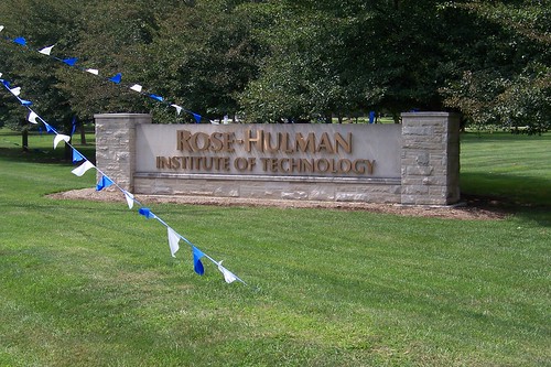
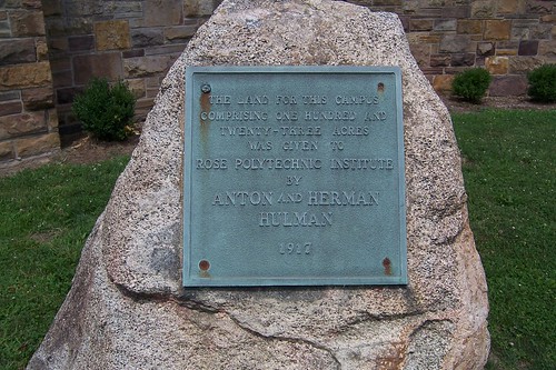
Rose-Hulman was originally Rose Poly.
Rose was originally located well within Terre Haute, but moved here after the Hulman family donated this land. You may have heard of the Hulmans; they own a little race track up in Indianapolis.
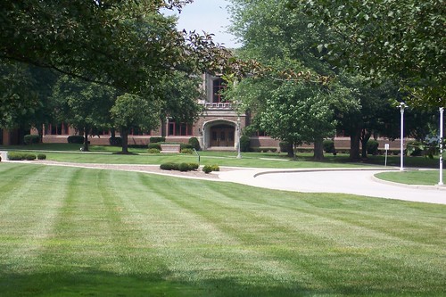
This is Moench Hall, the school's original (and for many years only) classroom building.
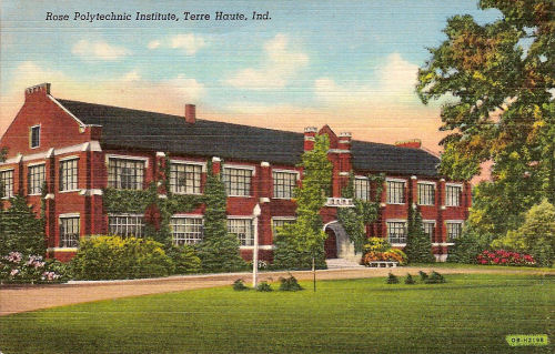
Here's a postcard image of this building from days gone by.
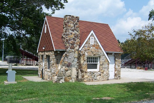
On the western edge of the Rose-Hulman campus stands this 1931 gas station building. Its original location was on US 40 in town. I have a dim memory of once noticing a tiny little house and wondering who could possibly live in it; I think it was this gas station. It hadn’t operated in some time and the pumps were gone. What I didn’t know then was that early gas stations were deliberately built to look like little houses because travelers of the day were more comfortable stopping at a place that looked homey. This little building was in danger of being demolished a few years ago when the Indiana National Road Association partnered with Rose-Hulman to move it here and restore it.
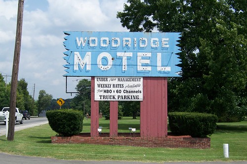
This motel is within spitting distance of Rose-Hulman and was a common place for parents to stay when they visited; maybe it still is. I’ve never been inside, but here’s a postcard view of a room from days gone by.
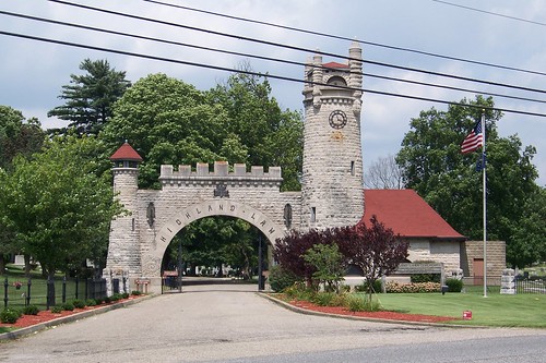
Across the street from the Woodridge is Highland Lawn Cemetery, founded in 1884.
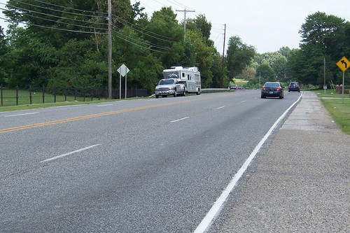
US 40 is a heavily traveled local road here on Terre Haute's east end.
In Terre Haute, the National Road and US 40 are better known as Wabash Avenue.
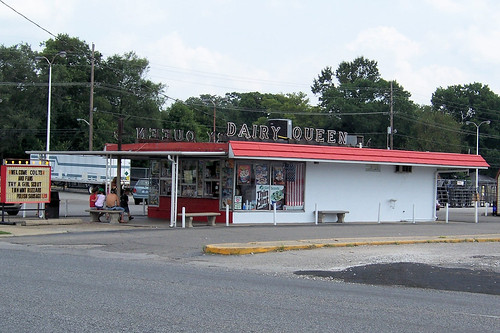
During my Terre Haute days, my bike rides frequently amounted to Dairy Queen runs. I didn’t intend them to be that way, but there are so many DQs in Terre Haute that most of my routes passed by one. I’d inevitably ride home sucking down a chocolate malt, undermining the ride’s health benefits. I’ve never seen a Dairy Queen sign of this type except in Terre Haute.
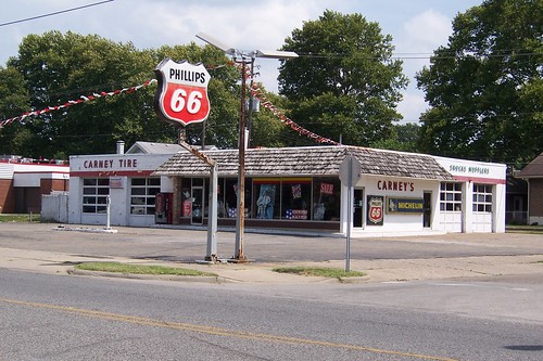
Carney’s Tire is a former Phillips 66 station. The pumps are long gone, but they kept the sign.
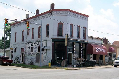
Ambrosini's is an Italian restaurant. It was closed for renovations when I passed through, but I stopped here for many enjoyable pizzas while I lived in Terre Haute.
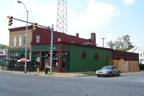
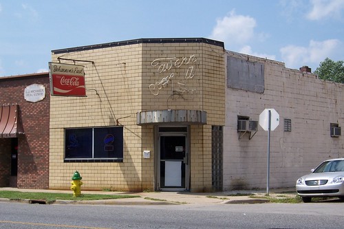
Across the street is Sonka's pub, which was my favorite watering hole back in the day. They had the best beer selection in town.
This neon wasn’t broken the last time I drove through here, but I can’t remember what it used to spell out. The top word is certainly Tavern.
Eastbound US 40 turns north here today and runs west to the Wabash River over Cherry Street. Westbound US 40 follows Ohio St. to 11th St., and then turns north and exits town on Wabash Avenue. The road's original path, of course, stayed on Wabash Avenue through town. Two bridges carry US 40 over the Wabash River today, but through around 1990 (as best as I can remember) there was a single bridge here that was in line with Wabash Avenue.
The Hulman Building stands on the northeast corner of 9th Street. They're known for Clabber Girl Baking Powder.
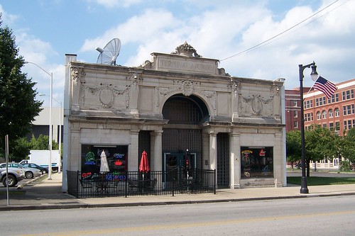
The Terminal Arcade building stands nearby. This was the interurban station. The interurbans had long been gone while I lived in Terre Haute and this building was closed. Today, it's a bar.
Downtown Terre Haute is a lot more alive today than it was 15 years ago when I moved away. That’s not to say that it’s become a hotspot, but there are more bars and restaurants here now than then. I don’t think this building was anything when I lived here. As a matter of fact, I don’t even remember it. As I mentioned earlier, I hadn’t yet learned to see in those days. At any rate, it was doing good business on this late Saturday afternoon.
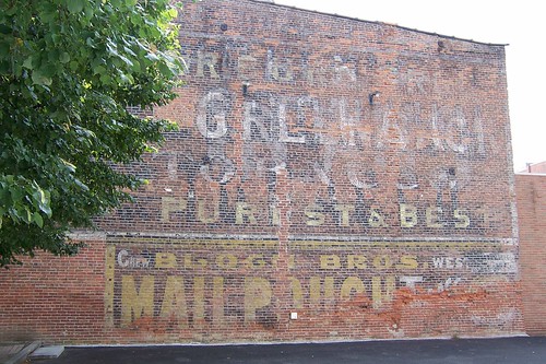
What caught my eye about this building was all the advertising painted on its side.
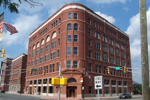
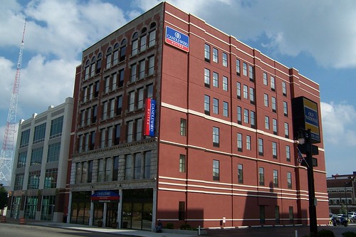
This is the Tribune building. Terre Haute once had two newspapers, The Tribune and The Star. They merged to become The Tribune-Star and operated from here until sometime in the 90s when they built a new headquarters around the corner on 7th Street. The building is now a hotel.
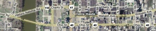
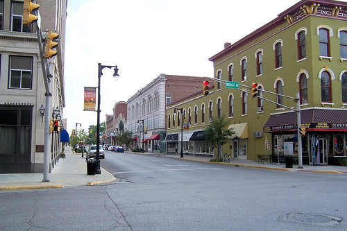
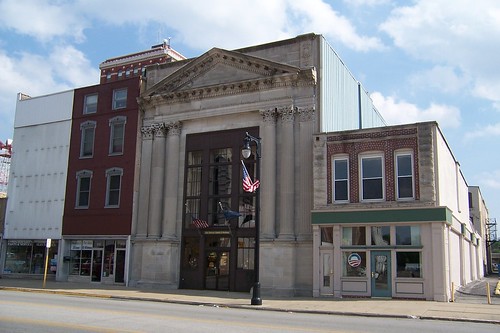
Terre Hauteans claim that the Crossroads of America is right here, where Wabash Avenue (old US 40) and 7th Street (old US 41) intersect. This is a southbound view down 7th St. Behind the green building is the Swope Block; behind it (and across Ohio St., which is US 40's westbound alignment today) is the grand Indiana Theater.
Here's a better look at the green building, which looks to have been nicely restored and refreshed. It houses the Corner Grind restaurant and a few other businesses today.
Terre Haute's downtown once boomed. Some evidence of its better days remain, such as the building above and the center building below. But as much of Terre Haute's downtown consists of lots where buildings once stood and buildings that have not enjoyed good care.
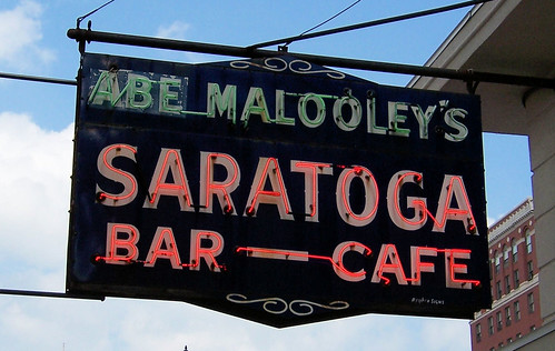
Soon I came upon this landmark sign in downtown Terre Haute. Everybody knows the Saratoga.
Check out the building this sign is attached to.
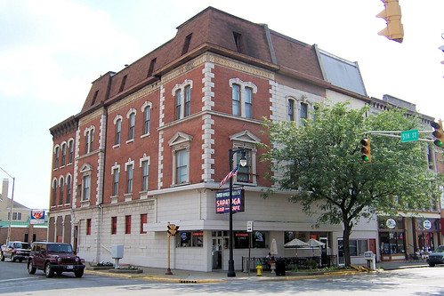
I’d been to the Saratoga only once while I lived here, and that was for a company holiday party. I was in my 20s then, and the Saratoga’s regular crowd was a bit older. But now I’m a bit older. The day I came through here was a couple days before my birthday, so I stopped in and treated myself to a nice dinner. I fit right in, and the prime rib was really good! The sun was starting to set by now, which made it difficult to get a good shot of the Vigo County Courthouse. The National Road and US 40 used to pass by the courthouse's north side and across the Wabash River.
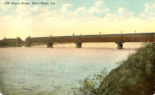
This wooden covered bridge over the Wabash was built in 1865. This postcard image is dated 1911.
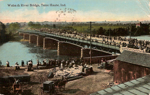
A new bridge of steel, concrete, and brick was built here in 1905. This postcard image, which seems to be of the bridge being built, is postmarked 1912. This bridge served until the current bridges were built. You can still see some of its piers in the water. Unfortunately, I found no good place to park my car so I could photograph them.
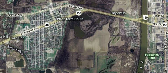
The postcard shows how the westbound National Road curves northward a little bit just after coming off the bridge. That bend is still there, as this aerial image shows. I would have liked to photograph West Terre Haute and the curious spot where the road forks just before entering town – the right fork is a concrete road which, I have since learned, used to be US 150 – but I was running out of light. I still wanted to photograph the road's inglorious end.
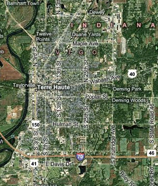
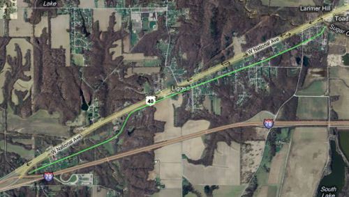
One more old alignment of US 40 and the National Road lurks in western Indiana, and it runs from West Terre Haute almost to the Illinois border. It’s highlighted in green on this image. Notice how the old road ends where US 40 and I-70 merge.
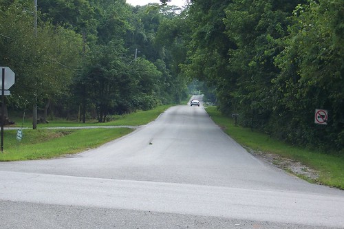
At one time, as best as I can piece together, the road curved south just before it crossed Sugar Creek (at upper right on the image above). The bridge is gone and buildings stand in the former roadway on both sides of the creek, but the old road is accessible via the next crossroads. Here’s the old road westbound.
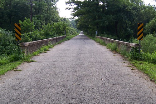
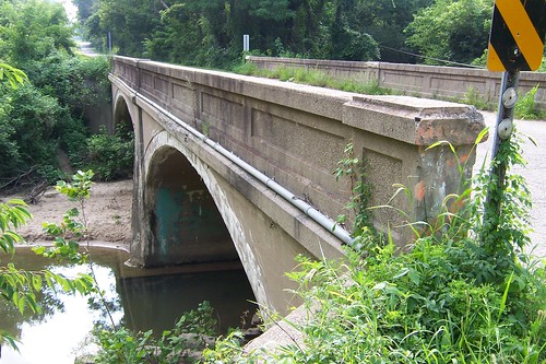
After the road curves again it crosses another little creek. This time, the bridge is still intact.
This bridge was built in 1919. Indiana had just formed its first numbered highway system the year before, and the National Road was State Road 3. It wouldn’t become US 40 until 1926.
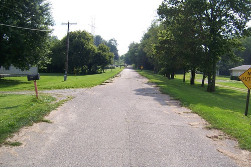
Not far beyond the bridge is one final road allowing access to current US 40. Beyond it, the old road fades away. Modern US 40 and I-70 merge just past the end of the road.
Fortunately, the old road survives in Illinois. It emerges just past the state line where I-70 veers away from the National Road's path. And it's brick! The Indiana trip ended here, but if you're curious you can follow my earlier Illinois trip along the old bricks here. |
||||
|
||||
|
Created 1 January 2010. |
||||