The National Road in Western Indiana, Revisited |
||||
Marion CountyI had grand visions of starting my trip at Washington and Meridian Streets in Indianapolis, just south of the Soldiers and Sailors Monument, but events conspired against me and I got a late start on the day. I decided I'd make a special trip through Marion County another day. I did stop at the Marion-Hendricks county line, however, to see an old alignment I'd overlooked on earlier trips. This image from Bing Maps shows the road around the Marion-Hendricks county line as it is now. The county line is about 2/3 of the way across the image from the left.
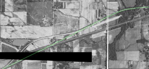
Compare it to this image, which I stitched together from 1937 and 1941 aerial images available at the Indianapolis General Data Viewer. (Gaps in the images made stitching necessary.) I highlighted US 40’s original alignment in green. Can you find the remnants of this alignment on the map above? Can you see where the current alignment was being built?
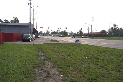
As early as 1937, the Six Points area just inside Hendricks County had already been bypassed. This was probably done for safety’s sake, as the original National Road intersected a railroad track there a dangerously shallow angle. The 1941 image shows a new alignment being built to straighten the curve and cross a creek at Marion County’s western border. Remnants of the original alignment remain. East of the creek, at the extreme right edge of the aerial images above, faint traces of the original road remain. I’m told that until a few years ago you could clearly see the original two-lane alignment of US 40 here. Today, only a little evidence remains. I took this eastbound shot from where the road used to lie. Notice how the building at left is at an odd angle to the current road. It looks to me like this building was parallel to the original road path.
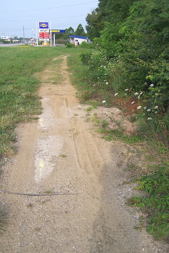
Westbound from the same place, notice the concrete road remnant. It looks to me like the road used to go to about the Sunoco station and then crossed the creek there.
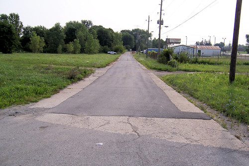
The old road stretches out beyond the creek and the Sunoco station. Notice the red billboard in the distance; we'll see it again in Hendricks County.
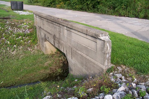
The bridge over the creek is long gone, but this little bridge remains just west of it. My guess is that it dates to the 1910s.
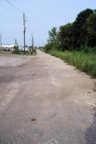
This road segment ends at Raceway Road, which is the county line. Notice the modern road on the far left of this photo. The road used to continue west from here, but the only evidence of it is that a farmer's fence follows the old right-of way.
|
||||
|
||||
|
Created 1 January 2010. |
||||