The National Road in Illinois |
||||
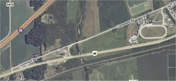
Bridges west of GreenupAs we drove west out of Greenup on the National Road, we encountered two bridges. The first was nothing special, and the other was pretty neat. On the map below, I think the first bridge is west of the oval track, perhaps just west of where the C in Cumberland Rd appears there. The second bridge is over the river about halfway across the map.
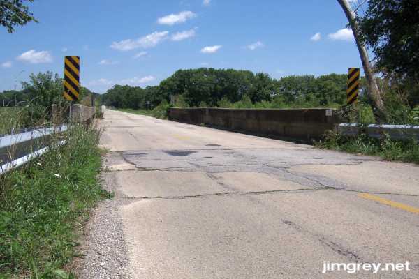
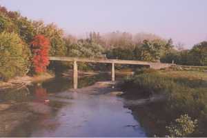
Here's the first bridge, eastbound. It was a simple cement bridge like so many on old highways.
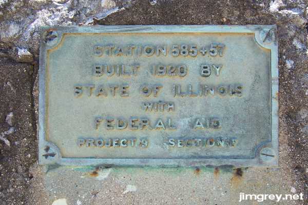
I found a plaque on the bridge that placed it at 87 years old. I think this plaque was just over the south side of the bridge, facing the sky.
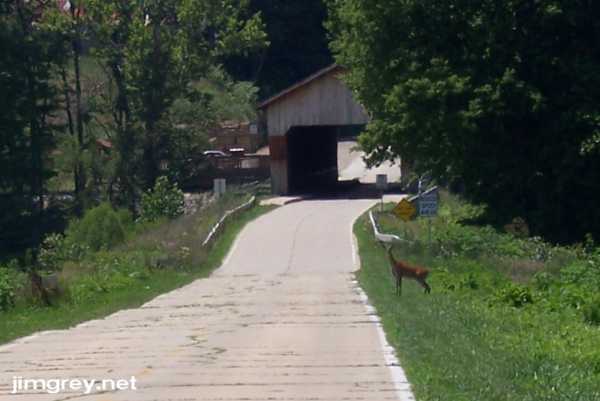
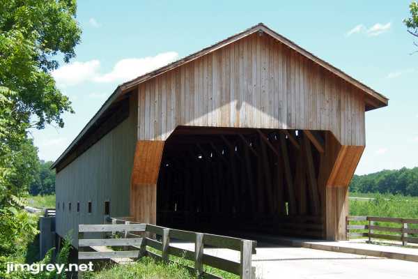
I had heard about the next bridge, the new Jackson truss covered bridge over the Embarras (AM-braw) River. It was built in 2000 to replace a condemned concrete bridge and, I believe, to stir tourism in Cumberland County. Shortly after crossing the little concrete bridge, the covered bridge came into view. A young deer was watching us carefully as she waited for the right moment to cross the road.
I read online somewhere that this bridge was cut and assembled in Wisconsin, disassembled and shipped to Florida to be laminated, and then shipped to Greenup to be assembled over the river. We drove over the bridge, parked in a small lot set up just for tourists, and started snapping photos. This eastbound photo shows the bridge's mass.
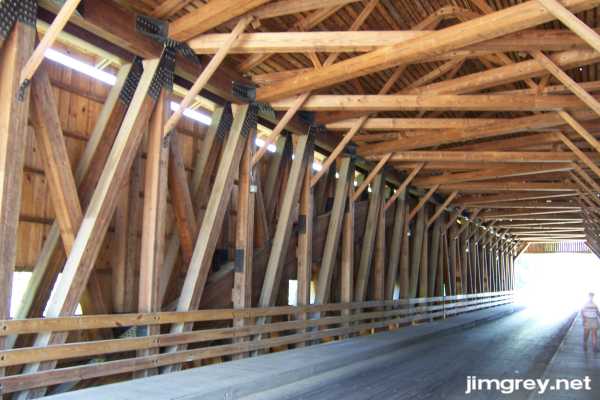
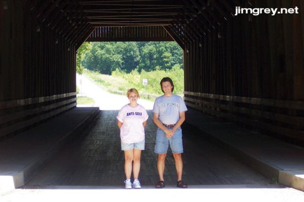
We stepped inside the bridge, and I was blown away by its construction. Living near the covered bridge capitol of the universe, I have seen a few covered bridges. None of them were as solidly constructed as this one. It was double-trussed on each side, with an arch between the trusses! They built this bridge to last. They also placed it six feet higher than the previous bridge and built up the road on either side to meet it. You can see that two photos above, where suddenly no more grass grows in the cracks of the road. That's the new road built to reach the bridge's higher elevation. Since a flood fatally damaged the previous bridge, I'm sure that they built this one higher as protection against future floods. It looks so solidly constructed, though, that I imagine it would take quite a flood to knock this baby out.
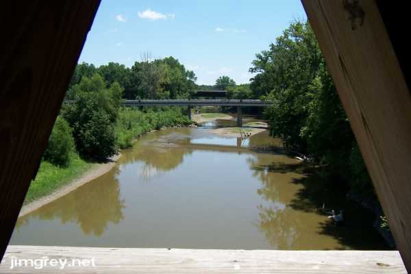
I looked south through one of the bridge's windows, and there were the US 40 and railroad bridges across the Embarras. In this part of Illinois, where one road goes, there go the other two.
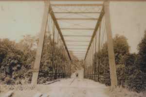
Between the bridge and the parking lot, large signs told the history of the several bridges that had spanned the river here, including detailed information about building this bridge. I hope the Illinois Department of Transportation doesn't mind, but I'm going to share two photos I took of photos on those signs. The first bridge here was a divided covered bridge built in 1832. Abraham Lincoln and his father Tom are said to have helped build it. It collapsed in 1865. Ferries carried people across until 1875, when the Pratt iron truss bridge in the left photo was built. It was condemned in 1896 and, after a court battle over who should pay to fix it, it was repaired and reopened. It closed permanently in 1912. Ferries carried traffic across the river until 1920, when the singularly ugly concrete bridge in the right photo was built. A 1996 flood severely damaged this bridge, closing it.
Construction on the new bridge began in 1998 and opened in October, 2000. According to the signs, the arches went up first, then the trusses. It cost $2,823,429.45. These signs also gave a brief history of US 40 in Illinois. It said that the National Road was paved with brick or concrete between 1920 and 1926, and that between 1950 and 1955 many sections of US 40 were redesigned to become a 4-lane freeway, bypassing many towns. The second lane was never constructed. Upon reading this, the first thing I thought was, "The narrow brick and cement roads were used until the 1950s?" I was amazed. But then a flash of realization washed through my body. As we approached Greenup, I remarked to Dawn how much US 40 felt like the westbound lanes of a divided highway, but I couldn't put my finger on why. Well, they probably are the westbound lanes of a never-completed freeway. And I realized that all those brick and cement segments of the National Road probably still exist because the freeway's eastbound lanes were never built over them. I'll bet you could put a median and two lanes in that wide right-of-way in most places. And then I realized that by the mid 1950s, I-70, which would render a US 40 freeway redundant, had to be on the drawing board. My conclusion: Ironically, we have I-70 to thank for saving the brick and concrete sections of the National Road. You could have knocked me over with a feather. As we explored the bridge, others came to look at it, too. Two couples arrived together shortly after we did and shared the bridge with us. One of the gentlemen approached me and asked if I'd take a photo of all of them with their camera. I did, and he returned the favor. It's nice to be able to share a photo with us in it to remember the day.
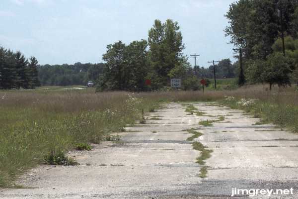
We left the bridge and headed west. Shortly, US 40 met Cumberland Road. As usual, there was a turnoff and a short sliver of old road beyond. The end of the road was clearly marked. Trees were in the way of showing how this segment flows into the path of US 40 (although the map suggests that US 40 ran parallel, slightly south), but you can see a car driving on it in the photo.
|
||||
|
||||
|
Created 22 July 2007. |
||||