The Michigan Road |
||||
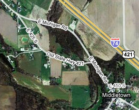
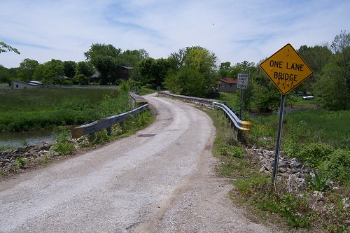
Shelby CountyThe road in Shelby County is standard county-road gray and decidedly rural. If you didn't know that the road used to be a US highway, you probably would never guess. Shelby County was organized in 1821. Because so many early Shelby County settlers were said to be from Kentucky, the county was named after Kentucky's first governor, Isaac Shelby, who was a General in the Revolutionary War. Early settlers cut farms and towns out of "an unbroken and almost impenetrable woodland." It also appears that a road known locally as "The Old State Road," made as early as 1821, went from the Ohio River at Lawrenceburg to Napoleon, then through Shelby County from southeast to northwest. Given that through human history we've preferred to use and improve existing roads rather than build new ones, it seems likely to me that once the Old State Road got to Napoleon, it followed what became the Michigan Road's route to Shelby County. (It also seems likely that the Old State Road followed Napoleon's Main St, State Road 229, which becomes State Road 48 just outside of town and leads directly to Lawrenceburg.) Source: Not quite a mile inside Shelby County lies a one-lane bridge on a one-lane former alignment of the road. It's labeled E 425 South on the map.
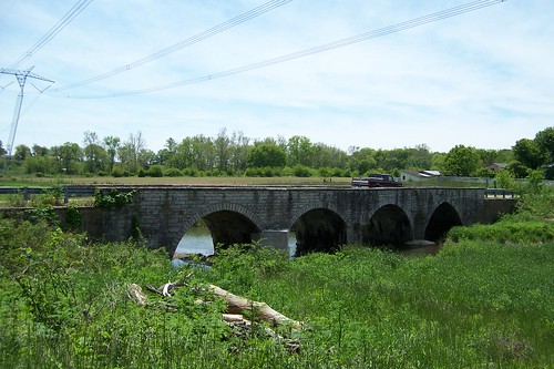
The bridge on the newer alignment looks like the kind of cement bridge the state was building between the late 1910s and the 1930s. So I wager that the new alignment was built about the time the state took control of the road in the 1920s to provide a two-lane bridge over this creek. For whatever reason, they decided it was better to realign the road than to widen the old road and build a new bridge. I thank them for that!
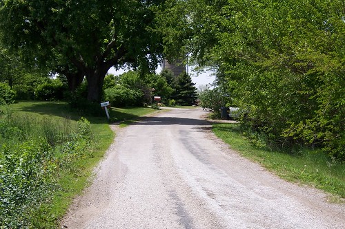
Here's what it looks like to drive over the bridge and along this alignment. Several homes and at least one farm lie along this short segment.
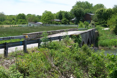
The rutted pavement over the bridge is heavily patched. It looks to me as though several layers of pavement have raised the bridge's surface.
This is the road northbound just past the bridge. This is a two-way road, so I suppose that oncoming cars drive slightly off the road to pass each other.
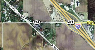
A bit north of the one-lane alignment, the Michigan Road meets State Road 244.
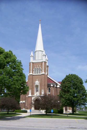
South of SR 244 stands St. Vincent de Paul Catholic Church, its parsonage, its school, and its cemetery. This is the church, which was established in 1836. I didn't find a cornerstone that dated this building, but the church's first building was built here in 1839. This was one of the earliest Catholic parishes in Indiana. Until 1846, there were no Catholic churches in Indianapolis, and so the priest from St. Vincent's traveled to Indianapolis to serve the Catholics there. This page shows a photo of an earlier building here. Source:
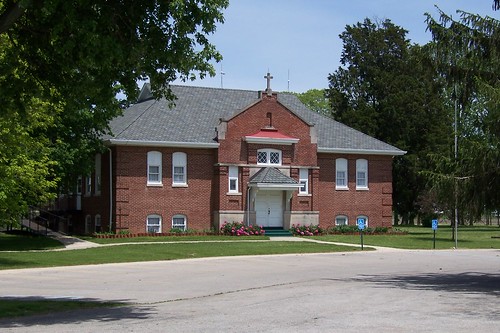
This school stands just south of the church.
This appears to be the church's parsonage.
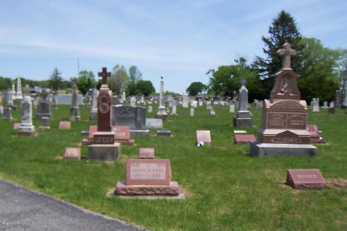
Behind the church, a cemetery stretches most of the way to I-74.
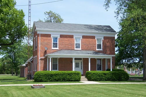
This building stands just north of SR 244. It appears to be somebody's home today, but it probably wasn't built to be a private residence. The plaque above the middle second-floor window says "1909 St. Vincent's Hall," which suggests this building was at one time connected with the church. Above the cornice it reads, "Y.M.I. Bauer No. 574," whatever that means.
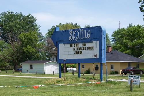
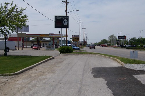
The Skyline Drive-In with its one screen stands a bit north of SR 244.
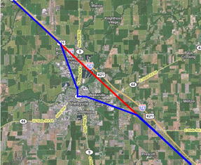
The Michigan Road makes a nearly perfect southeast-to-northwest trek through Shelby County, except where it bends out of its way to go through Shelbyville. The blue line on the map below shows how the Michigan Road bends more westerly on its way into Shelbyville, and then more northerly on its way out of Shelbyville, until it reaches its former course and returns to its northwesterly ways. The straight red line shows now neatly the roadbuilders returned the Michigan Road to its course.
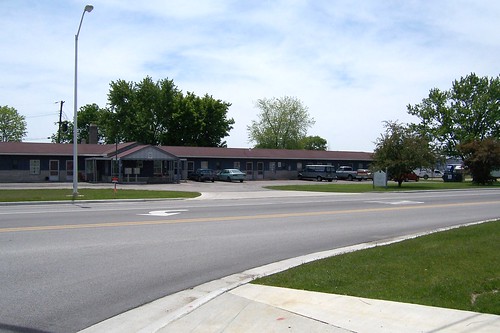
This former motel on the edge of Shelbyville is now rented long-term as "sleeping rooms," which is a way of saying "efficiency apartment that has no kitchen."
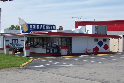
The neon sign atop this Dairy Queen identifies it as an old-timer in the chain.
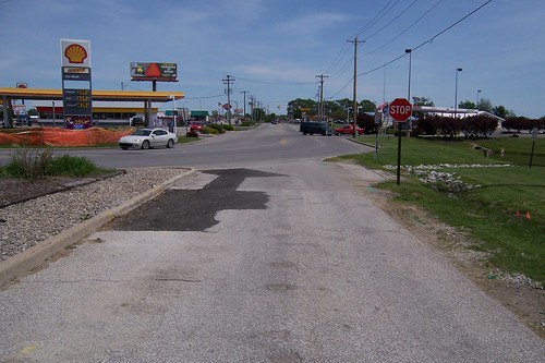
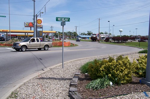
That DQ stands just south of where the Michigan Road meets State Road 44 in Shelbyville. Notice how deftly State Road 44 curves in and takes over the Michigan Road's former glory into town.
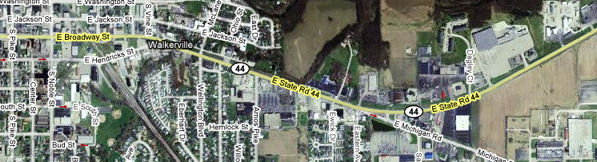
Adding insult to injury, a tiny segment of the Michigan Road's path was reduced to a narrow access road when SR 44 ascended to primacy. The map below shows how the Michigan Road was curved to meet SR 44 squarely, with maybe 75 yards of its original path left behind, although closed at its northwest end.
Here's the northwest end of that segment. It only gives access to the southwestbound Michigan Road to people leaving the businesses along this curve.
Stepping back, here's this segment in its entirety.
Looking southwest, notice how nicely the segment lines up? It brings a tear to the eye.
Here's where the Michigan Road now curves to meet SR 44.
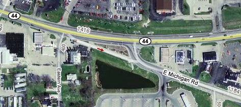
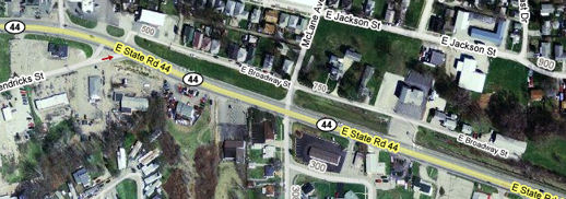
A few hundred yards east, a short, disconnected strip of road lies tantalizingly just north of SR 44. My old-alignment radar went ping when I saw it. Notice how the map labels it E. Broadway St., which is the name SR 44 takes after it curves to head straight west at the left of the map below.
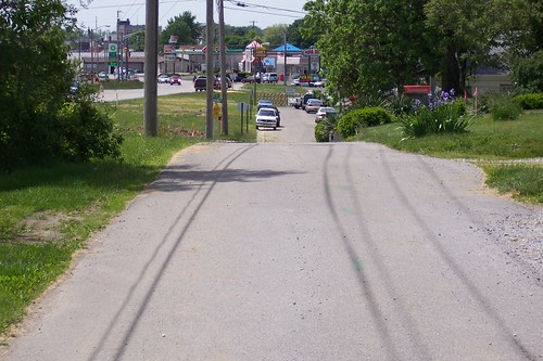
This is what this two-block segment looks like. A highway that rolls like this would have been smoothed out in a hurry by the modern Indiana Department of Transportation and I suspect even by its predecessor, the Indiana State Highway Commission. This suggests to me that this segment was bypassed a long time ago, and if it was ever a state highway, it wasn't one for long.
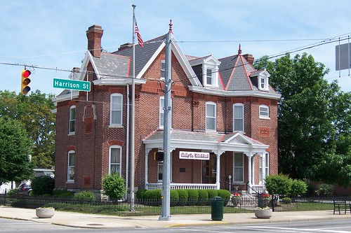
Broadway St. leads to downtown Shelbyville. The Michigan Road turns right onto Harrison St. on its way to the public square.
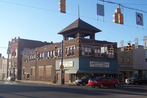
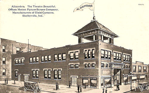
When Broadway St. meets Harrison St., the Michigan Road turns north onto Harrison. On the northwest corner stands the Shelbyville Antique Mall, which was Major's 5 & 10 at one time, but began its life as the Alhambra Theatre.
Here's an image of the theater from a postcard postmarked February 1912. The postcard was sent by the theatre to a patron at 317 Harrison Avenue to promote the 1911 film Zigomar, a French detective story. It cost 5 cents to see the show.
Next to the theater standsLinnes Pastries. It has been in Shelbyville since the mid 1930s, but started in Danville, IL, in 1890.
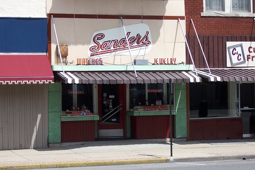
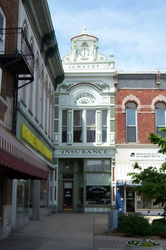
Sander's Jewelry and its retro signage are on Harrison St.
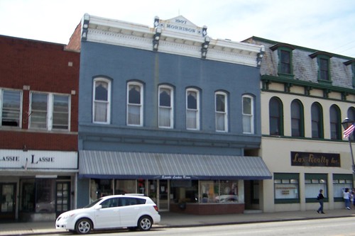
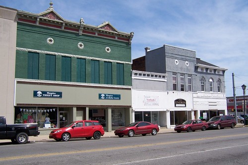
While downtown Shelbyville is certainly not dilapidated, restoration money hasn't been poured into it as it has down south in Greensburg.
Hard telling what condition these buildings are inside, but from the outside it looks like there's a lot to work with if Shelbyville ever experiences a renaissance and these buildings are restored.
Shelbyville's is the only square on the Michigan Road that does not feature a courthouse. Rather, it features a parking lot. The Michigan Road enters the square from the left and exits on the right of the photo.
In the northeast corner of the square stands the former Blessings Opera House, now a physical therapy practice.
This building stands in the northeast quadrant of the square at Harrison St. The leftmost building in the second photo at this link shows what was here at about the turn of the 20th century.
The third photo in this link shows this, the northwest quadrant of the square, at the turn of the 20th century.
This narrow building in the square's northwest corner is my favorite.
This is the Methodist Building, completed in 1929.
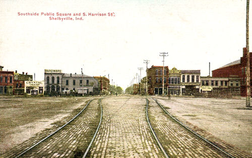
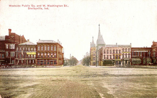
These two postcard images of the public square are from the 1910s. This one is southbound.
What is now parking lot was once used for streetcar rails. This photo is westbound. Notice that the Methodist Building is missing.
Just north of the square, the Shelby County United Fund inhabits this old house.
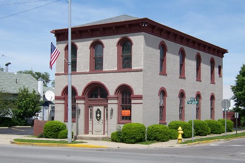
I don't know anything about this building or its history, but it sure looks well kept.
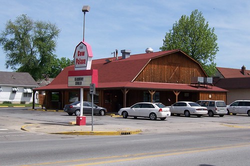
This is a former Red Barn fast-food restaurant. These were pretty big in the 1970s, with 300-400 stores nationwide in at least 19 states, but they were all gone by the mid 1980s. Sources:
Dig the neon on the Coca-Cola building.
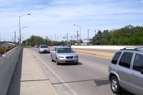
This bridge carries Michigan Road traffic over the Big Blue River.
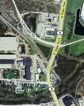
The Michigan Road is State Road 9 as it crosses the bridge, but SR 9 veers away from the original route and today briefly takes the Michigan Road with it. As the map suggests, the Michigan Road once crossed the railroad tracks here at a pretty wicked, and therefore dangerous, angle. Also, SR 9 eventually became the major route out of Shelbyville. So it made practical sense to route Michigan Road traffic over the tracks on SR 9 and then branch the Michigan Road off SR 9.
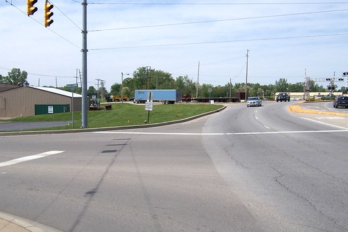
A short remnant of the original route remains between the bridge and the tracks. The blue semi trailer stands where the Michigan Road used to go.
This southbound photo shows the original Michigan Road path just south of the tracks looking back at the bridge.
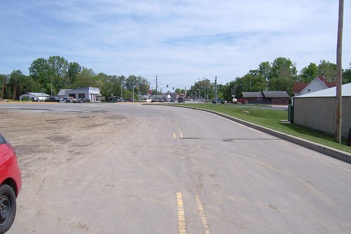
Looking northbound again, the road ends at the tracks.
The utility poles tell the story: The road used to go through here. If you squint at the center of this photograph, you can see the Michigan Road pick up on the other side.
Southbound from the north side of the tracks, this is where the Michigan Road used to be.
Here's where the modern Michigan Road branches from SR 9 north of the railroad tracks.
It curves and resumes its original route.
A few miles north of town the Michigan Road crosses I-74. The green line is what I think the original route was. Thanks to I-74, the most extensive damage to the original Michigan Road along its entire route begins here and ends just inside Marion County.
This photo shows where the Michigan Road curves to pass over I-74.
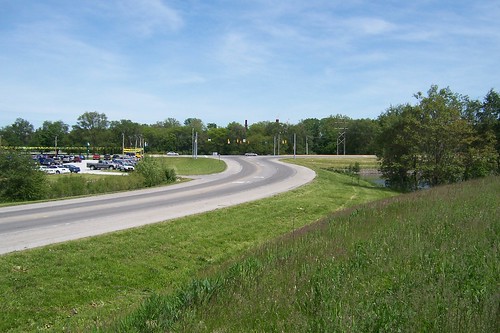
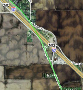
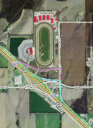
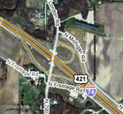
The Indiana Downs track stands at the next I-74 exit. On this map, the green line shows the road's original route, the blue line shows how the road was rerouted when I-74 was built, and the magenta line shows how the road was rerouted again when Indiana Downs was built.
This is what was left of the I-74 rerouting in July, 2008, northbound from the left turn on the map's blue line.
This is the original Michigan Road route, southbound, where the magenta line intersects the green line. None of this exists anymore; it's parking for the horse track now.
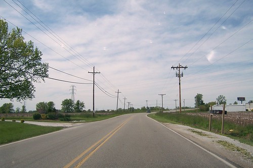
Here's what it's like to travel right next to I-74.
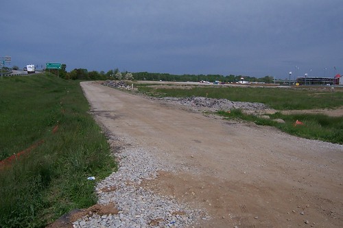
At the next I-74 exit, 700 W, the Michigan Road ends. Starting here, I-74 was built on top of it.
So to follow the Michigan Road, you have to get on I-74. Being able to go 70 mph didn't quite make up for losing the original road.
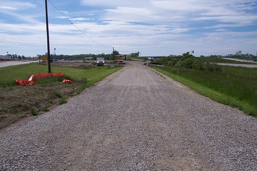
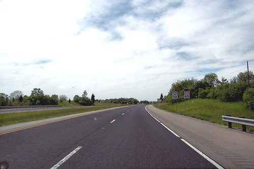
After less than a mile, however, I-74 curves away and you can see the Michigan Road re-emerge on the right.
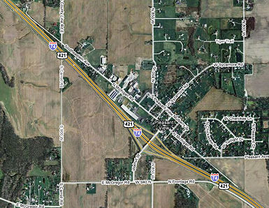
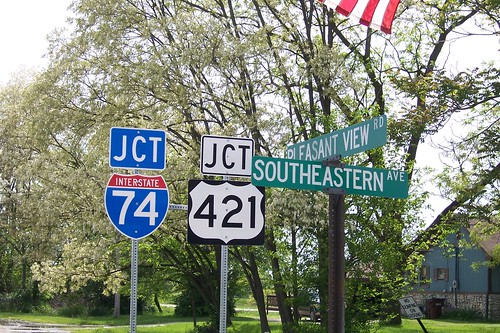
I-74 was built around the tiny town of Pleasant View. There's almost nothing to Pleasant View, making the routing a bit puzzling – you'd think the government would just have bought the town under eminent domain. But at least a mile or so of the Michigan Road was saved.
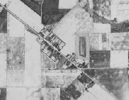
The Indianapolis General Data Viewer includes aerial maps of Marion County as old as 1937. The 1937 image set includes just enough of Shelby County to show Pleasant View as it was then.
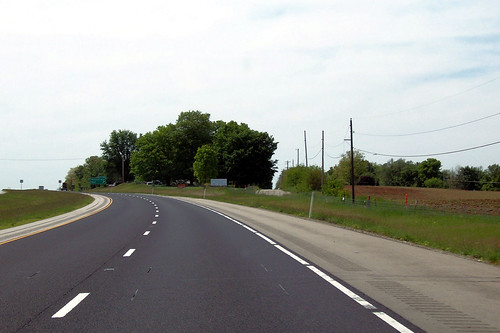
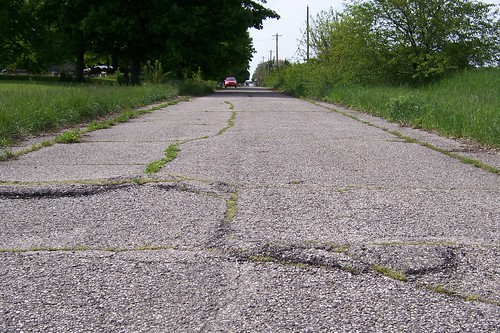
This southbound shot shows the Michigan Road emerging from the northbound lanes of I-74.
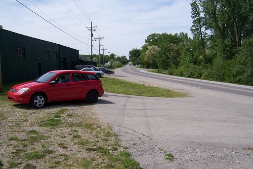
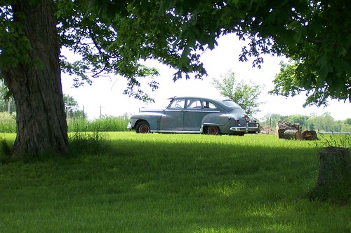
This old Dodge, circa 1946, sat in the grass between I-74 and the Michigan Road, watching I-74 traffic go by.
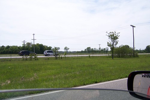
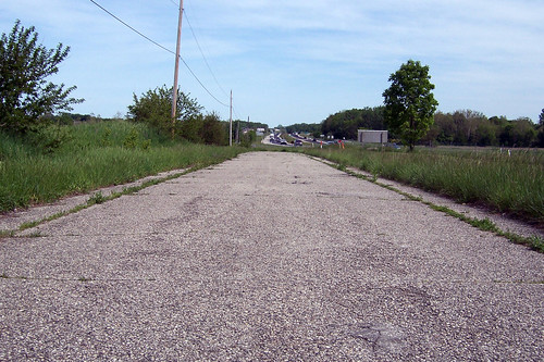
I've seen aerial photos of the area that show I-74 not yet built in 1956, but complete in 1962, so this northbound shot shows a road bypassed, and probably only minimally maintained, for about 50 years.
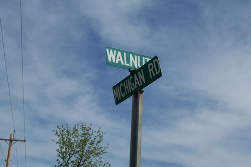
You can exit I-74 into Pleasant View via Walnut St.
Pleasant View is in the northwest corner of Shelby County, within spitting distance of Marion County. Across the street from the sign above stands the sign below, showing Marion County's name for the Michigan Road on the county's south side, Southeastern Ave. It's interesting how Walnut St. is signed Pleasant View Rd. here, too.
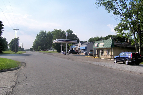
This is Pleasant View. There are a few houses along the road, too. Just beyond Pleasant View is the Marion county line.
|
||||
|
||||
|
Created 15 November 2008. Updated 21 January 2010, 2 January 2012. |
||||


