The Dixie Highway in western Indiana |
||||
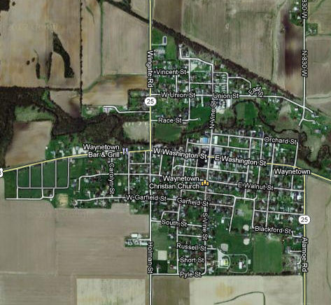
Montgomery CountyJust after the Dixie Highway enters Montgomery County, it enters Waynetown. Despite being near the west edge of the county, it was platted as Middletown in 1830.
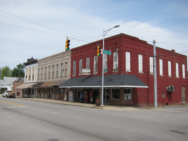
Imagery ©2012 DigitalGlobe, GeoEye, IndianaMap Framework Data, USDA Farm Service Agency, Map data ©2012 Google At first I thought the windows on the second floor of the red building were boarded up, but on closer inspection it loo0ks like those are shutters.
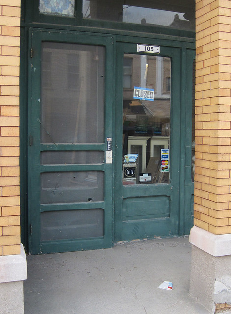
This is the most interesting set of buildings in downtown Waynetown.
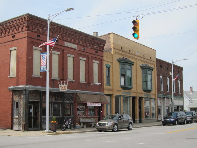
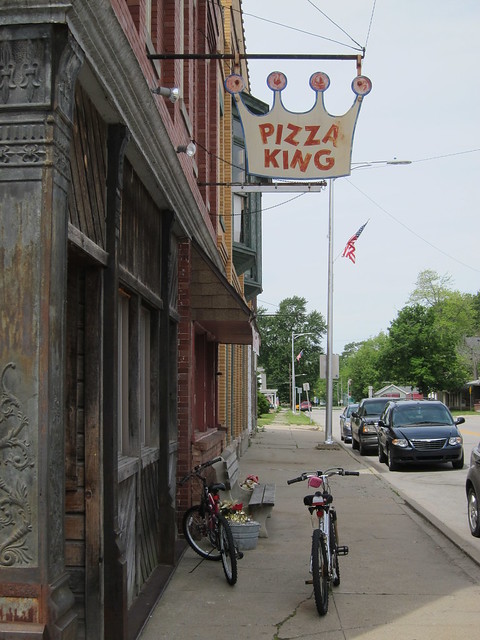
I was especially taken with the Pizza King sign and the scene it created.
This store entrance looks like it's straight out of the 1930s.
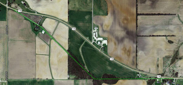
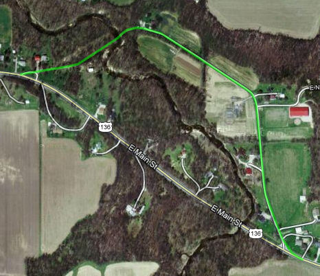
Just east of Waynetown I found what looks like an old alignment. On this map, I've drawn in green where I think it used to go. The only reason I can see for realigning the road was to smooth out that sharp curve, but it sure seems like there would have been less invasive ways to do that.
Imagery ©2012 DigitalGlobe, GeoEye, IndianaMap Framework Data, USDA Farm Service Agency, Map data ©2012 Google Here's where the old road starts on the west end, with just a tiny bit of pavement that hasn't crumbled to dust over the years.
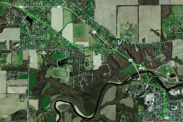
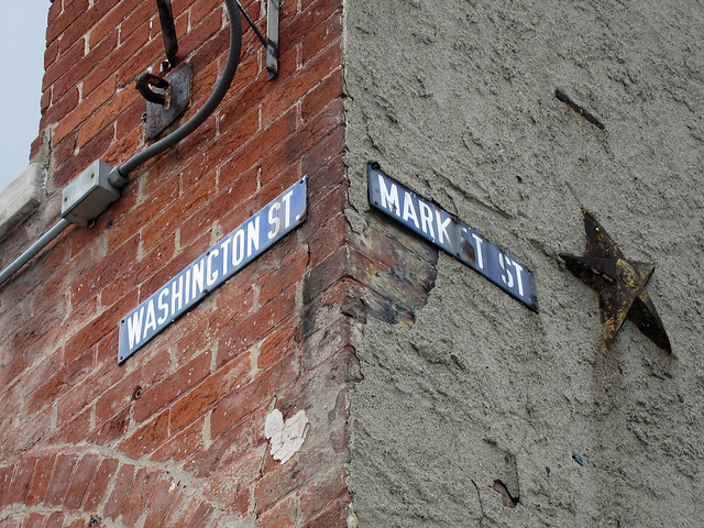
As I entered Crawfordsville, I followed Old Waynetown Road, which is almost certainly the Dixie Highway's original alignment. I'm pretty sure that the Dixie crossed the river at what is now Wayne Ct. and followed Wayne Ave. to Market St. before heading due east. I've drawn that route in green. I didn't go look, but Google Maps' Street View shows Wayne Ct. extending beyond the last house and fading away as it approaches the river, a good sign that there was once a bridge there.
Imagery ©2012 DigitalGlobe, GeoEye, IndianaMap Framework Data, USDA Farm Service Agency, Map data ©2012 Google I crossed the river on US 136, of course, but decided to just follow it as it curved around and became Market St. As you can see on this map, US 136 (the Dixie) doesn't quite go through the heart of Crawfordsville, instead passing along the northern edge of downtown.
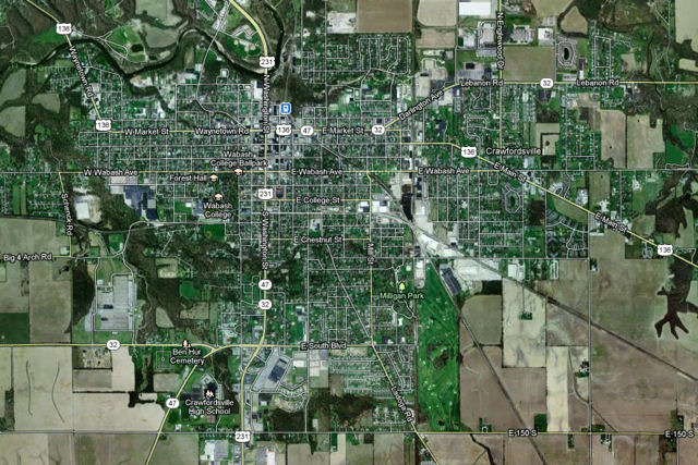
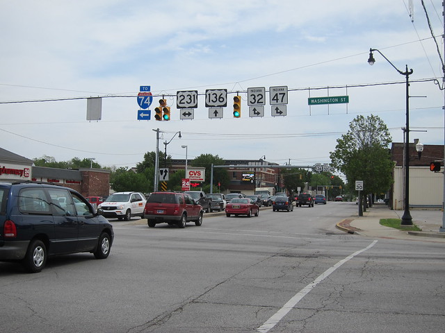
That simply wasn't going to do for me, so I parked and explored downtown Crawfordsville, which lies along US 231. Here's the road eastbound from there.
A few old European-style street signs remain attached to some of the buildings. This one is on the southwest corner of US 136 (Dixie Highway) and US 231.
A bit south of the Dixie on US 231 stands the Montgomery County courthouse.
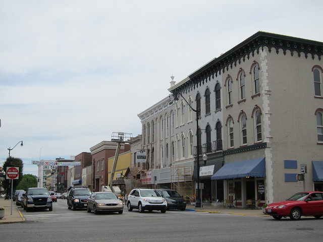
This is Crawfordsville's Main St., but it doesn't look very main to me. It's by far the lesser street to US 231, which is the main drag through town.
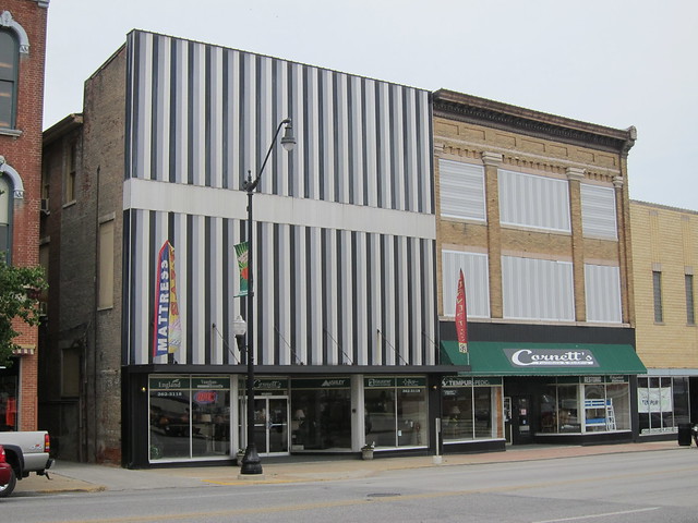
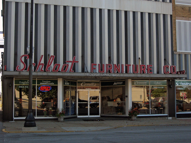
I hoped to photograph the great sign on the Schloot Furniture Company buidling, but I was so disappointed that it had been removed (from the building on the left).
Then later, while looking for another photo in my archives, I discovered that I photographed it (probably from my car window!) while passing through in 2010!
Just after leaving Crawfordsville, there is what I think is an old alignment. Where the road would have crossed the creek, there is no longer a bridge, but I see possible evidence on Google Maps that one was once there.
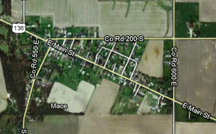
Imagery ©2012 DigitalGlobe, GeoEye, IndianaMap Framework Data, USDA Farm Service Agency, Map data ©2012 Google A bit east of there is the tiny town of Mace.
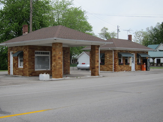
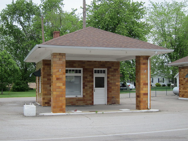
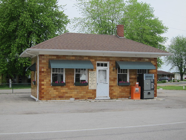
Imagery ©2012 DigitalGlobe, GeoEye, IndianaMap Framework Data, USDA Farm Service Agency, Map data ©2012 Google You never know what you'll find even in the tiniest of towns. In Mace, I found a former gas station and what was probably a tiny diner.
This was the gas station. The pumps stood between the two pillars.
I'm guessing this was a diner. It's mighty tiny, though, probably offering just enough room for the grill and a counter or maybe one or two booths or tables. It's used as the rental office for some nearby apartments today.
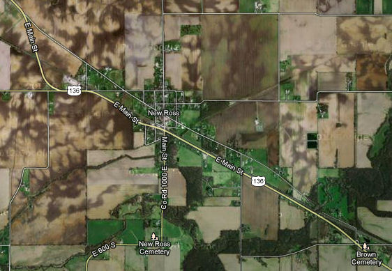
Up next is New Ross, which hugs the Boone County line. The Dixie went right through New Ross, but US 136 bypasses it.
Imagery ©2012 DigitalGlobe, GeoEye, IndianaMap Framework Data, USDA Farm Service Agency, Map data ©2012 Google That US 136 passed New Ross by doesn't seem to have bothered it. There are plenty of signs of life here, most notably the delightful 1878 Browns Chapel Methodist Episcopal Church, which has been well kept.
There's a branch of a bank here, and behind it this monstrous contraption, which dominates the view in town.
Beyond the stop sign the old Dixie Highway leads to a few homes before dead ending at a creek. On the other side of the creek, the road enters Boone County. The road surface there is brick, so be sure to click to the Boone County page to see it.
|
||||
|
||||
|
Created 1 January 2013. |
||||