The Dixie Highway in western Indiana |
||||
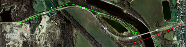
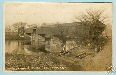
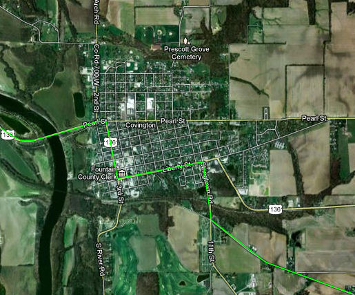
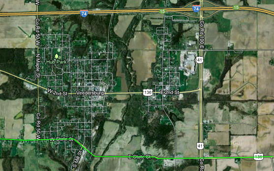
Fountain CountyThings started to heat up inside Fountain County. Several old alignments lurk as the Dixie nears the Wabash River at Covington. It's pretty common for an old road to have many previous alignments near where it crosses a river. First, the terrain in the river valley can be challenging, and as road construction techniques improved, old alignments along the path of least resistance could be improved to smoother and safer rights of way. Second, a succession of bridges likely carried traffic over the river, each at a slightly different place. Such appears to be the case where the Dixie reaches the Wabash. On the map below, I believe the green line to be the oldest surviving alignment, although at its east end (marked with the question mark) I can't tell from evidence on the ground how it flowed to the wooden covered bridge that crossed the Wabash at about the same place as the red line does. The red line is the next alignment, which carried a 1916 steel truss bridge. The current bridge was built in 1978.
Imagery ©2012 DigitalGlobe, GeoEye, IndianaMap Framework Data, USDA Farm Service Agency, Map data ©2012 Google Remnants remain along both the green and the red lines. Here's where the green line begins at its west end.
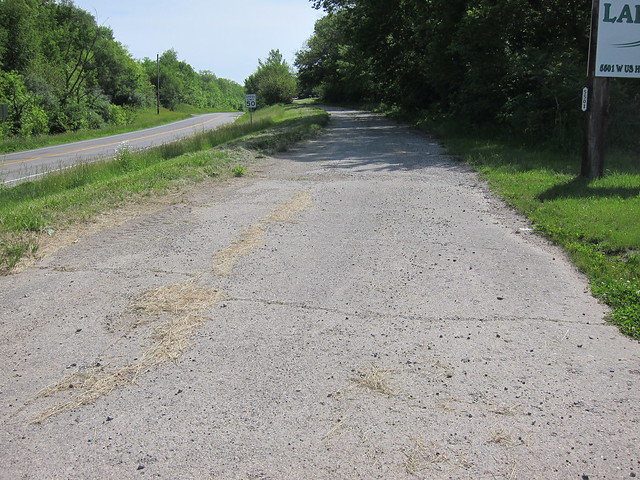
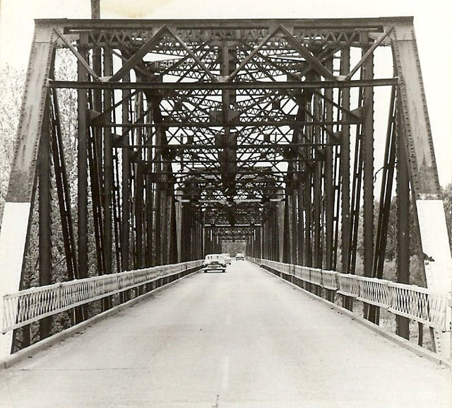
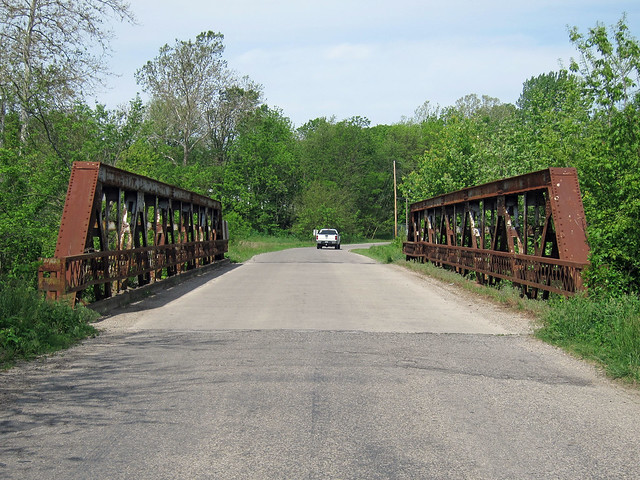
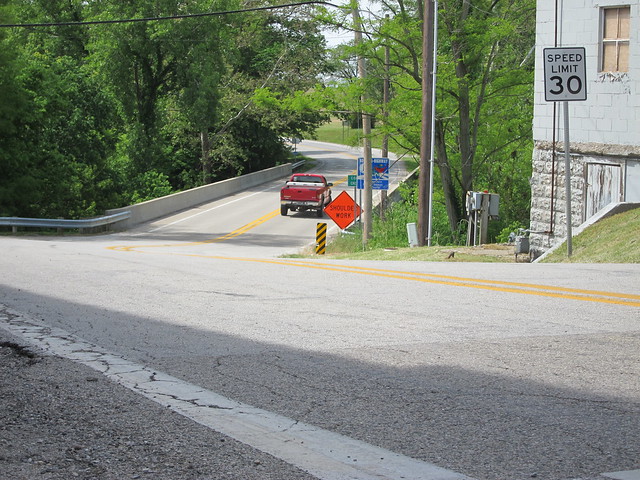
I'm not sure now why I didn't explore more of the old algnments here, but I didn't. My next stop was on the other side of the Wabash, to look at the 1916 alignment. Here's an eastbound shot. There's nothing back here; I was surprised local officials didn't block this at its eastern end.
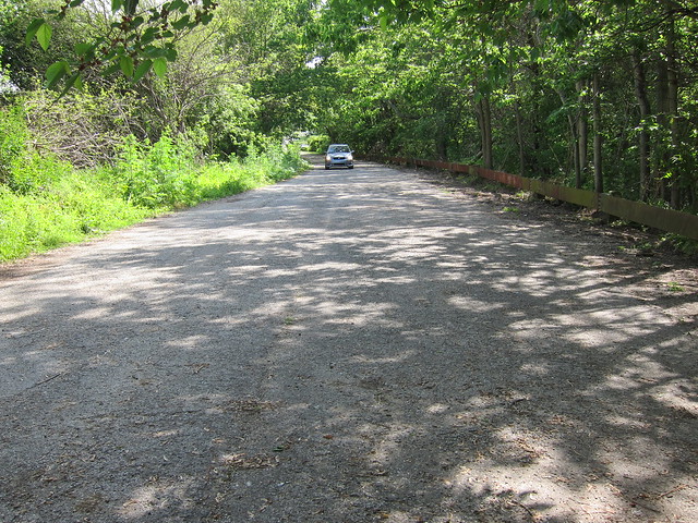
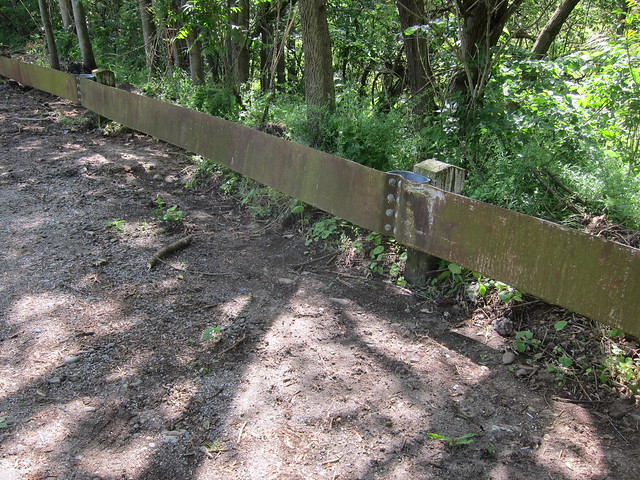
A guardrail eventually blocks access, though the pavement continues westbound to the river.
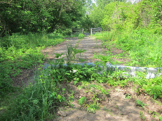
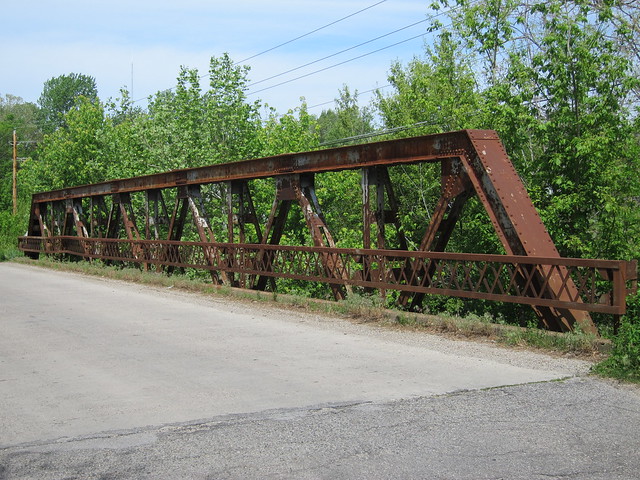
An old-style guardrail lines the south side of the road.
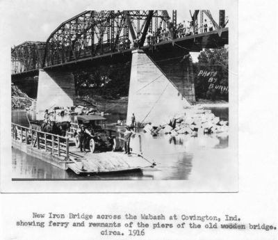
I don't know when the covered bridge was built, but apparently it burned in a fire. A more modern six-span iron Pennsylvania through truss bridge was built on the same spot. A ferry was used to move people across the Wabash in the meantime.
Consider that the Dixie Highway was organized in 1914, and that losing this bridge must have been quite a hindrance to this section of the newly formed highway, which stretched to Chicago. The 1916 bridge was narrow, which was typical of the time. It's surprising that it was used through 1978, as it had to be quite harrowing to meet an oncoming semi on it. I always wish, of course, that old bridges can be rehabilitated and used for one-way traffic, with a newer bridge carrying traffic the other way. Alas, this structure has now been lost for more than 30 years.
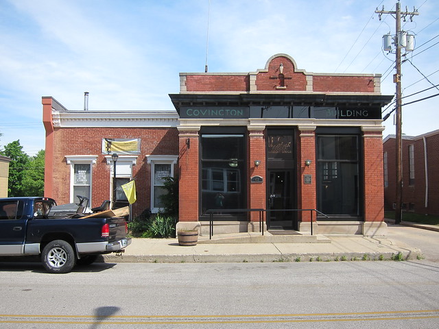
After crossing the Wabash, the Dixie makes its way through Covington.
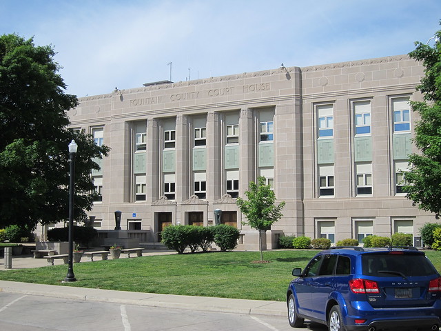
Imagery ©2012 DigitalGlobe, GeoEye, IndianaMap Framework Data, USDA Farm Service Agency, Map data ©2012 Google It makes a left at the courthouse square, passing behind the courthouse. I stopped to take photos all around the square. This is the courthouse itself, a fairly modern-looking building.
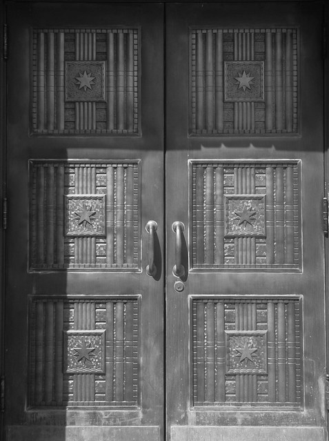
The courthouse doors are imposing.
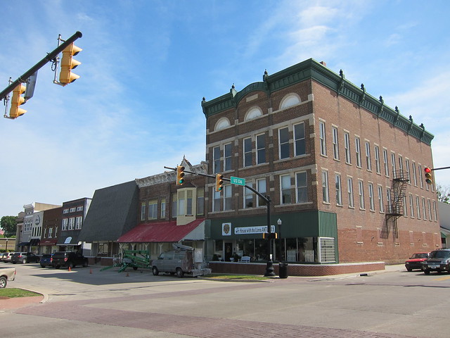
This is 4th St. from Liberty St., at the southeast corner of the square.
This little building stands just east of the square on Washington St. I just liked the way it looks.
If you’re not too persnickety, the easiest way to drive the Dixie Highway’s western mainline in Indiana is just to follow US 136. You will miss a few old alignments in so doing, but your cruising will be eased by needing only to follow the marked highway. If you’ve read this blog at all, you know I’m persnickety. Naturally, I followed all of the old alignments. The longest old alignment stretches about 8½ miles from Covington to just past Veedersburg at US 41. The road is narrow with no shoulders, which suggests that the road saw few improvements while it was still the state highway. When Indiana chose to seriously invest in its road here, it chose to build a new alignment to the north.
Most of this road is signed Dixie Bee Road. A competing auto trail known as
the
Dixie Bee Line connected Chicago and Nashville, Tennessee, via Danville,
Illinois and Terre Haute, Indiana. My 1920s Indiana road maps show the Dixie Bee
Line following a different path from this road, but given that some auto trails’
routes changed frequently, it is still possible that this was once the Dixie Bee
Line as well as the Dixie Highway. After all, this segment ends at US 41, which
leads directly to Terre Haute.
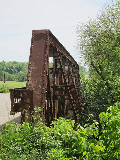
Imagery ©2012 DigitalGlobe, GeoEye, IndianaMap Framework Data, USDA Farm Service Agency, Map data ©2012 Google It cuts across Veedersburg’s south side and then crosses Coal Creek on on this great pony-truss bridge.
Except for rust and a bent railing where a vehicle nudged it, the bridge looks to be quite solid. Whenever you see equilateral triangles in a truss bridge, you know you’re looking at a Warren truss.
These trusses are massive, stretching about eight feet above the deck.
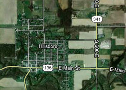
About a mile east of the bridge, the Dixie Highway meets US 41. US 136 rejoins the historic alignment from here west. Hillsboro is about five miles down the road.
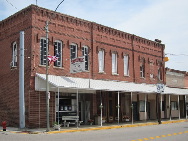
Imagery ©2012 DigitalGlobe, GeoEye, IndianaMap Framework Data, USDA Farm Service Agency, Map data ©2012 Google It is a typical Indiana small town.
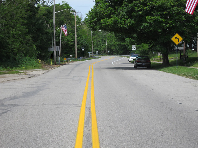
Here's the road, westbound from the middle of Hillsboro.
State Road 341 heads south out of Hillsboro here. I can imagine a time when perhaps a steel truss bridge crossed this creek. What a lovely scene it must have been. I so lament the loss of so many of these old bridges.
|
||||
|
||||
|
Created 1 January 2013. |
||||